
GribStream Blog
What NOAA's National Water Model v3.1 changes for land forecasts
NOAA's NWM v3.1 improves temperature downscaling, precipitation type, observed-flow initialization, and the hydrofabric while keeping the familiar land products.
NOAA plans to begin running National Water Model v3.1 with the August 18, 2026 12 UTC cycle. The upgrade changes how the model represents several important hydrologic processes, but it does not change the two NWM land products currently available through GribStream.
What changes in NWM v3.1
The CONUS upgrade includes a dynamic temperature lapse-rate method for downscaling atmospheric forcing. Instead of relying on a fixed relationship between elevation and temperature, NWM v3.1 derives the lapse rate from current numerical weather prediction data.
NOAA is also adding precipitation-type information from MRMS and numerical weather prediction models to the analysis, short-range, and GFS-forced medium-range configurations. That gives the land model more information about whether incoming precipitation is rain, snow, or another type before it affects snowpack and soil conditions.
Several river-system changes are more localized but operationally meaningful:
- Observation-based flow persistence represents the diversion from the Mississippi River into the Atchafalaya River through the Old River Control Structure.
- The CONUS hydrofabric includes refined locations for 311 USGS stream gauges and targeted routing corrections.
- Available USGS observations are incorporated into the opening hours of short-, medium-, and long-range forecasts, so those initial periods track recent observed flows.
The release also adds and revises coastal guidance, including a Puerto Rico P-Surge-forced short-range configuration. Those coastal and channel-routing products are separate from GribStream's regular land-grid datasets.
What the upgrade means for GribStream's land datasets
GribStream currently serves two NWM land datasets:
nwmshortland: hourly deterministic cycles with lead times from 1 through 18 hours.nwmmediumlandens: six time-lagged members at 3-hour intervals, reaching hour 240 for member 1 and hour 204 for members 2–6.
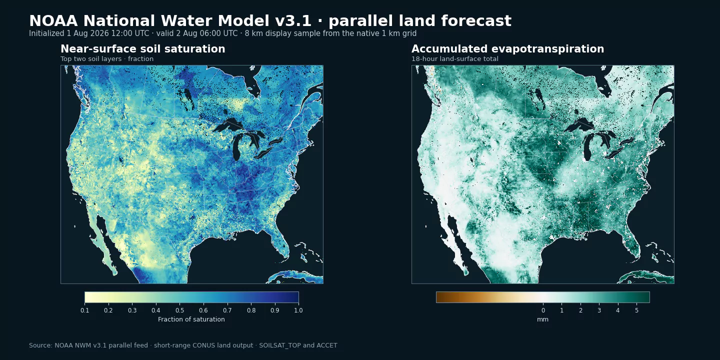
For the land products available through GribStream, v3.1 is a model upgrade rather than a product redesign. NOAA is keeping the supported land filenames, 1 km CONUS+ grid, forecast lengths, and six land variables unchanged. We also checked representative v3.1 parallel files against the current production products: SOILSAT_TOP, SNEQV, SNOWH, FSNO, SNOWT_AVG, and ACCET retain the same published definitions and units.
The new LQFRAC variable belongs to NWM forcing files, not these land datasets. Similarly, the reduction from 240 to 120 forecast hours applies to selected coastal total-water products rather than the medium-range land ensemble.
We will verify the first complete v3.1 cycles after the operational change. Once confirmed, the new forecasts will appear in the same nwmshortland and nwmmediumlandens datasets. Long-running analyses should treat the first v3.1 cycle as a model-version boundary because subsequent values will reflect the new science.
Query the land forecast
After the August 18 cycle becomes available, this nwmshortland query retrieves the 18-hour land forecast:
{
  "fromTime": "2026-08-18T12:00:00Z",
  "untilTime": "2026-08-19T06:00:00Z",
  "coordinates": [
    {"lat": 40.02, "lon": -105.27, "name": "Boulder"}
  ],
  "variables": [
    {"name": "SOILSAT_TOP", "level": "0-0.4 m below ground", "alias": "soil_saturation"},
    {"name": "ACCET", "level": "land surface", "alias": "evapotranspiration"}
  ]
}
Send the body to POST /api/v2/nwmshortland/timeseries. The short-range inventory and medium-range ensemble inventory list the exact selectors, units, members, and currently available runs.
Sources
- NWS Service Change Notice 26-64, updated July 30, 2026: https://www.weather.gov/media/notification/pdf_2026/scn26-64_Updated_National_Water_Model_V3.1_aaa.pdf
- NOAA National Water Model overview: https://water.noaa.gov/about/nwm
- NOAA NWM output-file contents: https://water.noaa.gov/about/output_file_contents
- NOAA NWM Registry of Open Data on AWS: https://registry.opendata.aws/noaa-nwm-pds/