
GribStream Blog
GOES-18 ABI brings the live GOES-West view to GribStream
GribStream adds NOAA's operational GOES-18 ABI full-disk observations, bringing a live Pacific-centered satellite view to the weather data API.
GribStream now provides GOES-18 Advanced Baseline Imager (ABI) observations from NOAA's operational GOES-West satellite. The new datasets add a Pacific-centered full-disk view that complements the GOES-19 coverage already available from GOES-East.
GOES-18 is available as two datasets so each collection retains one source-native fixed grid:
goes18abi, approximately 2 km at nadir: 46 fields spanning sixteen-band imagery, clouds, aerosols, fire, rainfall, snow, radiation, land, and ocean products.goes18abi10km, approximately 10 km at nadir: 15 fields covering moisture, atmospheric stability, cloud layers, cloud height, and land-surface temperature.
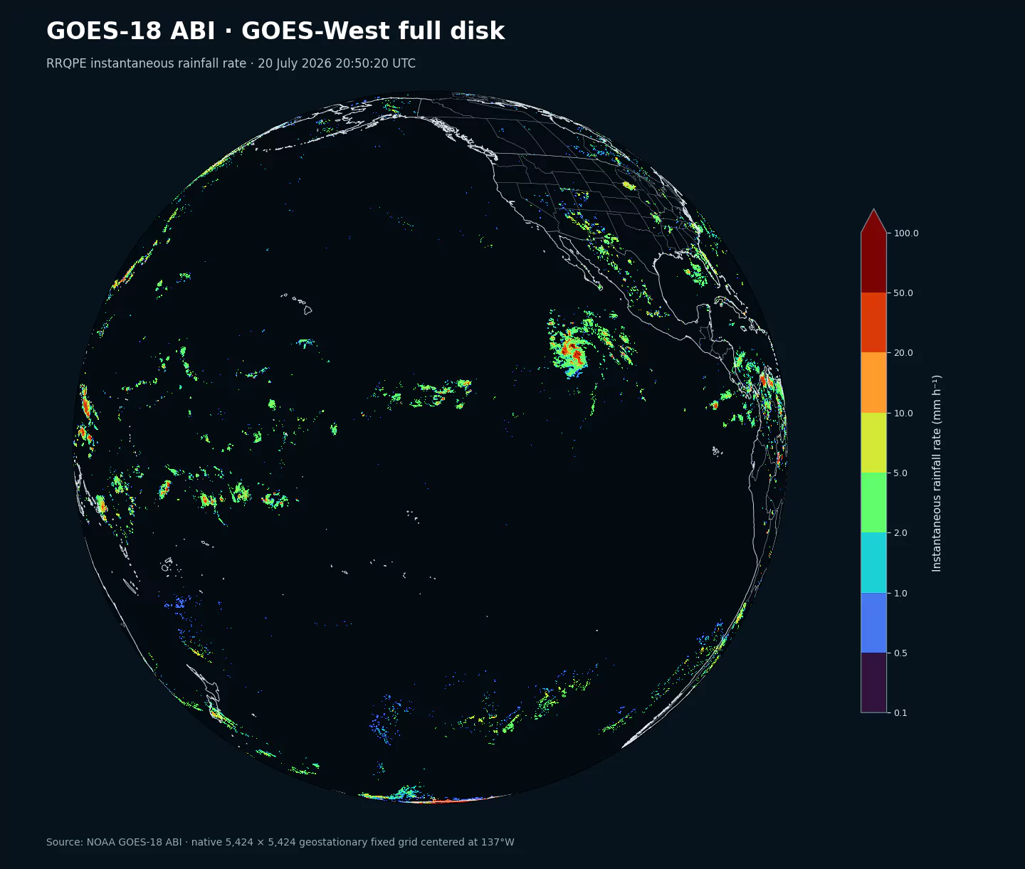
RRQPE at 2026-07-20 20:50:20 UTC on the native GOES-West fixed grid. The scan shows the satellite's Pacific-centered full-disk footprint.A live view from GOES-West
GOES-West is centered near 137 degrees west. Its view spans the eastern and central Pacific, western North America, Hawaii, and parts of the Southern Hemisphere. That perspective is particularly useful for following Pacific tropical cyclones, atmospheric rivers approaching the West Coast, wildfire smoke, marine cloud systems, and storms crossing regions where radar coverage is sparse.
GOES-18 assumed the operational GOES-West role in January 2023 and continues to publish new observations. Most full-disk product families update about every 10 minutes, while several moisture, stability, cloud, and surface products are hourly.
What ABI observes
ABI observes the geostationary disk in 16 spectral bands spanning visible reflectance, near-infrared signals, water-vapor absorption, and thermal infrared brightness temperatures. NOAA Level 2 products turn those measurements into application-focused observations of clouds, aerosols, fire, precipitation, snow, radiation, atmospheric moisture and stability, and land and ocean surfaces.
The exact cadence and availability vary by product. Daylight, clear-sky requirements, cloud screening, atmospheric assumptions, and viewing geometry can limit individual retrievals. Spatial footprints also grow toward the edge of the visible disk.
Current observations first
This launch prioritizes the satellite that is actively publishing the GOES-West record. Recent GOES-18 observations are available first, while earlier dates back to January 4, 2023 are being added progressively.
NOAA also retains historical operational-position records from GOES-16 and GOES-17. Those predecessor archives are not part of this launch. GribStream can prioritize them later if users need the longer historical record; for most monitoring, alerting, and dashboard workflows, the continuously updating GOES-18 feed provides the highest immediate value.
Where GOES-18 is useful
The two collections support cloud and storm monitoring, tropical-cyclone analysis, wildfire and smoke detection, dust and aerosol tracking, satellite rainfall estimation, solar-resource monitoring, snow mapping, land-temperature analysis, ocean-temperature tracking, and atmospheric-stability assessment. Together with GOES-19, they provide complementary operational views from both sides of the Americas.
Authoritative sources and inventories:
- NOAA GOES open-data registry: https://registry.opendata.aws/noaa-goes/
- NOAA GOES-R Level 2 product guide: https://goes-r.noaa.gov/products/docs/PUG-L2%2B-vol5.pdf
- NOAA/NESDIS geostationary satellites: https://www.nesdis.noaa.gov/our-satellites/currently-flying/geostationary-satellites
- GOES-18 ABI 2 km inventory and 10 km inventory
- GOES-19 ABI 2 km inventory and 10 km inventory