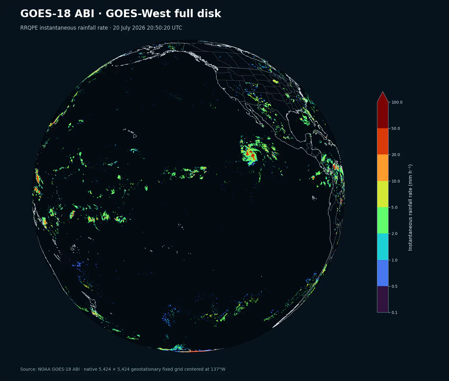
Representative GOES-West full-disk footprint using RRQPE from the 2 km goes18abi dataset. goes18abi10km uses the same projection and extent on its own 1,086 by 1,086 grid; the pictured rainfall field is not a variable in this dataset.
Current coverage: 15 source-native fields from 5 ABI Level 2 full-disk product families are available for 2023-01-04 onward. Individual families begin when NOAA first published the compatible operational source version. These are observations, not forecasts; horizon is 0.
Operational record: this collection follows GOES-18 while it served in the GOES-West position on the nominal fixed grid centered near 137W. It is the current operational satellite for this slot.
One fixed grid: this dataset contains only the approximately 10 km product families on NOAA's 1,086 by 1,086 grid. The related goes18abi dataset contains the other resolution.
Availability and open data: gaps can occur during maneuvers, calibration, outages, seasonal retrieval limits, and product transitions. NOAA data distributed through the Open Data program are available for public use; attribution is requested and NOAA endorsement must not be implied.
Archive availability: recent observations are available first while earlier dates back to the start of the operational record are added progressively.
Description
This collection combines satellite-derived moisture and land temperature with stability and cloud-height diagnostics. The fields describe the pre-convective environment and the vertical context of cloud systems over the full disk.
Availability and accuracy depend on cloud screening, atmospheric profiles, surface emissivity, daylight for some retrievals, and viewing angle. These observations complement rather than replace radiosondes, radar, lightning, and numerical-model analysis.
The inventory below lists the 15 exact source selectors and their availability periods. Product families retain their original NOAA names and units.
Moisture and surface retrievals including TPW, cloud-top HT, and LST.
Moisture and surface retrievals including TPW, cloud-top HT, and LST.
Atmospheric-stability fields CAPE, KI, LI, SI, and TT.
One source-native 1,086 by 1,086 GOES-West fixed grid, corresponding to about 10 km sampling at nadir.
Cloud fraction in five altitude layers (CF1-CF5), cloud-layer category CL, and total cloud fraction TCF.
Resolution: One native geostationary fixed grid with 1,086 by 1,086 cells at about 10 km sampling at nadir. Ground footprints become larger toward the limb, and cells outside the visible Earth disk are null.
Temporal coverage: Product-dependent full-disk observations, generally approximately every 10 minutes or hourly. Exact source scan times include seconds.
Primary uses: Atmospheric-moisture and stability monitoring, convective-environment analysis, cloud-height and cloud-cover assessment, tropical-cyclone context, land-temperature tracking, heat, and drought.
Convective Available Potential Energy (CAPE) quantifies buoyant energy available to rising air parcels. Larger values generally imply stronger potential updrafts and greater convective intensity.
Units: J/kg.
Often used with CIN and lifting mechanisms to assess thunderstorm potential.