Maximum Estimated Size of Hail (MESH) (mm).

GribStream
GribStream Code: mrms
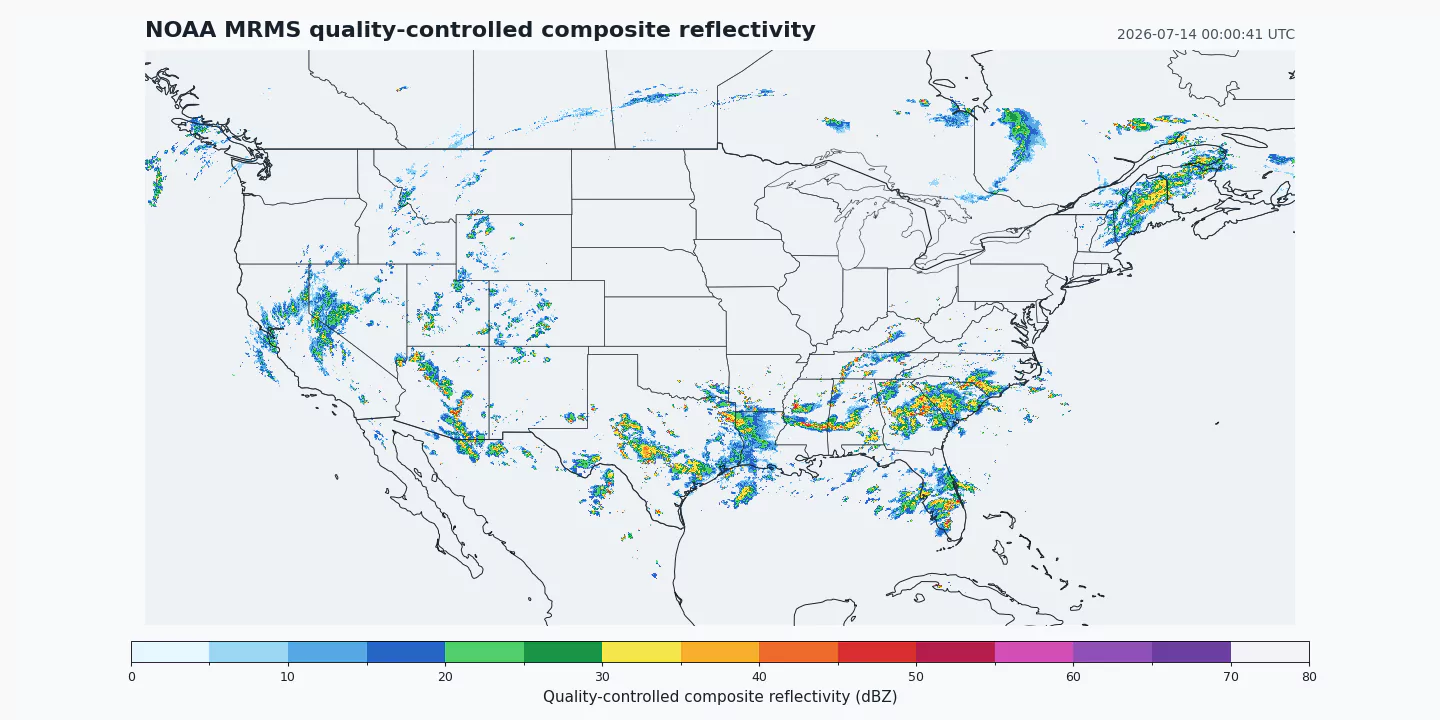
Official source: NOAA's Multi-Radar/Multi-Sensor system combines radar networks with surface and upper-air observations, lightning, satellite data, and forecast-model fields to produce seamless operational analyses. GribStream reads the public NOAA Open Data Dissemination MRMS bucket.
Current GribStream scope: mrms provides five CONUS products: quality-controlled composite reflectivity, MESH, radar precipitation rate, one-hour MultiSensor QPE Pass 2, and Radar Quality Index. Historical coverage begins October 14, 2020 and grows forward. The rapid products update nominally every two minutes; Pass 2 QPE updates hourly and has a nominal one-hour latency.
Open data: NOAA data distributed through NODD are open to public use. NOAA requests attribution for unaltered data and prohibits implying NOAA endorsement or affiliation.
MRMS is NOAA's operational Multi-Radar/Multi-Sensor analysis system. It was built to turn many heterogeneous observing streams into spatially continuous products for hazardous-weather warning, hydrology, aviation, transportation, and numerical weather prediction. Rather than exposing one radar site at a time, MRMS merges neighboring radars and applies automated quality control across a national mosaic.
The mrms dataset starts with five fields that work together. Quality-controlled composite reflectivity shows the strongest analyzed return through the vertical column. MESH estimates maximum hail size from radar-derived storm structure; it is not a surface hail report. PrecipRate supplies an analyzed instantaneous rate, while MultiSensor_QPE_01H_Pass2 supplies a one-hour accumulation with a later, multi-sensor processing pass. RadarQualityIndex provides context on radar quality, but it is not a universal accuracy score.
That combination supports more defensible products than treating reflectivity alone as rain rate, hail size, or data quality. A storm application can display reflectivity, use MESH as one hail diagnostic, compare rate with the one-hour accumulation, and use RQI to identify areas where the radar estimate deserves additional caution.
MRMS timestamps are not model cycle times. Each source filename carries an observation timestamp with seconds, and GribStream preserves it exactly. For API consistency, that timestamp appears in both forecasted_at and forecasted_time, with horizon = 0. This keeps a two-minute analysis series chronologically faithful without inventing forecast lead times.
The source's missing-data conventions are parameter-specific rather than encoded as a generic GRIB bitmap. GribStream applies NOAA's operational MRMS table for each included product and returns missing or no-coverage cells as null. Valid zero precipitation or reflectivity values remain distinct where the source convention allows them.
Use /api/v2/mrms/timeseries for coordinate-based analysis histories and /api/v2/mrms/runs for timestamp-oriented or gridded extraction. The inventory below provides the exact name, level, and info selectors.
MergedReflectivityQCComposite, MESH, PrecipRate, MultiSensor_QPE_01H_Pass2, and RadarQualityIndex.forecasted_at and forecasted_time are the same observation time and horizon is 0.dBZ, hail size and one-hour accumulation in mm, precipitation rate in mm/hr, and RQI as a dimensionless index.mrmsazshear dataset preserves the denser 0.005 degree grid used by the 0-2 km azimuthal-shear analysis.Click a parameter to reveal variants in a compact table with ready-to-copy JSON selectors.
Maximum Estimated Size of Hail (MESH) (mm).
| Level | Info | Horizon | Introduced | Selector |
|---|---|---|---|---|
500 m above mean sea level |
0h | 2020-10-14 |
{"name":"MESH","level":"500 m above mean sea level","info":""}
|
Composite Reflectivity Mosaic (optimal method) (dBZ).
| Level | Info | Horizon | Introduced | Selector |
|---|---|---|---|---|
500 m above mean sea level |
0h | 2020-10-14 |
{"name":"MergedReflectivityQCComposite","level":"500 m above mean sea level","info":""}
|
Multi-sensor precipitation accumulation, 1 hour, Pass 2 (1-hour latency) (mm).
| Level | Info | Horizon | Introduced | Selector |
|---|---|---|---|---|
0 m above mean sea level |
0h | 2020-10-14 |
{"name":"MultiSensor_QPE_01H_Pass2","level":"0 m above mean sea level","info":""}
|
Radar Precipitation Rate (mm/hr).
| Level | Info | Horizon | Introduced | Selector |
|---|---|---|---|---|
0 m above mean sea level |
0h | 2020-10-14 |
{"name":"PrecipRate","level":"0 m above mean sea level","info":""}
|
Radar Quality Index (non-dim).
| Level | Info | Horizon | Introduced | Selector |
|---|---|---|---|---|
0 m above mean sea level |
0h | 2020-10-14 |
{"name":"RadarQualityIndex","level":"0 m above mean sea level","info":""}
|
No parameters match your search.