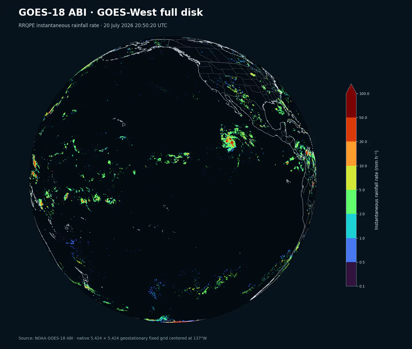
Referenz für die GOES-West-Full-Disk-Abdeckung anhand von RRQPE aus dem 2-km-Dataset goes18abi. goes18abi10km nutzt dieselbe Projektion und Ausdehnung auf seinem eigenen 1.086-mal-1.086-Gitter; Niederschlag gehört nicht zu den Variablen dieses Datasets.
Archivabdeckung: 15 quellnative Felder aus 5 ABI-Level-2-Familien sind für 2023-01-04 bis heute verfügbar. Jede Familie beginnt mit der ersten kompatiblen operationellen NOAA-Version. Es sind Beobachtungen, keine Vorhersagen; horizon ist 0.
Operationelle Reihe: Die Sammlung folgt GOES-18 während des Einsatzes im GOES-West-Slot auf dem nominal bei 137W zentrierten Grid. Er ist der derzeit operationelle Satellit in diesem Slot.
Ein Fixed Grid: Enthalten sind nur die etwa 10-km-Familien auf dem NOAA-Grid mit 1.086 mal 1.086 Zellen. goes18abi enthält die andere Auflösung.
Verfügbarkeit und Open Data: Manöver, Kalibrierung, Ausfälle, saisonale Grenzen und Produktwechsel können Lücken verursachen. NOAA-Daten im Open-Data-Programm sind öffentlich nutzbar; Quellenangabe wird erbeten, eine NOAA-Unterstützung darf nicht suggeriert werden.
Archivverfügbarkeit: Aktuelle Beobachtungen sind zuerst verfügbar; frühere Daten bis zum Beginn der operationellen Reihe werden schrittweise ergänzt.
Beschreibung
Die Sammlung verbindet Feuchte und Landtemperatur mit satellitengestützten Stabilitäts- und Wolkenhöhendiagnosen für die präkonvektive Umgebung.
Verfügbarkeit und Genauigkeit hängen von Wolkenfilterung, Atmosphärenprofilen, Emissivität, Tageslicht und Blickwinkel ab. Die Daten ergänzen Radiosonden, Radar, Blitzdaten und numerische Analysen.
Das Inventar listet die 15 exakten Quellselektoren und ihre Verfügbarkeitszeiträume.
Feuchte und Oberfläche: TPW, Wolkenhöhe HT und LST.
Feuchte und Oberfläche: TPW, Wolkenhöhe HT und LST.
Atmosphärische Stabilität: CAPE, KI, LI, SI und TT.
Ein natives GOES-West Fixed Grid mit 1.086 mal 1.086 Zellen und etwa 10 km im Nadir.
Wolkenanteil in fünf Höhenschichten (CF1-CF5), Kategorie CL und Gesamtwolkenanteil TCF.
Auflösung: Ein natives geostationäres Fixed Grid mit 1.086 mal 1.086 Zellen und etwa 10 km Abtastung im Nadir. Zum Rand der Erdscheibe werden die Bodenflächen größer; Zellen außerhalb sind null.
Zeitliche Abdeckung: Produktabhängige Full-Disk-Beobachtungen, meist ungefähr alle 10 Minuten oder stündlich. Exakte Scan-Zeiten enthalten Sekunden.
Hauptanwendungen: Feuchte und Stabilität, konvektive Umgebung, Wolkenhöhe und -bedeckung, tropische Wirbelstürme, Landtemperatur, Hitze und Dürre.
Klicken Sie auf einen Parameter, um Varianten in einer kompakten Tabelle mit kopierbaren JSON-Selektoren zu sehen. Codes, Levels und Selector-Werte bleiben exakt so, wie die API sie ausgibt.
Convective Available Potential Energy (CAPE) quantifies buoyant energy available to rising air parcels. Larger values generally imply stronger potential updrafts and greater convective intensity.
Units: J/kg.
Often used with CIN and lifting mechanisms to assess thunderstorm potential.