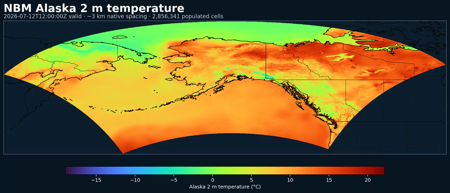
GribStream

National Blend of Models Parallel β€” Alaska core grid

GribStream Code: nbmparak

Other NBM parallel core grids: nbmpar, nbmparhi, nbmparpr, nbmpargu, nbmparoc

Operational counterpart: nbmak

Description

Experimental public parallel feed for NBM v5 on the Alaska core grid, kept separate from operational NBM Alaska for comparison workflows.

The upstream bucket is noaa-nbm-para-pds. GribStream keeps the parallel feed under dedicated dataset codes so you can compare it to the operational NBM family instead of swapping existing archives underneath current workflows.

NBM v5 is more than a parameter refresh. NOAA's July 15, 2025 change notice highlights one especially visible change for API users: most hourly guidance extends from 36 hours to 48 hours, which matters if you use NBM as an hourly time series rather than just a daily summary.

NOAA also revised the blend itself, including more quantile-mapped processing for key temperature, moisture, and precipitation guidance, a percentile-picking approach for deterministic wind and gusts, higher-resolution ECMWF and Canadian inputs, and ECAIFS as a new input for several core fields. See PNS 25-45, winter configuration notes, and NBM Versions.

For Alaska, NOAA's v5 highlights include new QM 10-meter wind and gust guidance plus the expanded snow suite, including calibrated 24/48/72-hour snow exceedance products and probability-matched-mean snow and ice guidance.

Detail

Parameters

0 parameters

Click a parameter to reveal variants in a compact table with ready-to-copy JSON selectors.

APCP –Accumulated Precipitation (kg/m^2)
2 variants

Accumulated precipitation represents the total water-equivalent amount of rain and snow during the output period. It is a primary field for hydrologic impacts and event totals.

  • Units: kg/m^2.
  • Use with the model time interval to interpret totals and compare to gauges.
Level Info Horizon Introduced Selector
surface 1h-264h 2026-04-15
{"name":"APCP","level":"surface","info":""}
surface prob >0.254 1h-264h 2026-04-15
{"name":"APCP","level":"surface","info":"prob >0.254"}
APTMP –Apparent Temperature (K)
1 variant

Apparent temperature combines air temperature, humidity, and wind to estimate how hot or cold it feels to humans. It is useful for heat and cold stress assessments.

  • Units: K.
Level Info Horizon Introduced Selector
2 m above ground 1h-264h 2026-04-15
{"name":"APTMP","level":"2 m above ground","info":""}
ASNOW –Accumulated Snow Depth (m)
28 variants

Accumulated snow depth is the total depth of snow on the ground over the period. It is a physical depth, not water equivalent.

  • Units: m.
  • Accumulations represent water-equivalent depth over the output interval; rates describe intensity.
Level Info Horizon Introduced Selector
surface 1h-264h 2026-04-15
{"name":"ASNOW","level":"surface","info":""}
surface 1% level 1h-263h 2026-04-15
{"name":"ASNOW","level":"surface","info":"1% level"}
surface 10% level 1h-263h 2026-04-15
{"name":"ASNOW","level":"surface","info":"10% level"}
surface 20% level 1h-263h 2026-04-15
{"name":"ASNOW","level":"surface","info":"20% level"}
surface 25% level 1h-263h 2026-04-15
{"name":"ASNOW","level":"surface","info":"25% level"}
surface 30% level 1h-263h 2026-04-15
{"name":"ASNOW","level":"surface","info":"30% level"}
surface 40% level 1h-263h 2026-04-15
{"name":"ASNOW","level":"surface","info":"40% level"}
surface 5% level 1h-263h 2026-04-15
{"name":"ASNOW","level":"surface","info":"5% level"}
surface 50% level 1h-263h 2026-04-15
{"name":"ASNOW","level":"surface","info":"50% level"}
surface 60% level 1h-263h 2026-04-15
{"name":"ASNOW","level":"surface","info":"60% level"}
surface 70% level 1h-263h 2026-04-15
{"name":"ASNOW","level":"surface","info":"70% level"}
surface 75% level 1h-263h 2026-04-15
{"name":"ASNOW","level":"surface","info":"75% level"}
surface 80% level 1h-263h 2026-04-15
{"name":"ASNOW","level":"surface","info":"80% level"}
surface 90% level 1h-263h 2026-04-15
{"name":"ASNOW","level":"surface","info":"90% level"}
surface 95% level 1h-263h 2026-04-15
{"name":"ASNOW","level":"surface","info":"95% level"}
surface 99% level 1h-263h 2026-04-15
{"name":"ASNOW","level":"surface","info":"99% level"}
surface prob >0.00254 1h-263h 2026-04-15
{"name":"ASNOW","level":"surface","info":"prob >0.00254"}
surface prob >0.0127 1h-48h 2026-04-15
{"name":"ASNOW","level":"surface","info":"prob >0.0127"}
surface prob >0.0254 1h-263h 2026-04-15
{"name":"ASNOW","level":"surface","info":"prob >0.0254"}
surface prob >0.0381 1h-48h 2026-04-15
{"name":"ASNOW","level":"surface","info":"prob >0.0381"}
surface prob >0.0508 1h-263h 2026-04-15
{"name":"ASNOW","level":"surface","info":"prob >0.0508"}
surface prob >0.0635 1h-48h 2026-04-15
{"name":"ASNOW","level":"surface","info":"prob >0.0635"}
surface prob >0.0762 1h-48h 2026-04-15
{"name":"ASNOW","level":"surface","info":"prob >0.0762"}
surface prob >0.1016 1h-263h 2026-04-15
{"name":"ASNOW","level":"surface","info":"prob >0.1016"}
surface prob >0.1524 49h-263h 2026-04-15
{"name":"ASNOW","level":"surface","info":"prob >0.1524"}
surface prob >0.2032 49h-263h 2026-04-15
{"name":"ASNOW","level":"surface","info":"prob >0.2032"}
surface prob >0.254 49h-263h 2026-04-15
{"name":"ASNOW","level":"surface","info":"prob >0.254"}
surface prob >0.3048 49h-263h 2026-04-15
{"name":"ASNOW","level":"surface","info":"prob >0.3048"}
CAPE –Convective Available Potential Energy (J/kg)
2 variants

Convective Available Potential Energy (CAPE) quantifies buoyant energy available to rising air parcels. Larger values generally imply stronger potential updrafts and greater convective intensity.

  • Units: J/kg.
  • Often used with CIN and lifting mechanisms to assess thunderstorm potential.
Level Info Horizon Introduced Selector
surface 1h-264h 2026-04-15
{"name":"CAPE","level":"surface","info":""}
surface ens std dev 1h-264h 2026-04-15
{"name":"CAPE","level":"surface","info":"ens std dev"}
CEIL –Ceiling Height (m)
2 variants

Ceiling height is the altitude of the lowest cloud base that covers a significant portion of the sky. It is a key aviation and surface-visibility metric.

  • Units: m.
Level Info Horizon Introduced Selector
cloud base 1h-84h 2026-04-15
{"name":"CEIL","level":"cloud base","info":""}
cloud ceiling 1h-84h 2026-04-15
{"name":"CEIL","level":"cloud ceiling","info":""}
DIST –Distance to Feature (km)
1 variant

Distance to feature is the horizontal distance to the named hazard or boundary in the source product. It is used to map proximity to key features like fronts or hazards.

  • Units: km.
Level Info Horizon Introduced Selector
surface - 610 m above ground 1h-36h 2026-04-15
{"name":"DIST","level":"surface - 610 m above ground","info":""}
DPT –Dew Point Temperature (K)
2 variants

Dew point temperature is the temperature at which the air becomes saturated. It is a direct measure of moisture content.

  • Units: K.
  • When dew point is close to air temperature, fog or low cloud potential increases.
Level Info Horizon Introduced Selector
2 m above ground 1h-264h 2026-04-15
{"name":"DPT","level":"2 m above ground","info":""}
2 m above ground ens std dev 1h-264h 2026-04-15
{"name":"DPT","level":"2 m above ground","info":"ens std dev"}
DSWRF –Downward Short-Wave Radiation Flux (W/m^2)
1 variant

Downward radiative flux represents incoming energy at the surface. It is a key driver of surface heating and cooling.

  • Units: W/m^2.
  • Shortwave affects surface heating; longwave affects radiative cooling.
Level Info Horizon Introduced Selector
surface 1h-264h 2026-04-15
{"name":"DSWRF","level":"surface","info":""}
ELLINX –Ellrod Index (unitless)
1 variant

Ellrod index is a diagnostic for clear-air turbulence based on deformation and vertical wind shear. Higher values indicate greater turbulence potential for aviation.

  • Units: unitless.
Level Info Horizon Introduced Selector
400-300 mb 1h-259h 2026-04-15
{"name":"ELLINX","level":"400-300 mb","info":""}
FICEAC –Fractional Ice Accumulation (percent)
21 variants

Fractional ice accumulation is an index of ice accretion relative to a reference amount. It is used to describe freezing rain impacts.

  • Units: percent.
Level Info Horizon Introduced Selector
surface 1h-264h 2026-04-15
{"name":"FICEAC","level":"surface","info":""}
surface 1% level 49h-263h 2026-04-15
{"name":"FICEAC","level":"surface","info":"1% level"}
surface 10% level 49h-263h 2026-04-15
{"name":"FICEAC","level":"surface","info":"10% level"}
surface 20% level 49h-263h 2026-04-15
{"name":"FICEAC","level":"surface","info":"20% level"}
surface 25% level 49h-263h 2026-04-15
{"name":"FICEAC","level":"surface","info":"25% level"}
surface 30% level 49h-263h 2026-04-15
{"name":"FICEAC","level":"surface","info":"30% level"}
surface 40% level 49h-263h 2026-04-15
{"name":"FICEAC","level":"surface","info":"40% level"}
surface 5% level 49h-263h 2026-04-15
{"name":"FICEAC","level":"surface","info":"5% level"}
surface 50% level 49h-263h 2026-04-15
{"name":"FICEAC","level":"surface","info":"50% level"}
surface 60% level 49h-263h 2026-04-15
{"name":"FICEAC","level":"surface","info":"60% level"}
surface 70% level 49h-263h 2026-04-15
{"name":"FICEAC","level":"surface","info":"70% level"}
surface 75% level 49h-263h 2026-04-15
{"name":"FICEAC","level":"surface","info":"75% level"}
surface 80% level 49h-263h 2026-04-15
{"name":"FICEAC","level":"surface","info":"80% level"}
surface 90% level 49h-263h 2026-04-15
{"name":"FICEAC","level":"surface","info":"90% level"}
surface 95% level 49h-263h 2026-04-15
{"name":"FICEAC","level":"surface","info":"95% level"}
surface 99% level 49h-263h 2026-04-15
{"name":"FICEAC","level":"surface","info":"99% level"}
surface prob >0.254 49h-263h 2026-04-15
{"name":"FICEAC","level":"surface","info":"prob >0.254"}
surface prob >12.7 49h-263h 2026-04-15
{"name":"FICEAC","level":"surface","info":"prob >12.7"}
surface prob >2.54 49h-263h 2026-04-15
{"name":"FICEAC","level":"surface","info":"prob >2.54"}
surface prob >25.4 49h-263h 2026-04-15
{"name":"FICEAC","level":"surface","info":"prob >25.4"}
surface prob >6.35 49h-263h 2026-04-15
{"name":"FICEAC","level":"surface","info":"prob >6.35"}
FOSINDX –Fosberg Fire Weather Index (unitless)
1 variant

Fosberg fire weather index combines temperature, humidity, and wind to estimate potential fire spread. Higher values indicate more favorable wildfire conditions.

  • Units: unitless.
Level Info Horizon Introduced Selector
surface 6h-264h 2026-04-15
{"name":"FOSINDX","level":"surface","info":""}
FRZSPR –Freezing Spray Indicator (boolean)
1 variant

Freezing spray indicator flags marine conditions favorable for ice accretion on vessels. It depends on wind, air temperature, and wave conditions.

  • Units: boolean.
Level Info Horizon Introduced Selector
surface 1h-264h 2026-04-15
{"name":"FRZSPR","level":"surface","info":""}
GUST –Wind Speed (Gust) (m/s)
2 variants

Wind gust is the peak short-duration wind speed. It captures brief, hazardous bursts that can exceed sustained winds.

  • Units: m/s.
Level Info Horizon Introduced Selector
10 m above ground 1h-264h 2026-04-15
{"name":"GUST","level":"10 m above ground","info":""}
10 m above ground ens std dev 1h-264h 2026-04-15
{"name":"GUST","level":"10 m above ground","info":"ens std dev"}
MAXREF –Hourly Maximum of Simulated Reflectivity at 1 km AGL (dBZ)
1 variant

Hourly maximum simulated reflectivity at 1 km AGL captures the strongest modeled reflectivity near the surface. It is used to identify peak convective intensity and heavy precipitation cores.

  • Units: dBZ.
Level Info Horizon Introduced Selector
1000 m above ground 1h-48h 2026-04-15
{"name":"MAXREF","level":"1000 m above ground","info":""}
MAXRH –Maximum Relative Humidity (percent)
1 variant

Maximum relative humidity is the highest RH reached during the period. It can indicate peak cloud or fog potential.

  • Units: percent.
  • Higher values indicate more atmospheric moisture and greater cloud or precip potential.
Level Info Horizon Introduced Selector
2 m above ground 13h-264h 2026-04-15
{"name":"MAXRH","level":"2 m above ground","info":""}
MINRH –Minimum Relative Humidity (percent)
1 variant

Minimum relative humidity is the lowest RH reached during the period. It is used in fire‑weather and drying assessments.

  • Units: percent.
  • Higher values indicate more atmospheric moisture and greater cloud or precip potential.
Level Info Horizon Introduced Selector
2 m above ground 13h-264h 2026-04-15
{"name":"MINRH","level":"2 m above ground","info":""}
MIXHT –Mixing Height (m)
1 variant

Mixing height is the depth of the well-mixed layer near the surface. It is widely used for dispersion, smoke, and air-quality applications.

  • Units: m.
Level Info Horizon Introduced Selector
entire atmosphere (considered as a single layer) 1h-264h 2026-04-15
{"name":"MIXHT","level":"entire atmosphere (considered as a single layer)","info":""}
PCPDUR –Precipitation Duration (hours)
1 variant

Precipitation duration is the total time with measurable precipitation in the output period. It helps distinguish intermittent from persistent events.

  • Units: hours.
  • Accumulations represent water-equivalent depth over the output interval; rates describe intensity.
Level Info Horizon Introduced Selector
surface 12h-36h 2026-04-15
{"name":"PCPDUR","level":"surface","info":""}
PTYPE –Precipitation Type (coded)
4 variants

Coded surface precipitation type derived from model precipitation and near-surface thermodynamics. It distinguishes rain, snow, freezing rain, mixed types, and related categories.

  • Units: coded.
  • Interpret together with precipitation rate or accumulation.
NOAA GRIB2 Table 4.201
Source
0
Reserved
1
Rain
2
Thunderstorm
3
Freezing rain
4
Mixed/ice
5
Snow
6
Wet snow
7
Mixture of rain and snow
8
Ice pellets
9
Graupel
10
Hail
11
Drizzle
12
Freezing drizzle
13
Hail (< 5 mm)
14
Hail (>= 5 mm)
255
Missing
Level Info Horizon Introduced Selector
surface prob >=1 <2 1h-264h 2026-04-15
{"name":"PTYPE","level":"surface","info":"prob >=1 <2"}
surface prob >=3 <4 1h-264h 2026-04-15
{"name":"PTYPE","level":"surface","info":"prob >=3 <4"}
surface prob >=5 <7 1h-264h 2026-04-15
{"name":"PTYPE","level":"surface","info":"prob >=5 <7"}
surface prob >=8 <9 1h-264h 2026-04-15
{"name":"PTYPE","level":"surface","info":"prob >=8 <9"}
PWAT –Precipitable Water (kg/m^2)
9 variants

Precipitable water is the total column water vapor from the surface to the top of the atmosphere. It is a key moisture indicator.

  • Units: kg/m^2.
Level Info Horizon Introduced Selector
entire atmosphere (considered as a single layer) 1h-264h 2026-04-15
{"name":"PWAT","level":"entire atmosphere (considered as a single layer)","info":""}
entire atmosphere (considered as a single layer) 10% level 1h-264h 2026-04-15
{"name":"PWAT","level":"entire atmosphere (considered as a single layer)","info":"10% level"}
entire atmosphere (considered as a single layer) 50% level 1h-264h 2026-04-15
{"name":"PWAT","level":"entire atmosphere (considered as a single layer)","info":"50% level"}
entire atmosphere (considered as a single layer) 90% level 1h-264h 2026-04-15
{"name":"PWAT","level":"entire atmosphere (considered as a single layer)","info":"90% level"}
entire atmosphere (considered as a single layer) prob >12.7 1h-264h 2026-04-15
{"name":"PWAT","level":"entire atmosphere (considered as a single layer)","info":"prob >12.7"}
entire atmosphere (considered as a single layer) prob >19.05 1h-264h 2026-04-15
{"name":"PWAT","level":"entire atmosphere (considered as a single layer)","info":"prob >19.05"}
entire atmosphere (considered as a single layer) prob >25.4 1h-264h 2026-04-15
{"name":"PWAT","level":"entire atmosphere (considered as a single layer)","info":"prob >25.4"}
entire atmosphere (considered as a single layer) prob >31.75 1h-264h 2026-04-15
{"name":"PWAT","level":"entire atmosphere (considered as a single layer)","info":"prob >31.75"}
entire atmosphere (considered as a single layer) prob >38.1 1h-264h 2026-04-15
{"name":"PWAT","level":"entire atmosphere (considered as a single layer)","info":"prob >38.1"}
PWTHER –Predominant Weather (coded)
1 variant

Predominant weather encodes the most likely weather type for the grid cell and valid period. It is used for compact categorical weather guidance such as rain, snow, ice, fog, or thunder-related outcomes.

  • Units: coded.
  • Code meanings depend on the model or product's weather-category mapping.
Level Info Horizon Introduced Selector
surface - reserved 1h-264h 2026-04-15
{"name":"PWTHER","level":"surface - reserved","info":""}
RETOP –Radar Echo Top Height (m)
1 variant

Echo top height is the altitude of the highest reflectivity in the column. It is a proxy for storm depth and convective vigor.

  • Units: m.
Level Info Horizon Introduced Selector
cloud top 1h-48h 2026-04-15
{"name":"RETOP","level":"cloud top","info":""}
RH –Relative Humidity (percent)
1 variant

Relative humidity describes how close the air is to saturation at the specified level. High values favor cloud formation.

  • Units: percent.
  • Higher values indicate more atmospheric moisture and greater cloud or precip potential.
Level Info Horizon Introduced Selector
2 m above ground 1h-264h 2026-04-15
{"name":"RH","level":"2 m above ground","info":""}
SNOD –Snow Depth (m)
4 variants

Snow depth is the physical thickness of the snowpack. It is distinct from snow water equivalent, which measures water content.

  • Units: m.
Level Info Horizon Introduced Selector
surface 1h-263h 2026-04-15
{"name":"SNOD","level":"surface","info":""}
surface prob >0.00254 1h-263h 2026-04-15
{"name":"SNOD","level":"surface","info":"prob >0.00254"}
surface prob >0.0127 1h-263h 2026-04-15
{"name":"SNOD","level":"surface","info":"prob >0.0127"}
surface prob >0.0254 1h-263h 2026-04-15
{"name":"SNOD","level":"surface","info":"prob >0.0254"}
SNOWLR –Snow-Liquid Ratio (unitless)
16 variants

Snow-liquid ratio is the ratio of snowfall depth to liquid water equivalent. Higher values indicate lighter, fluffier snow.

  • Units: unitless.
Level Info Horizon Introduced Selector
surface 1h-264h 2026-04-15
{"name":"SNOWLR","level":"surface","info":""}
surface 1% level 1h-263h 2026-04-15
{"name":"SNOWLR","level":"surface","info":"1% level"}
surface 10% level 1h-263h 2026-04-15
{"name":"SNOWLR","level":"surface","info":"10% level"}
surface 20% level 1h-263h 2026-04-15
{"name":"SNOWLR","level":"surface","info":"20% level"}
surface 25% level 1h-263h 2026-04-15
{"name":"SNOWLR","level":"surface","info":"25% level"}
surface 30% level 1h-263h 2026-04-15
{"name":"SNOWLR","level":"surface","info":"30% level"}
surface 40% level 1h-263h 2026-04-15
{"name":"SNOWLR","level":"surface","info":"40% level"}
surface 5% level 1h-263h 2026-04-15
{"name":"SNOWLR","level":"surface","info":"5% level"}
surface 50% level 1h-263h 2026-04-15
{"name":"SNOWLR","level":"surface","info":"50% level"}
surface 60% level 1h-263h 2026-04-15
{"name":"SNOWLR","level":"surface","info":"60% level"}
surface 70% level 1h-263h 2026-04-15
{"name":"SNOWLR","level":"surface","info":"70% level"}
surface 75% level 1h-263h 2026-04-15
{"name":"SNOWLR","level":"surface","info":"75% level"}
surface 80% level 1h-263h 2026-04-15
{"name":"SNOWLR","level":"surface","info":"80% level"}
surface 90% level 1h-263h 2026-04-15
{"name":"SNOWLR","level":"surface","info":"90% level"}
surface 95% level 1h-263h 2026-04-15
{"name":"SNOWLR","level":"surface","info":"95% level"}
surface 99% level 1h-263h 2026-04-15
{"name":"SNOWLR","level":"surface","info":"99% level"}
SNOWLVL –Snow Level (m)
16 variants

Snow level is the approximate altitude where precipitation changes from rain to snow. It is useful for terrain and road-impact forecasting.

  • Units: m.
Level Info Horizon Introduced Selector
0 m above mean sea level 1h-264h 2026-04-15
{"name":"SNOWLVL","level":"0 m above mean sea level","info":""}
surface 1% level 1h-263h 2026-04-15
{"name":"SNOWLVL","level":"surface","info":"1% level"}
surface 10% level 1h-263h 2026-04-15
{"name":"SNOWLVL","level":"surface","info":"10% level"}
surface 20% level 1h-263h 2026-04-15
{"name":"SNOWLVL","level":"surface","info":"20% level"}
surface 25% level 1h-263h 2026-04-15
{"name":"SNOWLVL","level":"surface","info":"25% level"}
surface 30% level 1h-263h 2026-04-15
{"name":"SNOWLVL","level":"surface","info":"30% level"}
surface 40% level 1h-263h 2026-04-15
{"name":"SNOWLVL","level":"surface","info":"40% level"}
surface 5% level 1h-263h 2026-04-15
{"name":"SNOWLVL","level":"surface","info":"5% level"}
surface 50% level 1h-263h 2026-04-15
{"name":"SNOWLVL","level":"surface","info":"50% level"}
surface 60% level 1h-263h 2026-04-15
{"name":"SNOWLVL","level":"surface","info":"60% level"}
surface 70% level 1h-263h 2026-04-15
{"name":"SNOWLVL","level":"surface","info":"70% level"}
surface 75% level 1h-263h 2026-04-15
{"name":"SNOWLVL","level":"surface","info":"75% level"}
surface 80% level 1h-263h 2026-04-15
{"name":"SNOWLVL","level":"surface","info":"80% level"}
surface 90% level 1h-263h 2026-04-15
{"name":"SNOWLVL","level":"surface","info":"90% level"}
surface 95% level 1h-263h 2026-04-15
{"name":"SNOWLVL","level":"surface","info":"95% level"}
surface 99% level 1h-263h 2026-04-15
{"name":"SNOWLVL","level":"surface","info":"99% level"}
TCDC –Total Cloud Cover (percent)
3 variants

Total cloud cover is the fraction of the grid cell covered by clouds at any level. It influences radiation, temperature, and visibility.

  • Units: percent.
  • Cloud fraction influences surface radiation and temperature.
Level Info Horizon Introduced Selector
surface 1h-264h 2026-04-15
{"name":"TCDC","level":"surface","info":""}
surface ens std dev 1h-48h 2026-04-15
{"name":"TCDC","level":"surface","info":"ens std dev"}
surface unknown derived fcst 49h-264h 2026-04-15
{"name":"TCDC","level":"surface","info":"unknown derived fcst"}
THUNC –Thunderstorm Probability (percent)
1 variant

Thunderstorm probability gives the chance of thunderstorms during the valid period. It is used for convective hazard guidance.

  • Units: percent.
Level Info Horizon Introduced Selector
entire atmosphere 1h-36h 2026-04-15
{"name":"THUNC","level":"entire atmosphere","info":""}
TMAX –Maximum Temperature (K)
2 variants

Maximum temperature is the highest temperature reached during the output period. It is commonly used for heat stress and daily extremes.

  • Units: K.
Level Info Horizon Introduced Selector
2 m above ground 12h-264h 2026-04-15
{"name":"TMAX","level":"2 m above ground","info":""}
2 m above ground ens std dev 12h-264h 2026-04-15
{"name":"TMAX","level":"2 m above ground","info":"ens std dev"}
TMIN –Minimum Temperature (K)
2 variants

Minimum temperature is the lowest temperature reached during the output period. It is commonly used for frost and cold-stress assessment.

  • Units: K.
Level Info Horizon Introduced Selector
2 m above ground 12h-264h 2026-04-15
{"name":"TMIN","level":"2 m above ground","info":""}
2 m above ground ens std dev 12h-264h 2026-04-15
{"name":"TMIN","level":"2 m above ground","info":"ens std dev"}
TMP –Temperature (K)
3 variants

Air temperature is the thermal state of the atmosphere at the specified level. It influences density, stability, and energy exchange.

  • Units: K.
Level Info Horizon Introduced Selector
2 m above ground 1h-264h 2026-04-15
{"name":"TMP","level":"2 m above ground","info":""}
2 m above ground ens std dev 1h-264h 2026-04-15
{"name":"TMP","level":"2 m above ground","info":"ens std dev"}
surface 1h-264h 2026-04-15
{"name":"TMP","level":"surface","info":""}
TRWDIR –Tropical Wind Direction (degrees)
1 variant

Tropical wind direction is the direction of the tropical wind vector used in cyclone guidance.

  • Units: degrees.
Level Info Horizon Introduced Selector
entire atmosphere (considered as a single layer) 1h-264h 2026-04-15
{"name":"TRWDIR","level":"entire atmosphere (considered as a single layer)","info":""}
TRWSPD –Tropical Wind Speed (m/s)
1 variant

Tropical wind speed is the magnitude of the tropical wind vector. It is often used in cyclone diagnostics.

  • Units: m/s.
Level Info Horizon Introduced Selector
entire atmosphere (considered as a single layer) 1h-264h 2026-04-15
{"name":"TRWSPD","level":"entire atmosphere (considered as a single layer)","info":""}
TSTM –Thunderstorm Indicator (boolean)
1 variant

Thunderstorm indicator flags the presence of thunderstorm conditions in the grid cell. It is used as a categorical hazard field.

  • Units: boolean.
Level Info Horizon Introduced Selector
surface probability forecast 1h-192h 2026-04-15
{"name":"TSTM","level":"surface","info":"probability forecast"}
TURB –Turbulence Index (unitless)
1 variant

Turbulence index is a diagnostic measure of aviation turbulence. Higher values indicate increased turbulence risk along flight routes.

  • Units: unitless.
Level Info Horizon Introduced Selector
surface - 1372 m above ground 1h-259h 2026-04-15
{"name":"TURB","level":"surface - 1372 m above ground","info":""}
VIL –Vertically-Integrated Liquid Water (kg/m^2)
1 variant

Vertically‑integrated liquid water is the total column liquid water content. It is used as a proxy for precipitation intensity and hail potential.

  • Units: kg/m^2.
Level Info Horizon Introduced Selector
entire atmosphere 1h-48h 2026-04-15
{"name":"VIL","level":"entire atmosphere","info":""}
VIS –Visibility (m)
1 variant

Horizontal visibility at the surface. Lower values indicate reduced visibility due to fog, precipitation, or aerosols.

  • Units: m.
Level Info Horizon Introduced Selector
surface 1h-79h 2026-04-15
{"name":"VIS","level":"surface","info":""}
VRATE –Ventilation Rate (m^2/s)
1 variant

Ventilation rate combines mixing depth and transport wind to estimate the atmosphere's ability to disperse smoke and pollutants.

  • Units: m^2/s.
Level Info Horizon Introduced Selector
entire atmosphere (considered as a single layer) 1h-264h 2026-04-15
{"name":"VRATE","level":"entire atmosphere (considered as a single layer)","info":""}
WDIR –Wind Direction (degrees)
4 variants

Wind direction indicates the direction from which the wind is blowing at the specified level.

  • Units: degrees.
Level Info Horizon Introduced Selector
10 m above ground 1h-264h 2026-04-15
{"name":"WDIR","level":"10 m above ground","info":""}
30 m above ground 1h-264h 2026-04-15
{"name":"WDIR","level":"30 m above ground","info":""}
80 m above ground 1h-264h 2026-04-15
{"name":"WDIR","level":"80 m above ground","info":""}
surface - 610 m above ground 1h-36h 2026-04-15
{"name":"WDIR","level":"surface - 610 m above ground","info":""}
WIND –Wind Speed (m/s)
5 variants

Wind speed is the magnitude of the horizontal wind at the specified level. It is used for transport, mixing, and hazards.

  • Units: m/s.
Level Info Horizon Introduced Selector
10 m above ground 1h-264h 2026-04-15
{"name":"WIND","level":"10 m above ground","info":""}
10 m above ground ens std dev 1h-264h 2026-04-15
{"name":"WIND","level":"10 m above ground","info":"ens std dev"}
30 m above ground 1h-264h 2026-04-15
{"name":"WIND","level":"30 m above ground","info":""}
80 m above ground 1h-264h 2026-04-15
{"name":"WIND","level":"80 m above ground","info":""}
surface - 610 m above ground 1h-36h 2026-04-15
{"name":"WIND","level":"surface - 610 m above ground","info":""}

No parameters match your search.