Code GribStream: nbmhi
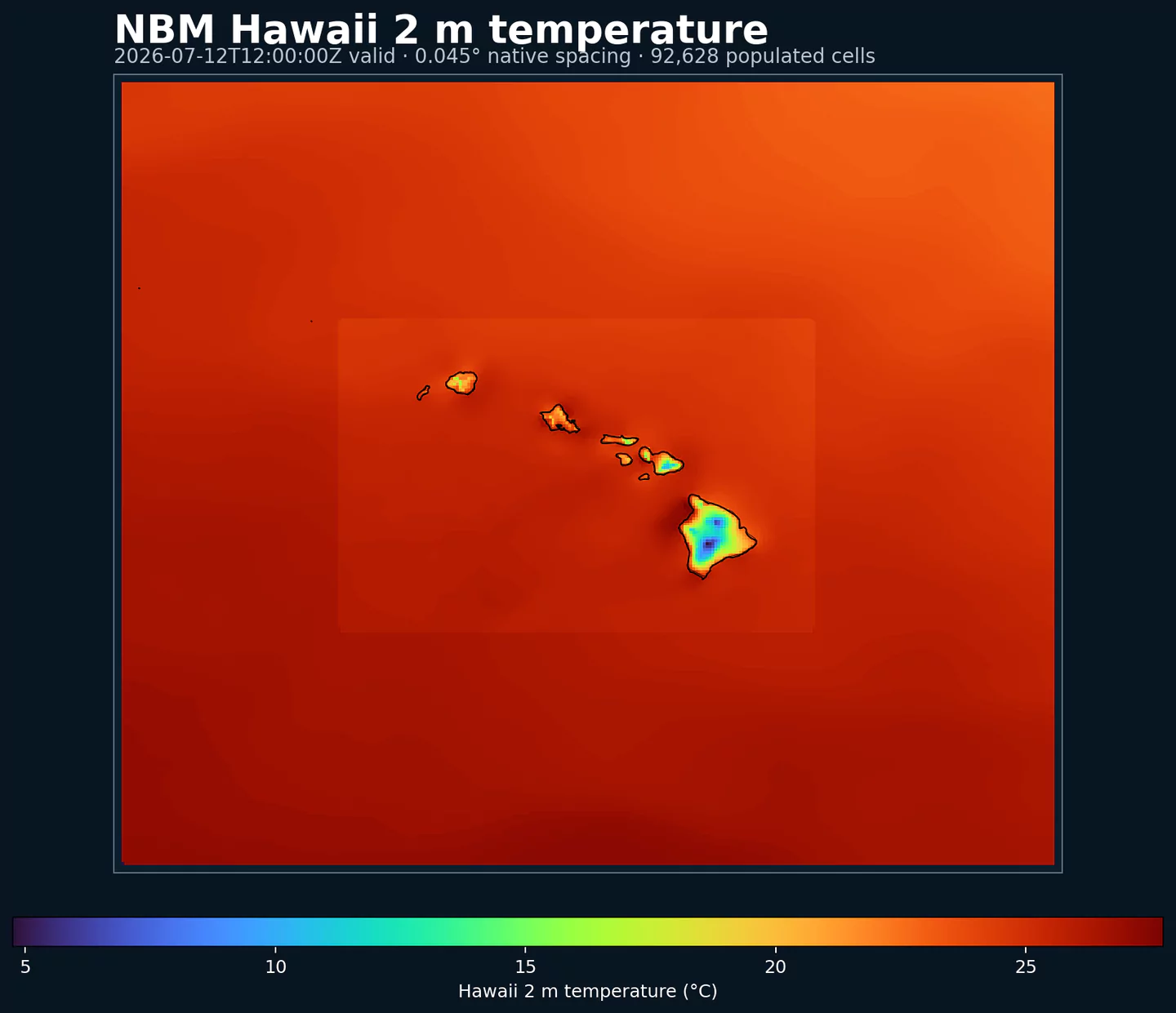
Representative Hawaii coverage: NBM 2 m temperature at its native 0.045 degree output spacing. This plot was generated from the nbmhi dataset.
Autres grilles NBM:
nbmnbmaknbmprnbmgunbmoc
Statut NBM v5 : NBM v5 est maintenant opérationnel dans ce dataset. Dans l'archive GribStream, les runs antérieurs à 2026-05-05 12:00 UTC contiennent la version opérationnelle précédente de NBM ; les runs à partir de 2026-05-05 12:00 UTC utilisent NBM v5.
Les champs d'accumulation comme APCP, ASNOW et FICEAC, lorsqu'ils sont présents, parcourent la plage horaire étendue de NBM v5 puis continuent dans /timeseries avec des périodes d'accumulation plus longues, sans trous ni fenêtres dupliquées.
Description
NBM Hawaii est la sortie régionale du National Blend of Models pour Hawaii. Elle applique le post-traitement opérationnel de la NOAA à une grille adaptée à ce domaine, au lieu d'utiliser la grille CONUS principale.
NBM combine plusieurs sources de prévision et les calibre statistiquement pour produire des champs plus cohérents qu'un modèle individuel non calibré. L'objectif est une base de prévision plus stable pour les produits opérationnels et les décisions où le risque météorologique compte.
Le système utilise des techniques comme Model Output Statistics (MOS), Quantile Mapping et pondération d'ensemble. Dans les domaines régionaux, le schéma API reste identique : choisissez le dataset NBM régional et utilisez les sélecteurs du catalogue comme pour les autres codes NBM.
Dans GribStream, nbmhi conserve les codes de variables, les niveaux et les valeurs info du catalogue. Vous pouvez utiliser les mêmes endpoints et schémas de sélecteur, en changeant seulement le code du modèle.
Détails
Archive depuis: 2020-10-01Page produit: https://vlab.noaa.gov/web/mdl/nbm/ Caractéristiques principales:
Étend la base opérationnelle NBM v5 à un domaine régional hors de la grille CONUS principale.
Publie des cycles horaires pour les produits qui ont besoin de mises à jour fréquentes.
Combine modèles globaux, régionaux, déterministes et modèles d'ensemble dans une sortie calibrée.
Utilise les mêmes schémas de requête GribStream que NBM CONUS, avec son propre code de dataset.
Résolution: Environ 2.5 km sur la grille régionale d'Hawaii.Couverture temporelle: Mises à jour horaires ; les horizons de prévision vont jusqu'à 264 h, environ 11 jours, lorsque la source publie ces Lead Times.Usages principaux: Opérations insulaires, énergie, tourisme, aviation, logistique, gestion d'urgence, prévision maritime près des côtes et produits locaux pour Hawaii.
Datasets liés
Paramètres
Cliquez sur un paramètre pour voir ses variantes dans une table compacte avec des sélecteurs JSON prêts à copier. Les codes, niveaux et valeurs de sélecteur restent exactement tels que l'API les expose.
APCP
– Accumulated Precipitation (kg/m^2)
2 variants
Accumulated precipitation represents the total water-equivalent amount of rain and snow during the output period. It is a primary field for hydrologic impacts and event totals.
Units: kg/m^2.
Use with the model time interval to interpret totals and compare to gauges.
Level
Info
Horizon
Introduced
Selector
surface1h-264h
2020-10-01
{"name":"APCP","level":"surface","info":""}
Copy
surfaceprob >0.2541h-264h
2020-10-01
{"name":"APCP","level":"surface","info":"prob >0.254"}
Copy
APTMP
– Apparent Temperature (K)
1 variant
Apparent temperature combines air temperature, humidity, and wind to estimate how hot or cold it feels to humans. It is useful for heat and cold stress assessments.
Level
Info
Horizon
Introduced
Selector
2 m above ground1h-264h
2020-10-01
{"name":"APTMP","level":"2 m above ground","info":""}
Copy
CAPE
– Convective Available Potential Energy (J/kg)
2 variants
Convective Available Potential Energy (CAPE) quantifies buoyant energy available to rising air parcels. Larger values generally imply stronger potential updrafts and greater convective intensity.
Units: J/kg.
Often used with CIN and lifting mechanisms to assess thunderstorm potential.
Level
Info
Horizon
Introduced
Selector
surface1h-264h
2020-10-01
{"name":"CAPE","level":"surface","info":""}
Copy
surfaceens std dev1h-264h
2020-10-01
{"name":"CAPE","level":"surface","info":"ens std dev"}
Copy
CEIL
– Ceiling Height (m)
7 variants
Ceiling height is the altitude of the lowest cloud base that covers a significant portion of the sky. It is a key aviation and surface-visibility metric.
Level
Info
Horizon
Introduced
Selector
cloud base1h-84h
2020-10-01
{"name":"CEIL","level":"cloud base","info":""}
Copy
cloud ceiling1h-78h
2020-10-01
{"name":"CEIL","level":"cloud ceiling","info":""}
Copy
cloud ceilingprob <152.41h-36h
2026-05-05
{"name":"CEIL","level":"cloud ceiling","info":"prob <152.4"}
Copy
cloud ceilingprob <2011.681h-36h
2026-05-05
{"name":"CEIL","level":"cloud ceiling","info":"prob <2011.68"}
Copy
cloud ceilingprob <304.81h-36h
2026-05-05
{"name":"CEIL","level":"cloud ceiling","info":"prob <304.8"}
Copy
cloud ceilingprob <609.61h-36h
2026-05-05
{"name":"CEIL","level":"cloud ceiling","info":"prob <609.6"}
Copy
cloud ceilingprob <914.51h-36h
2026-05-05
{"name":"CEIL","level":"cloud ceiling","info":"prob <914.5"}
Copy
DIST
– Distance to Feature (km)
1 variant
Distance to feature is the horizontal distance to the named hazard or boundary in the source product. It is used to map proximity to key features like fronts or hazards.
Level
Info
Horizon
Introduced
Selector
surface - 610 m above ground1h-36h
2020-10-01
{"name":"DIST","level":"surface - 610 m above ground","info":""}
Copy
DPT
– Dew Point Temperature (K)
2 variants
Dew point temperature is the temperature at which the air becomes saturated. It is a direct measure of moisture content.
Units: K.
When dew point is close to air temperature, fog or low cloud potential increases.
Level
Info
Horizon
Introduced
Selector
2 m above ground1h-264h
2020-10-01
{"name":"DPT","level":"2 m above ground","info":""}
Copy
2 m above groundens std dev1h-264h
2020-10-01
{"name":"DPT","level":"2 m above ground","info":"ens std dev"}
Copy
DSWRF
– Downward Short-Wave Radiation Flux (W/m^2)
1 variant
Downward radiative flux represents incoming energy at the surface. It is a key driver of surface heating and cooling.
Units: W/m^2.
Shortwave affects surface heating; longwave affects radiative cooling.
Level
Info
Horizon
Introduced
Selector
surface1h-264h
2020-10-01
{"name":"DSWRF","level":"surface","info":""}
Copy
ELLINX
– Ellrod Index (unitless)
1 variant
Ellrod index is a diagnostic for clear-air turbulence based on deformation and vertical wind shear. Higher values indicate greater turbulence potential for aviation.
Level
Info
Horizon
Introduced
Selector
400-300 mb1h-259h
2022-06-01
{"name":"ELLINX","level":"400-300 mb","info":""}
Copy
FOSINDX
– Fosberg Fire Weather Index (unitless)
1 variant
Fosberg fire weather index combines temperature, humidity, and wind to estimate potential fire spread. Higher values indicate more favorable wildfire conditions.
Level
Info
Horizon
Introduced
Selector
surface6h-264h
2020-10-01
{"name":"FOSINDX","level":"surface","info":""}
Copy
GUST
– Wind Speed (Gust) (m/s)
2 variants
Wind gust is the peak short-duration wind speed. It captures brief, hazardous bursts that can exceed sustained winds.
Level
Info
Horizon
Introduced
Selector
10 m above ground1h-264h
2020-10-01
{"name":"GUST","level":"10 m above ground","info":""}
Copy
10 m above groundens std dev1h-264h
2020-10-01
{"name":"GUST","level":"10 m above ground","info":"ens std dev"}
Copy
HINDEX
– Haines Index (Numeric)
1 variant
Haines Index combines atmospheric stability and dryness to estimate the potential for large fire growth. Higher values indicate a more favorable environment for extreme fire behavior.
Units: Numeric.
Typically used in wildfire forecasting and risk monitoring.
Level
Info
Horizon
Introduced
Selector
entire atmosphere (considered as a single layer)6h-264h
2020-10-01
{"name":"HINDEX","level":"entire atmosphere (considered as a single layer)","info":""}
Copy
HTSGW
– Significant Wave Height (m)
5 variants
Significant wave height represents the average height of the highest third of waves. It is the standard metric for sea state and marine hazards.
Level
Info
Horizon
Introduced
Selector
surface1h-240h
2020-10-01
{"name":"HTSGW","level":"surface","info":""}
Copy
surface10% level1h-240h
2023-01-16
{"name":"HTSGW","level":"surface","info":"10% level"}
Copy
surface50% level1h-240h
2023-01-16
{"name":"HTSGW","level":"surface","info":"50% level"}
Copy
surface90% level1h-240h
2023-01-16
{"name":"HTSGW","level":"surface","info":"90% level"}
Copy
surfaceens std dev1h-240h
2020-10-01
{"name":"HTSGW","level":"surface","info":"ens std dev"}
Copy
MAXREF
– Hourly Maximum of Simulated Reflectivity at 1 km AGL (dBZ)
1 variant
Hourly maximum simulated reflectivity at 1 km AGL captures the strongest modeled reflectivity near the surface. It is used to identify peak convective intensity and heavy precipitation cores.
Level
Info
Horizon
Introduced
Selector
1000 m above ground1h-48h
2020-10-01
{"name":"MAXREF","level":"1000 m above ground","info":""}
Copy
MAXRH
– Maximum Relative Humidity (percent)
1 variant
Maximum relative humidity is the highest RH reached during the period. It can indicate peak cloud or fog potential.
Units: percent.
Higher values indicate more atmospheric moisture and greater cloud or precip potential.
Level
Info
Horizon
Introduced
Selector
2 m above ground13h-264h
2020-10-01
{"name":"MAXRH","level":"2 m above ground","info":""}
Copy
MINRH
– Minimum Relative Humidity (percent)
1 variant
Minimum relative humidity is the lowest RH reached during the period. It is used in fire‑weather and drying assessments.
Units: percent.
Higher values indicate more atmospheric moisture and greater cloud or precip potential.
Level
Info
Horizon
Introduced
Selector
2 m above ground13h-264h
2020-10-01
{"name":"MINRH","level":"2 m above ground","info":""}
Copy
MIXHT
– Mixing Height (m)
1 variant
Mixing height is the depth of the well-mixed layer near the surface. It is widely used for dispersion, smoke, and air-quality applications.
Level
Info
Horizon
Introduced
Selector
entire atmosphere (considered as a single layer)1h-264h
2020-10-01
{"name":"MIXHT","level":"entire atmosphere (considered as a single layer)","info":""}
Copy
PCPDUR
– Precipitation Duration (hours)
1 variant
Precipitation duration is the total time with measurable precipitation in the output period. It helps distinguish intermittent from persistent events.
Units: hours.
Accumulations represent water-equivalent depth over the output interval; rates describe intensity.
Level
Info
Horizon
Introduced
Selector
surface12h-36h
2022-06-01
{"name":"PCPDUR","level":"surface","info":""}
Copy
RETOP
– Radar Echo Top Height (m)
1 variant
Echo top height is the altitude of the highest reflectivity in the column. It is a proxy for storm depth and convective vigor.
Level
Info
Horizon
Introduced
Selector
cloud top1h-48h
2020-10-01
{"name":"RETOP","level":"cloud top","info":""}
Copy
RH
– Relative Humidity (percent)
1 variant
Relative humidity describes how close the air is to saturation at the specified level. High values favor cloud formation.
Units: percent.
Higher values indicate more atmospheric moisture and greater cloud or precip potential.
Level
Info
Horizon
Introduced
Selector
2 m above ground1h-264h
2020-10-01
{"name":"RH","level":"2 m above ground","info":""}
Copy
SNOWLVL
– Snow Level (m)
16 variants
Snow level is the approximate altitude where precipitation changes from rain to snow. It is useful for terrain and road-impact forecasting.
Level
Info
Horizon
Introduced
Selector
0 m above mean sea level1h-264h
2022-06-01
{"name":"SNOWLVL","level":"0 m above mean sea level","info":""}
Copy
surface1% level1h-263h
2026-05-05
{"name":"SNOWLVL","level":"surface","info":"1% level"}
Copy
surface10% level1h-263h
2023-01-16
{"name":"SNOWLVL","level":"surface","info":"10% level"}
Copy
surface20% level1h-263h
2026-05-05
{"name":"SNOWLVL","level":"surface","info":"20% level"}
Copy
surface25% level1h-263h
2023-01-16
{"name":"SNOWLVL","level":"surface","info":"25% level"}
Copy
surface30% level1h-263h
2026-05-05
{"name":"SNOWLVL","level":"surface","info":"30% level"}
Copy
surface40% level1h-263h
2026-05-05
{"name":"SNOWLVL","level":"surface","info":"40% level"}
Copy
surface5% level1h-263h
2023-01-16
{"name":"SNOWLVL","level":"surface","info":"5% level"}
Copy
surface50% level1h-263h
2023-01-16
{"name":"SNOWLVL","level":"surface","info":"50% level"}
Copy
surface60% level1h-263h
2026-05-05
{"name":"SNOWLVL","level":"surface","info":"60% level"}
Copy
surface70% level1h-263h
2026-05-05
{"name":"SNOWLVL","level":"surface","info":"70% level"}
Copy
surface75% level1h-263h
2023-01-16
{"name":"SNOWLVL","level":"surface","info":"75% level"}
Copy
surface80% level1h-263h
2026-05-05
{"name":"SNOWLVL","level":"surface","info":"80% level"}
Copy
surface90% level1h-263h
2023-01-16
{"name":"SNOWLVL","level":"surface","info":"90% level"}
Copy
surface95% level1h-263h
2023-01-16
{"name":"SNOWLVL","level":"surface","info":"95% level"}
Copy
surface99% level1h-263h
2026-05-05
{"name":"SNOWLVL","level":"surface","info":"99% level"}
Copy
TCDC
– Total Cloud Cover (percent)
3 variants
Total cloud cover is the fraction of the grid cell covered by clouds at any level. It influences radiation, temperature, and visibility.
Units: percent.
Cloud fraction influences surface radiation and temperature.
Level
Info
Horizon
Introduced
Selector
surface1h-264h
2020-10-01
{"name":"TCDC","level":"surface","info":""}
Copy
surfaceens std dev1h-48h
2020-10-01
{"name":"TCDC","level":"surface","info":"ens std dev"}
Copy
surfaceunknown derived fcst37h-264h
2020-10-01
{"name":"TCDC","level":"surface","info":"unknown derived fcst"}
Copy
THUNC
– Thunderstorm Probability (percent)
1 variant
Thunderstorm probability gives the chance of thunderstorms during the valid period. It is used for convective hazard guidance.
Level
Info
Horizon
Introduced
Selector
entire atmosphere1h-36h
2023-01-16
{"name":"THUNC","level":"entire atmosphere","info":""}
Copy
TMAX
– Maximum Temperature (K)
2 variants
Maximum temperature is the highest temperature reached during the output period. It is commonly used for heat stress and daily extremes.
Level
Info
Horizon
Introduced
Selector
2 m above ground12h-264h
2020-10-01
{"name":"TMAX","level":"2 m above ground","info":""}
Copy
2 m above groundens std dev12h-264h
2020-10-01
{"name":"TMAX","level":"2 m above ground","info":"ens std dev"}
Copy
TMIN
– Minimum Temperature (K)
2 variants
Minimum temperature is the lowest temperature reached during the output period. It is commonly used for frost and cold-stress assessment.
Level
Info
Horizon
Introduced
Selector
2 m above ground12h-264h
2020-10-01
{"name":"TMIN","level":"2 m above ground","info":""}
Copy
2 m above groundens std dev12h-264h
2020-10-01
{"name":"TMIN","level":"2 m above ground","info":"ens std dev"}
Copy
TMP
– Temperature (K)
2 variants
Air temperature is the thermal state of the atmosphere at the specified level. It influences density, stability, and energy exchange.
Level
Info
Horizon
Introduced
Selector
2 m above ground1h-264h
2020-10-01
{"name":"TMP","level":"2 m above ground","info":""}
Copy
2 m above groundens std dev1h-264h
2020-10-01
{"name":"TMP","level":"2 m above ground","info":"ens std dev"}
Copy
TPWDIR
– Total Precipitable Water Transport Direction (degrees)
1 variant
Total precipitable water transport direction is the direction of column‑integrated moisture flux. It indicates moisture transport pathways.
Level
Info
Horizon
Introduced
Selector
10 m above ground1h-167h
2024-04-16
{"name":"TPWDIR","level":"10 m above ground","info":""}
Copy
TPWSPD
– Total Precipitable Water Transport Speed (m/s)
1 variant
Total precipitable water transport speed is the magnitude of column‑integrated moisture transport. It highlights atmospheric river strength.
Level
Info
Horizon
Introduced
Selector
10 m above ground1h-167h
2024-04-16
{"name":"TPWSPD","level":"10 m above ground","info":""}
Copy
TRWDIR
– Tropical Wind Direction (degrees)
1 variant
Tropical wind direction is the direction of the tropical wind vector used in cyclone guidance.
Level
Info
Horizon
Introduced
Selector
entire atmosphere (considered as a single layer)1h-264h
2022-06-01
{"name":"TRWDIR","level":"entire atmosphere (considered as a single layer)","info":""}
Copy
TRWSPD
– Tropical Wind Speed (m/s)
1 variant
Tropical wind speed is the magnitude of the tropical wind vector. It is often used in cyclone diagnostics.
Level
Info
Horizon
Introduced
Selector
entire atmosphere (considered as a single layer)1h-264h
2022-06-01
{"name":"TRWSPD","level":"entire atmosphere (considered as a single layer)","info":""}
Copy
TSTM
– Thunderstorm Indicator (boolean)
1 variant
Thunderstorm indicator flags the presence of thunderstorm conditions in the grid cell. It is used as a categorical hazard field.
Level
Info
Horizon
Introduced
Selector
surfaceprobability forecast1h-192h
2020-10-01
{"name":"TSTM","level":"surface","info":"probability forecast"}
Copy
TURB
– Turbulence Index (unitless)
1 variant
Turbulence index is a diagnostic measure of aviation turbulence. Higher values indicate increased turbulence risk along flight routes.
Level
Info
Horizon
Introduced
Selector
surface - 1372 m above ground1h-259h
2020-10-01
{"name":"TURB","level":"surface - 1372 m above ground","info":""}
Copy
VIL
– Vertically-Integrated Liquid Water (kg/m^2)
1 variant
Vertically‑integrated liquid water is the total column liquid water content. It is used as a proxy for precipitation intensity and hail potential.
Level
Info
Horizon
Introduced
Selector
entire atmosphere1h-48h
2020-10-01
{"name":"VIL","level":"entire atmosphere","info":""}
Copy
VIS
– Visibility (m)
5 variants
Horizontal visibility at the surface. Lower values indicate reduced visibility due to fog, precipitation, or aerosols.
Level
Info
Horizon
Introduced
Selector
surface1h-84h
2020-10-01
{"name":"VIS","level":"surface","info":""}
Copy
surfaceprob <1609.341h-36h
2026-05-05
{"name":"VIS","level":"surface","info":"prob <1609.34"}
Copy
surfaceprob <3218.691h-36h
2026-05-05
{"name":"VIS","level":"surface","info":"prob <3218.69"}
Copy
surfaceprob <4828.031h-36h
2026-05-05
{"name":"VIS","level":"surface","info":"prob <4828.03"}
Copy
surfaceprob <8046.731h-36h
2026-05-05
{"name":"VIS","level":"surface","info":"prob <8046.73"}
Copy
VRATE
– Ventilation Rate (m^2/s)
1 variant
Ventilation rate combines mixing depth and transport wind to estimate the atmosphere's ability to disperse smoke and pollutants.
Level
Info
Horizon
Introduced
Selector
entire atmosphere (considered as a single layer)1h-264h
2020-10-01
{"name":"VRATE","level":"entire atmosphere (considered as a single layer)","info":""}
Copy
WDIR
– Wind Direction (degrees)
4 variants
Wind direction indicates the direction from which the wind is blowing at the specified level.
Level
Info
Horizon
Introduced
Selector
10 m above ground1h-264h
2020-10-01
{"name":"WDIR","level":"10 m above ground","info":""}
Copy
30 m above ground1h-264h
2020-10-01
{"name":"WDIR","level":"30 m above ground","info":""}
Copy
80 m above ground1h-264h
2020-10-01
{"name":"WDIR","level":"80 m above ground","info":""}
Copy
surface - 610 m above ground1h-36h
2020-10-01
{"name":"WDIR","level":"surface - 610 m above ground","info":""}
Copy
WIND
– Wind Speed (m/s)
5 variants
Wind speed is the magnitude of the horizontal wind at the specified level. It is used for transport, mixing, and hazards.
Level
Info
Horizon
Introduced
Selector
10 m above ground1h-264h
2020-10-01
{"name":"WIND","level":"10 m above ground","info":""}
Copy
10 m above groundens std dev1h-264h
2020-10-01
{"name":"WIND","level":"10 m above ground","info":"ens std dev"}
Copy
30 m above ground1h-264h
2020-10-01
{"name":"WIND","level":"30 m above ground","info":""}
Copy
80 m above ground1h-264h
2020-10-01
{"name":"WIND","level":"80 m above ground","info":""}
Copy
surface - 610 m above ground1h-36h
2020-10-01
{"name":"WIND","level":"surface - 610 m above ground","info":""}
Copy
Aucun paramètre ne correspond à la recherche.