Apparent temperature combines air temperature, humidity, and wind to estimate how hot or cold it feels to humans. It is useful for heat and cold stress assessments.
- Units: K.
Code GribStream: nbmoc
Autres grilles NBM:
nbm, nbmak, nbmhi, nbmpr, nbmgu
Statut NBM v5 : NBM v5 est maintenant opérationnel dans ce dataset. Dans l'archive GribStream, les runs antérieurs à 2026-05-05 12:00 UTC contiennent la version opérationnelle précédente de NBM ; les runs à partir de 2026-05-05 12:00 UTC utilisent NBM v5.
Les champs d'accumulation comme APCP, ASNOW et FICEAC, lorsqu'ils sont présents, parcourent la plage horaire étendue de NBM v5 puis continuent dans /timeseries avec des périodes d'accumulation plus longues, sans trous ni fenêtres dupliquées.
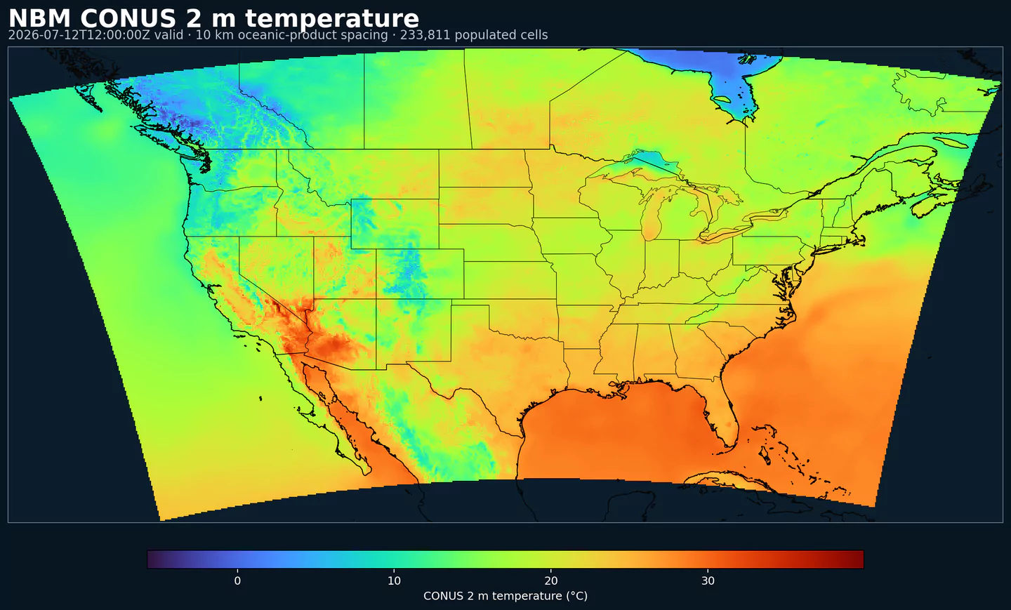
NBM Oceanic est la sortie régionale du National Blend of Models pour le domaine océanique. Elle applique le post-traitement opérationnel de la NOAA à une grille adaptée à ce domaine, au lieu d'utiliser la grille CONUS principale.
NBM combine plusieurs sources de prévision et les calibre statistiquement pour produire des champs plus cohérents qu'un modèle individuel non calibré. L'objectif est une base de prévision plus stable pour les produits opérationnels et les décisions où le risque météorologique compte.
Le système utilise des techniques comme Model Output Statistics (MOS), Quantile Mapping et pondération d'ensemble. Dans les domaines régionaux, le schéma API reste identique : choisissez le dataset NBM régional et utilisez les sélecteurs du catalogue comme pour les autres codes NBM.
Dans GribStream, nbmoc conserve les codes de variables, les niveaux et les valeurs info du catalogue. Vous pouvez utiliser les mêmes endpoints et schémas de sélecteur, en changeant seulement le code du modèle.
Cliquez sur un paramètre pour voir ses variantes dans une table compacte avec des sélecteurs JSON prêts à copier. Les codes, niveaux et valeurs de sélecteur restent exactement tels que l'API les expose.
Apparent temperature combines air temperature, humidity, and wind to estimate how hot or cold it feels to humans. It is useful for heat and cold stress assessments.
| Level | Info | Horizon | Introduced | Selector |
|---|---|---|---|---|
2 m above ground |
2h-264h | 2026-05-05 |
{"name":"APTMP","level":"2 m above ground","info":""}
|
Dew point temperature is the temperature at which the air becomes saturated. It is a direct measure of moisture content.
| Level | Info | Horizon | Introduced | Selector |
|---|---|---|---|---|
2 m above ground |
50% level |
2h-264h | 2026-05-05 |
{"name":"DPT","level":"2 m above ground","info":"50% level"}
|
Freezing spray indicator flags marine conditions favorable for ice accretion on vessels. It depends on wind, air temperature, and wave conditions.
| Level | Info | Horizon | Introduced | Selector |
|---|---|---|---|---|
surface |
2h-264h | 2024-04-15 |
{"name":"FRZSPR","level":"surface","info":""}
|
Wind gust is the peak short-duration wind speed. It captures brief, hazardous bursts that can exceed sustained winds.
| Level | Info | Horizon | Introduced | Selector |
|---|---|---|---|---|
10 m above ground |
50% level |
2h-264h | 2020-10-01 |
{"name":"GUST","level":"10 m above ground","info":"50% level"}
|
Significant wave height represents the average height of the highest third of waves. It is the standard metric for sea state and marine hazards.
| Level | Info | Horizon | Introduced | Selector |
|---|---|---|---|---|
surface |
2h-240h | 2020-10-01 |
{"name":"HTSGW","level":"surface","info":""}
|
|
surface |
10% level |
2h-240h | 2023-01-16 |
{"name":"HTSGW","level":"surface","info":"10% level"}
|
surface |
50% level |
2h-240h | 2023-01-16 |
{"name":"HTSGW","level":"surface","info":"50% level"}
|
surface |
90% level |
2h-240h | 2023-01-16 |
{"name":"HTSGW","level":"surface","info":"90% level"}
|
surface |
ens std dev |
2h-240h | 2020-10-01 |
{"name":"HTSGW","level":"surface","info":"ens std dev"}
|
Total cloud cover is the fraction of the grid cell covered by clouds at any level. It influences radiation, temperature, and visibility.
| Level | Info | Horizon | Introduced | Selector |
|---|---|---|---|---|
surface |
2h-264h | 2026-05-05 |
{"name":"TCDC","level":"surface","info":""}
|
|
surface |
ens std dev |
2h-264h | 2026-05-05 |
{"name":"TCDC","level":"surface","info":"ens std dev"}
|
Thunderstorm probability gives the chance of thunderstorms during the valid period. It is used for convective hazard guidance.
| Level | Info | Horizon | Introduced | Selector |
|---|---|---|---|---|
entire atmosphere |
1h-36h | 2023-01-16 |
{"name":"THUNC","level":"entire atmosphere","info":""}
|
Air temperature is the thermal state of the atmosphere at the specified level. It influences density, stability, and energy exchange.
| Level | Info | Horizon | Introduced | Selector |
|---|---|---|---|---|
2 m above ground |
50% level |
2h-264h | 2020-10-01 |
{"name":"TMP","level":"2 m above ground","info":"50% level"}
|
surface |
2h-264h | 2020-10-01 |
{"name":"TMP","level":"surface","info":""}
|
Total precipitable water transport direction is the direction of column‑integrated moisture flux. It indicates moisture transport pathways.
| Level | Info | Horizon | Introduced | Selector |
|---|---|---|---|---|
10 m above ground |
2h-167h | 2024-05-14 |
{"name":"TPWDIR","level":"10 m above ground","info":""}
|
Total precipitable water transport speed is the magnitude of column‑integrated moisture transport. It highlights atmospheric river strength.
| Level | Info | Horizon | Introduced | Selector |
|---|---|---|---|---|
10 m above ground |
2h-167h | 2024-05-14 |
{"name":"TPWSPD","level":"10 m above ground","info":""}
|
Thunderstorm indicator flags the presence of thunderstorm conditions in the grid cell. It is used as a categorical hazard field.
| Level | Info | Horizon | Introduced | Selector |
|---|---|---|---|---|
surface |
probability forecast |
1h-192h | 2020-10-01 |
{"name":"TSTM","level":"surface","info":"probability forecast"}
|
Horizontal visibility at the surface. Lower values indicate reduced visibility due to fog, precipitation, or aerosols.
| Level | Info | Horizon | Introduced | Selector |
|---|---|---|---|---|
surface |
50% level |
2h-264h | 2020-10-01 |
{"name":"VIS","level":"surface","info":"50% level"}
|
Wind direction indicates the direction from which the wind is blowing at the specified level.
| Level | Info | Horizon | Introduced | Selector |
|---|---|---|---|---|
10 m above ground |
5h-264h | 2020-10-01 |
{"name":"WDIR","level":"10 m above ground","info":""}
|
|
10 m above ground |
50% level |
5h-264h | 2020-10-01 |
{"name":"WDIR","level":"10 m above ground","info":"50% level"}
|
10 m above ground |
75% level |
5h-264h | 2020-10-01 |
{"name":"WDIR","level":"10 m above ground","info":"75% level"}
|
10 m above ground |
90% level |
5h-264h | 2020-10-01 |
{"name":"WDIR","level":"10 m above ground","info":"90% level"}
|
30 m above ground |
50% level |
5h-264h | 2020-10-01 |
{"name":"WDIR","level":"30 m above ground","info":"50% level"}
|
80 m above ground |
50% level |
5h-264h | 2020-10-01 |
{"name":"WDIR","level":"80 m above ground","info":"50% level"}
|
Wind speed is the magnitude of the horizontal wind at the specified level. It is used for transport, mixing, and hazards.
| Level | Info | Horizon | Introduced | Selector |
|---|---|---|---|---|
10 m above ground |
5h-264h | 2020-10-01 |
{"name":"WIND","level":"10 m above ground","info":""}
|
|
10 m above ground |
10% level |
2h-264h | 2020-10-01 |
{"name":"WIND","level":"10 m above ground","info":"10% level"}
|
10 m above ground |
25% level |
2h-264h | 2020-10-01 |
{"name":"WIND","level":"10 m above ground","info":"25% level"}
|
10 m above ground |
50% level |
2h-264h | 2020-10-01 |
{"name":"WIND","level":"10 m above ground","info":"50% level"}
|
10 m above ground |
75% level |
2h-264h | 2020-10-01 |
{"name":"WIND","level":"10 m above ground","info":"75% level"}
|
10 m above ground |
90% level |
2h-264h | 2020-10-01 |
{"name":"WIND","level":"10 m above ground","info":"90% level"}
|
30 m above ground |
50% level |
2h-264h | 2020-10-01 |
{"name":"WIND","level":"30 m above ground","info":"50% level"}
|
80 m above ground |
50% level |
2h-264h | 2020-10-01 |
{"name":"WIND","level":"80 m above ground","info":"50% level"}
|
Aucun paramètre ne correspond à la recherche.