Best (4-layer) lifted index uses parcels from the lowest four model layers to assess stability at 500 hPa. More negative values indicate greater instability.
- Units: K.
- Often used alongside CAPE and CIN in convective forecasting.
cdas
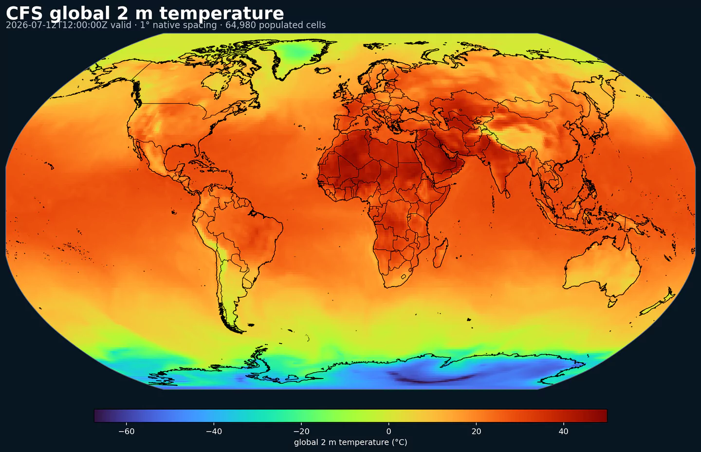
CDAS1 (Climate Data Assimilation System) is a global data assimilation stream designed for climate-oriented analysis and consistent retrospective fields. It blends a global model background with observations to produce gridded atmospheric states that are commonly used as baselines for climate diagnostics, anomaly studies, and long-running evaluation pipelines.
CDAS lives alongside NOAA’s CFS products in the same public AWS Open Data archive. That proximity is useful in practice: you can treat CDAS as a climate/assimilation reference and compare it against seasonal forecasts from CFS or operational guidance from GFS.
On GribStream, CDAS is exposed on a 1° latitude/longitude grid with 6-hourly cycles and short lead times (0–9 hours). The coarser resolution makes it cost-effective for global baselines and large-scale climate analytics, while still providing a broad set of standard atmospheric variables through the same API shape as the forecast models.
Click a parameter to reveal variants in a compact table with ready-to-copy JSON selectors.
Best (4-layer) lifted index uses parcels from the lowest four model layers to assess stability at 500 hPa. More negative values indicate greater instability.
| Level | Info | Horizon | Introduced | Selector |
|---|---|---|---|---|
surface |
0h-9h | 2023-04-22 |
{"name":"4LFTX","level":"surface","info":""}
|
5-wave geopotential height anomaly isolates planetary-scale wave patterns in the midlatitude flow. It highlights departures from the climatological wave-5 structure, useful for large-scale regime analysis.
| Level | Info | Horizon | Introduced | Selector |
|---|---|---|---|---|
500 mb |
0h-9h | 2023-04-22 |
{"name":"5WAVA","level":"500 mb","info":""}
|
5-wave geopotential height represents the planetary-scale wave-5 component of the flow. It is used in long-range diagnostics to describe large-scale ridge and trough patterns.
| Level | Info | Horizon | Introduced | Selector |
|---|---|---|---|---|
500 mb |
0h-9h | 2023-04-22 |
{"name":"5WAVH","level":"500 mb","info":""}
|
Absolute vorticity combines relative vorticity and planetary vorticity from Earth's rotation. It highlights rotation and dynamical forcing in the flow.
| Level | Info | Horizon | Introduced | Selector |
|---|---|---|---|---|
1 mb |
0h-9h | 2023-04-22 |
{"name":"ABSV","level":"1 mb","info":""}
|
|
10 mb |
0h-9h | 2023-04-22 |
{"name":"ABSV","level":"10 mb","info":""}
|
|
100 mb |
0h-9h | 2023-04-22 |
{"name":"ABSV","level":"100 mb","info":""}
|
|
1000 mb |
0h-9h | 2023-04-22 |
{"name":"ABSV","level":"1000 mb","info":""}
|
|
125 mb |
0h-9h | 2023-04-22 |
{"name":"ABSV","level":"125 mb","info":""}
|
|
150 mb |
0h-9h | 2023-04-22 |
{"name":"ABSV","level":"150 mb","info":""}
|
|
175 mb |
0h-9h | 2023-04-22 |
{"name":"ABSV","level":"175 mb","info":""}
|
|
2 mb |
0h-9h | 2023-04-22 |
{"name":"ABSV","level":"2 mb","info":""}
|
|
20 mb |
0h-9h | 2023-04-22 |
{"name":"ABSV","level":"20 mb","info":""}
|
|
200 mb |
0h-9h | 2023-04-22 |
{"name":"ABSV","level":"200 mb","info":""}
|
|
225 mb |
0h-9h | 2023-04-22 |
{"name":"ABSV","level":"225 mb","info":""}
|
|
250 mb |
0h-9h | 2023-04-22 |
{"name":"ABSV","level":"250 mb","info":""}
|
|
3 mb |
0h-9h | 2023-04-22 |
{"name":"ABSV","level":"3 mb","info":""}
|
|
30 mb |
0h-9h | 2023-04-22 |
{"name":"ABSV","level":"30 mb","info":""}
|
|
300 mb |
0h-9h | 2023-04-22 |
{"name":"ABSV","level":"300 mb","info":""}
|
|
350 mb |
0h-9h | 2023-04-22 |
{"name":"ABSV","level":"350 mb","info":""}
|
|
400 mb |
0h-9h | 2023-04-22 |
{"name":"ABSV","level":"400 mb","info":""}
|
|
450 mb |
0h-9h | 2023-04-22 |
{"name":"ABSV","level":"450 mb","info":""}
|
|
5 mb |
0h-9h | 2023-04-22 |
{"name":"ABSV","level":"5 mb","info":""}
|
|
50 mb |
0h-9h | 2023-04-22 |
{"name":"ABSV","level":"50 mb","info":""}
|
|
500 mb |
0h-9h | 2023-04-22 |
{"name":"ABSV","level":"500 mb","info":""}
|
|
550 mb |
0h-9h | 2023-04-22 |
{"name":"ABSV","level":"550 mb","info":""}
|
|
600 mb |
0h-9h | 2023-04-22 |
{"name":"ABSV","level":"600 mb","info":""}
|
|
650 mb |
0h-9h | 2023-04-22 |
{"name":"ABSV","level":"650 mb","info":""}
|
|
7 mb |
0h-9h | 2023-04-22 |
{"name":"ABSV","level":"7 mb","info":""}
|
|
70 mb |
0h-9h | 2023-04-22 |
{"name":"ABSV","level":"70 mb","info":""}
|
|
700 mb |
0h-9h | 2023-04-22 |
{"name":"ABSV","level":"700 mb","info":""}
|
|
750 mb |
0h-9h | 2023-04-22 |
{"name":"ABSV","level":"750 mb","info":""}
|
|
775 mb |
0h-9h | 2023-04-22 |
{"name":"ABSV","level":"775 mb","info":""}
|
|
800 mb |
0h-9h | 2023-04-22 |
{"name":"ABSV","level":"800 mb","info":""}
|
|
825 mb |
0h-9h | 2023-04-22 |
{"name":"ABSV","level":"825 mb","info":""}
|
|
850 mb |
0h-9h | 2023-04-22 |
{"name":"ABSV","level":"850 mb","info":""}
|
|
875 mb |
0h-9h | 2023-04-22 |
{"name":"ABSV","level":"875 mb","info":""}
|
|
900 mb |
0h-9h | 2023-04-22 |
{"name":"ABSV","level":"900 mb","info":""}
|
|
925 mb |
0h-9h | 2023-04-22 |
{"name":"ABSV","level":"925 mb","info":""}
|
|
950 mb |
0h-9h | 2023-04-22 |
{"name":"ABSV","level":"950 mb","info":""}
|
|
975 mb |
0h-9h | 2023-04-22 |
{"name":"ABSV","level":"975 mb","info":""}
|
Aerodynamic conductance measures the efficiency of turbulent exchange of heat and moisture between the surface and atmosphere. It depends on wind speed, stability, and surface roughness and is used in surface energy balance and evapotranspiration calculations.
| Level | Info | Horizon | Introduced | Selector |
|---|---|---|---|---|
surface |
0h-9h | 2023-04-22 |
{"name":"ACOND","level":"surface","info":""}
|
Convective precipitation accumulation represents precipitation produced by the convection scheme during the output period. It isolates convective rainfall from larger-scale precipitation.
| Level | Info | Horizon | Introduced | Selector |
|---|---|---|---|---|
surface |
0h-9h | 2023-04-22 |
{"name":"ACPCP","level":"surface","info":""}
|
Surface albedo is the fraction of incoming shortwave radiation reflected by the surface. Higher albedo means less solar energy absorbed and a cooler surface.
| Level | Info | Horizon | Introduced | Selector |
|---|---|---|---|---|
surface |
0h-9h | 2023-04-22 |
{"name":"ALBDO","level":"surface","info":""}
|
Accumulated precipitation represents the total water-equivalent amount of rain and snow during the output period. It is a primary field for hydrologic impacts and event totals.
| Level | Info | Horizon | Introduced | Selector |
|---|---|---|---|---|
surface |
0h-9h | 2023-04-22 |
{"name":"APCP","level":"surface","info":""}
|
Convective Available Potential Energy (CAPE) quantifies buoyant energy available to rising air parcels. Larger values generally imply stronger potential updrafts and greater convective intensity.
| Level | Info | Horizon | Introduced | Selector |
|---|---|---|---|---|
180-0 mb above ground |
0h-9h | 2023-04-22 |
{"name":"CAPE","level":"180-0 mb above ground","info":""}
|
|
surface |
0h-9h | 2023-04-22 |
{"name":"CAPE","level":"surface","info":""}
|
Clear‑sky UV‑B downward flux is UV‑B radiation at the surface without cloud effects. It is used for UV exposure estimates.
| Level | Info | Horizon | Introduced | Selector |
|---|---|---|---|---|
surface |
0h-9h | 2023-04-22 |
{"name":"CDUVB","level":"surface","info":""}
|
Categorical indicator of freezing rain occurrence at the surface during the output period.
| Level | Info | Horizon | Introduced | Selector |
|---|---|---|---|---|
surface |
0h-9h | 2023-04-22 |
{"name":"CFRZR","level":"surface","info":""}
|
Categorical indicator of ice pellet (sleet) occurrence at the surface during the output period.
| Level | Info | Horizon | Introduced | Selector |
|---|---|---|---|---|
surface |
0h-9h | 2023-04-22 |
{"name":"CICEP","level":"surface","info":""}
|
Convective Inhibition (CIN) measures the energy barrier that must be overcome to initiate convection. More negative values indicate a stronger cap that can suppress storms.
| Level | Info | Horizon | Introduced | Selector |
|---|---|---|---|---|
180-0 mb above ground |
0h-9h | 2023-04-22 |
{"name":"CIN","level":"180-0 mb above ground","info":""}
|
|
surface |
0h-9h | 2023-04-22 |
{"name":"CIN","level":"surface","info":""}
|
Cloud water mixing ratio is the mass of liquid cloud droplets per mass of air. It describes in‑cloud liquid water content.
| Level | Info | Horizon | Introduced | Selector |
|---|---|---|---|---|
10 mb |
0h-9h | 2023-04-22 |
{"name":"CLMR","level":"10 mb","info":""}
|
|
100 mb |
0h-9h | 2023-04-22 |
{"name":"CLMR","level":"100 mb","info":""}
|
|
1000 mb |
0h-9h | 2023-04-22 |
{"name":"CLMR","level":"1000 mb","info":""}
|
|
125 mb |
0h-9h | 2023-04-22 |
{"name":"CLMR","level":"125 mb","info":""}
|
|
150 mb |
0h-9h | 2023-04-22 |
{"name":"CLMR","level":"150 mb","info":""}
|
|
175 mb |
0h-9h | 2023-04-22 |
{"name":"CLMR","level":"175 mb","info":""}
|
|
20 mb |
0h-9h | 2023-04-22 |
{"name":"CLMR","level":"20 mb","info":""}
|
|
200 mb |
0h-9h | 2023-04-22 |
{"name":"CLMR","level":"200 mb","info":""}
|
|
225 mb |
0h-9h | 2023-04-22 |
{"name":"CLMR","level":"225 mb","info":""}
|
|
250 mb |
0h-9h | 2023-04-22 |
{"name":"CLMR","level":"250 mb","info":""}
|
|
30 mb |
0h-9h | 2023-04-22 |
{"name":"CLMR","level":"30 mb","info":""}
|
|
300 mb |
0h-9h | 2023-04-22 |
{"name":"CLMR","level":"300 mb","info":""}
|
|
350 mb |
0h-9h | 2023-04-22 |
{"name":"CLMR","level":"350 mb","info":""}
|
|
400 mb |
0h-9h | 2023-04-22 |
{"name":"CLMR","level":"400 mb","info":""}
|
|
450 mb |
0h-9h | 2023-04-22 |
{"name":"CLMR","level":"450 mb","info":""}
|
|
50 mb |
0h-9h | 2023-04-22 |
{"name":"CLMR","level":"50 mb","info":""}
|
|
500 mb |
0h-9h | 2023-04-22 |
{"name":"CLMR","level":"500 mb","info":""}
|
|
550 mb |
0h-9h | 2023-04-22 |
{"name":"CLMR","level":"550 mb","info":""}
|
|
600 mb |
0h-9h | 2023-04-22 |
{"name":"CLMR","level":"600 mb","info":""}
|
|
650 mb |
0h-9h | 2023-04-22 |
{"name":"CLMR","level":"650 mb","info":""}
|
|
70 mb |
0h-9h | 2023-04-22 |
{"name":"CLMR","level":"70 mb","info":""}
|
|
700 mb |
0h-9h | 2023-04-22 |
{"name":"CLMR","level":"700 mb","info":""}
|
|
750 mb |
0h-9h | 2023-04-22 |
{"name":"CLMR","level":"750 mb","info":""}
|
|
775 mb |
0h-9h | 2023-04-22 |
{"name":"CLMR","level":"775 mb","info":""}
|
|
800 mb |
0h-9h | 2023-04-22 |
{"name":"CLMR","level":"800 mb","info":""}
|
|
825 mb |
0h-9h | 2023-04-22 |
{"name":"CLMR","level":"825 mb","info":""}
|
|
850 mb |
0h-9h | 2023-04-22 |
{"name":"CLMR","level":"850 mb","info":""}
|
|
875 mb |
0h-9h | 2023-04-22 |
{"name":"CLMR","level":"875 mb","info":""}
|
|
900 mb |
0h-9h | 2023-04-22 |
{"name":"CLMR","level":"900 mb","info":""}
|
|
925 mb |
0h-9h | 2023-04-22 |
{"name":"CLMR","level":"925 mb","info":""}
|
|
950 mb |
0h-9h | 2023-04-22 |
{"name":"CLMR","level":"950 mb","info":""}
|
|
975 mb |
0h-9h | 2023-04-22 |
{"name":"CLMR","level":"975 mb","info":""}
|
Plant canopy surface water is liquid water intercepted by vegetation. It represents interception storage and evaporation potential.
| Level | Info | Horizon | Introduced | Selector |
|---|---|---|---|---|
surface |
0h-9h | 2023-04-22 |
{"name":"CNWAT","level":"surface","info":""}
|
Convective precipitation rate is the intensity of precipitation produced by convection. It highlights storm‑driven rainfall rates.
| Level | Info | Horizon | Introduced | Selector |
|---|---|---|---|---|
surface |
0h-9h | 2023-04-22 |
{"name":"CPRAT","level":"surface","info":""}
|
Categorical indicator of rain occurrence at the surface during the output period. Useful as a yes/no mask for rain.
| Level | Info | Horizon | Introduced | Selector |
|---|---|---|---|---|
surface |
0h-9h | 2023-04-22 |
{"name":"CRAIN","level":"surface","info":""}
|
Downward longwave (thermal) flux represents incoming energy at the surface. Clear-sky versions remove cloud effects to isolate the atmospheric background.
| Level | Info | Horizon | Introduced | Selector |
|---|---|---|---|---|
surface |
0h-9h | 2023-04-22 |
{"name":"CSDLF","level":"surface","info":""}
|
Clear‑sky downward shortwave flux is broadband solar energy at the surface without cloud effects.
| Level | Info | Horizon | Introduced | Selector |
|---|---|---|---|---|
surface |
0h-9h | 2023-04-22 |
{"name":"CSDSF","level":"surface","info":""}
|
Categorical indicator of snow occurrence at the surface during the output period.
| Level | Info | Horizon | Introduced | Selector |
|---|---|---|---|---|
surface |
0h-9h | 2023-04-22 |
{"name":"CSNOW","level":"surface","info":""}
|
Upward longwave (thermal) flux represents outgoing energy at the surface. Clear-sky versions remove cloud effects to isolate the atmospheric background.
| Level | Info | Horizon | Introduced | Selector |
|---|---|---|---|---|
surface |
0h-9h | 2023-04-22 |
{"name":"CSULF","level":"surface","info":""}
|
|
top of atmosphere |
0h-9h | 2023-04-22 |
{"name":"CSULF","level":"top of atmosphere","info":""}
|
Upward shortwave (solar) flux represents outgoing energy at the surface. Clear-sky versions remove cloud effects to isolate the atmospheric background.
| Level | Info | Horizon | Introduced | Selector |
|---|---|---|---|---|
surface |
0h-9h | 2023-04-22 |
{"name":"CSUSF","level":"surface","info":""}
|
|
top of atmosphere |
0h-9h | 2023-04-22 |
{"name":"CSUSF","level":"top of atmosphere","info":""}
|
Cloud water is the total liquid water content (often column‑integrated). It is used to assess cloud water burden.
| Level | Info | Horizon | Introduced | Selector |
|---|---|---|---|---|
entire atmosphere (considered as a single layer) |
0h-9h | 2023-04-22 |
{"name":"CWAT","level":"entire atmosphere (considered as a single layer)","info":""}
|
Cloud work function is an energy measure used by convection schemes to diagnose convective potential. Larger values generally indicate a more favorable environment for deep convection.
| Level | Info | Horizon | Introduced | Selector |
|---|---|---|---|---|
entire atmosphere (considered as a single layer) |
0h-9h | 2023-04-22 |
{"name":"CWORK","level":"entire atmosphere (considered as a single layer)","info":""}
|
Downward longwave (thermal) flux represents incoming energy at the surface. It is a key driver of surface heating and cooling.
| Level | Info | Horizon | Introduced | Selector |
|---|---|---|---|---|
surface |
0h-9h | 2023-04-22 |
{"name":"DLWRF","level":"surface","info":""}
|
Dew point temperature is the temperature at which the air becomes saturated. It is a direct measure of moisture content.
| Level | Info | Horizon | Introduced | Selector |
|---|---|---|---|---|
2 m above ground |
0h-9h | 2023-04-22 |
{"name":"DPT","level":"2 m above ground","info":""}
|
|
30-0 mb above ground |
0h-9h | 2023-04-22 |
{"name":"DPT","level":"30-0 mb above ground","info":""}
|
Downward radiative flux represents incoming energy at the surface. It is a key driver of surface heating and cooling.
| Level | Info | Horizon | Introduced | Selector |
|---|---|---|---|---|
surface |
0h-9h | 2023-04-22 |
{"name":"DSWRF","level":"surface","info":""}
|
|
top of atmosphere |
0h-9h | 2023-04-22 |
{"name":"DSWRF","level":"top of atmosphere","info":""}
|
Downward UV‑B solar flux is the UV‑B portion of incoming sunlight at the surface. It is used for UV exposure and health guidance.
| Level | Info | Horizon | Introduced | Selector |
|---|---|---|---|---|
surface |
0h-9h | 2023-04-22 |
{"name":"DUVB","level":"surface","info":""}
|
Direct evaporation from bare soil is the latent heat flux associated with moisture evaporating from exposed soil surfaces.
| Level | Info | Horizon | Introduced | Selector |
|---|---|---|---|---|
surface |
0h-9h | 2023-04-22 |
{"name":"EVBS","level":"surface","info":""}
|
Canopy evaporation represents water stored on vegetation surfaces that evaporates back to the atmosphere. It affects rainfall interception losses.
| Level | Info | Horizon | Introduced | Selector |
|---|---|---|---|---|
surface |
0h-9h | 2023-04-22 |
{"name":"EVCW","level":"surface","info":""}
|
Friction velocity (u*) is a measure of near‑surface shear stress. It is commonly used in turbulence, dust, and air‑sea exchange calculations.
| Level | Info | Horizon | Introduced | Selector |
|---|---|---|---|---|
surface |
0h-9h | 2023-04-22 |
{"name":"FRICV","level":"surface","info":""}
|
Ground heat flux is the conductive heat exchange between the surface and the subsurface. It is a key term in the surface energy balance.
| Level | Info | Horizon | Introduced | Selector |
|---|---|---|---|---|
surface |
0h-9h | 2023-04-22 |
{"name":"GFLUX","level":"surface","info":""}
|
Geopotential anomaly is the departure of geopotential from a reference field. It highlights large-scale mass anomalies and flow regime shifts.
| Level | Info | Horizon | Introduced | Selector |
|---|---|---|---|---|
1000 mb |
0h-9h | 2023-04-22 |
{"name":"GPA","level":"1000 mb","info":""}
|
|
500 mb |
0h-9h | 2023-04-22 |
{"name":"GPA","level":"500 mb","info":""}
|
Geopotential height is the altitude of a pressure surface in the atmosphere. It is the primary field for identifying ridges, troughs, and large‑scale flow patterns.
| Level | Info | Horizon | Introduced | Selector |
|---|---|---|---|---|
0C isotherm |
0h-9h | 2023-04-22 |
{"name":"HGT","level":"0C isotherm","info":""}
|
|
1 hybrid level |
0h-9h | 2023-04-22 |
{"name":"HGT","level":"1 hybrid level","info":""}
|
|
1 mb |
0h-9h | 2023-04-22 |
{"name":"HGT","level":"1 mb","info":""}
|
|
10 mb |
0h-9h | 2023-04-22 |
{"name":"HGT","level":"10 mb","info":""}
|
|
100 mb |
0h-9h | 2023-04-22 |
{"name":"HGT","level":"100 mb","info":""}
|
|
1000 mb |
0h-9h | 2023-04-22 |
{"name":"HGT","level":"1000 mb","info":""}
|
|
125 mb |
0h-9h | 2023-04-22 |
{"name":"HGT","level":"125 mb","info":""}
|
|
150 mb |
0h-9h | 2023-04-22 |
{"name":"HGT","level":"150 mb","info":""}
|
|
175 mb |
0h-9h | 2023-04-22 |
{"name":"HGT","level":"175 mb","info":""}
|
|
2 mb |
0h-9h | 2023-04-22 |
{"name":"HGT","level":"2 mb","info":""}
|
|
20 mb |
0h-9h | 2023-04-22 |
{"name":"HGT","level":"20 mb","info":""}
|
|
200 mb |
0h-9h | 2023-04-22 |
{"name":"HGT","level":"200 mb","info":""}
|
|
225 mb |
0h-9h | 2023-04-22 |
{"name":"HGT","level":"225 mb","info":""}
|
|
250 mb |
0h-9h | 2023-04-22 |
{"name":"HGT","level":"250 mb","info":""}
|
|
3 mb |
0h-9h | 2023-04-22 |
{"name":"HGT","level":"3 mb","info":""}
|
|
30 mb |
0h-9h | 2023-04-22 |
{"name":"HGT","level":"30 mb","info":""}
|
|
300 mb |
0h-9h | 2023-04-22 |
{"name":"HGT","level":"300 mb","info":""}
|
|
350 mb |
0h-9h | 2023-04-22 |
{"name":"HGT","level":"350 mb","info":""}
|
|
400 mb |
0h-9h | 2023-04-22 |
{"name":"HGT","level":"400 mb","info":""}
|
|
450 mb |
0h-9h | 2023-04-22 |
{"name":"HGT","level":"450 mb","info":""}
|
|
5 mb |
0h-9h | 2023-04-22 |
{"name":"HGT","level":"5 mb","info":""}
|
|
50 mb |
0h-9h | 2023-04-22 |
{"name":"HGT","level":"50 mb","info":""}
|
|
500 mb |
0h-9h | 2023-04-22 |
{"name":"HGT","level":"500 mb","info":""}
|
|
550 mb |
0h-9h | 2023-04-22 |
{"name":"HGT","level":"550 mb","info":""}
|
|
600 mb |
0h-9h | 2023-04-22 |
{"name":"HGT","level":"600 mb","info":""}
|
|
650 mb |
0h-9h | 2023-04-22 |
{"name":"HGT","level":"650 mb","info":""}
|
|
7 mb |
0h-9h | 2023-04-22 |
{"name":"HGT","level":"7 mb","info":""}
|
|
70 mb |
0h-9h | 2023-04-22 |
{"name":"HGT","level":"70 mb","info":""}
|
|
700 mb |
0h-9h | 2023-04-22 |
{"name":"HGT","level":"700 mb","info":""}
|
|
750 mb |
0h-9h | 2023-04-22 |
{"name":"HGT","level":"750 mb","info":""}
|
|
775 mb |
0h-9h | 2023-04-22 |
{"name":"HGT","level":"775 mb","info":""}
|
|
800 mb |
0h-9h | 2023-04-22 |
{"name":"HGT","level":"800 mb","info":""}
|
|
825 mb |
0h-9h | 2023-04-22 |
{"name":"HGT","level":"825 mb","info":""}
|
|
850 mb |
0h-9h | 2023-04-22 |
{"name":"HGT","level":"850 mb","info":""}
|
|
875 mb |
0h-9h | 2023-04-22 |
{"name":"HGT","level":"875 mb","info":""}
|
|
900 mb |
0h-9h | 2023-04-22 |
{"name":"HGT","level":"900 mb","info":""}
|
|
925 mb |
0h-9h | 2023-04-22 |
{"name":"HGT","level":"925 mb","info":""}
|
|
950 mb |
0h-9h | 2023-04-22 |
{"name":"HGT","level":"950 mb","info":""}
|
|
975 mb |
0h-9h | 2023-04-22 |
{"name":"HGT","level":"975 mb","info":""}
|
|
PV=-1.5e-06 (Km^2/kg/s) surface |
0h-9h | 2023-04-22 |
{"name":"HGT","level":"PV=-1.5e-06 (Km^2/kg/s) surface","info":""}
|
|
PV=-1e-06 (Km^2/kg/s) surface |
0h-9h | 2023-04-22 |
{"name":"HGT","level":"PV=-1e-06 (Km^2/kg/s) surface","info":""}
|
|
PV=-2e-06 (Km^2/kg/s) surface |
0h-9h | 2023-04-22 |
{"name":"HGT","level":"PV=-2e-06 (Km^2/kg/s) surface","info":""}
|
|
PV=-5e-07 (Km^2/kg/s) surface |
0h-9h | 2023-04-22 |
{"name":"HGT","level":"PV=-5e-07 (Km^2/kg/s) surface","info":""}
|
|
PV=1.5e-06 (Km^2/kg/s) surface |
0h-9h | 2023-04-22 |
{"name":"HGT","level":"PV=1.5e-06 (Km^2/kg/s) surface","info":""}
|
|
PV=1e-06 (Km^2/kg/s) surface |
0h-9h | 2023-04-22 |
{"name":"HGT","level":"PV=1e-06 (Km^2/kg/s) surface","info":""}
|
|
PV=2e-06 (Km^2/kg/s) surface |
0h-9h | 2023-04-22 |
{"name":"HGT","level":"PV=2e-06 (Km^2/kg/s) surface","info":""}
|
|
PV=5e-07 (Km^2/kg/s) surface |
0h-9h | 2023-04-22 |
{"name":"HGT","level":"PV=5e-07 (Km^2/kg/s) surface","info":""}
|
|
highest tropospheric freezing level |
0h-9h | 2023-04-22 |
{"name":"HGT","level":"highest tropospheric freezing level","info":""}
|
|
max wind |
0h-9h | 2023-04-22 |
{"name":"HGT","level":"max wind","info":""}
|
|
surface |
0h-9h | 2023-04-22 |
{"name":"HGT","level":"surface","info":""}
|
|
tropopause |
0h-9h | 2023-04-22 |
{"name":"HGT","level":"tropopause","info":""}
|
Storm-relative helicity measures the potential for streamwise vorticity to be ingested by a storm updraft. Higher values suggest a greater likelihood of rotating updrafts.
| Level | Info | Horizon | Introduced | Selector |
|---|---|---|---|---|
1000-0 m above ground |
0h-9h | 2023-04-22 |
{"name":"HLCY","level":"1000-0 m above ground","info":""}
|
|
3000-0 m above ground |
0h-9h | 2023-04-22 |
{"name":"HLCY","level":"3000-0 m above ground","info":""}
|
Boundary layer height marks the depth of the turbulent surface-influenced layer. It affects mixing, dispersion, and surface fluxes.
| Level | Info | Horizon | Introduced | Selector |
|---|---|---|---|---|
surface |
0h-9h | 2023-04-22 |
{"name":"HPBL","level":"surface","info":""}
|
Ice cover is the proportion of the grid cell covered by ice. It is used as a surface-state mask for sea ice and related cryosphere diagnostics.
| Level | Info | Horizon | Introduced | Selector |
|---|---|---|---|---|
surface |
0h-9h | 2023-04-22 |
{"name":"ICEC","level":"surface","info":""}
|
Ice thickness is the physical thickness of sea or lake ice. It is important for marine navigation and heat exchange.
| Level | Info | Horizon | Introduced | Selector |
|---|---|---|---|---|
surface |
0h-9h | 2023-04-22 |
{"name":"ICETK","level":"surface","info":""}
|
Land cover is a land/sea mask where 0 indicates sea and 1 indicates land. It is used to separate land and ocean surface processes.
| Level | Info | Horizon | Introduced | Selector |
|---|---|---|---|---|
surface |
0h-9h | 2023-04-22 |
{"name":"LAND","level":"surface","info":""}
|
Lifted Index compares a lifted parcel's temperature to the environment at 500 hPa. More negative values indicate greater instability and thunderstorm potential.
| Level | Info | Horizon | Introduced | Selector |
|---|---|---|---|---|
surface |
0h-9h | 2023-04-22 |
{"name":"LFTX","level":"surface","info":""}
|
Latent heat net flux represents energy exchange due to evaporation/condensation at the surface. It links moisture and energy budgets.
| Level | Info | Horizon | Introduced | Selector |
|---|---|---|---|---|
surface |
0h-9h | 2023-04-22 |
{"name":"LHTFL","level":"surface","info":""}
|
Convective precipitation is water-equivalent accumulation produced by convective processes during the output period. It highlights thunderstorm-driven rainfall.
| Level | Info | Horizon | Introduced | Selector |
|---|---|---|---|---|
surface |
0h-9h | 2023-04-22 |
{"name":"NCPCP","level":"surface","info":""}
|
Ozone mixing ratio is the mass of ozone per mass of air. It is used in radiation, chemistry, and upper‑air diagnostics.
| Level | Info | Horizon | Introduced | Selector |
|---|---|---|---|---|
1 mb |
0h-9h | 2023-04-22 |
{"name":"O3MR","level":"1 mb","info":""}
|
|
10 mb |
0h-9h | 2023-04-22 |
{"name":"O3MR","level":"10 mb","info":""}
|
|
100 mb |
0h-9h | 2023-04-22 |
{"name":"O3MR","level":"100 mb","info":""}
|
|
1000 mb |
0h-9h | 2023-04-22 |
{"name":"O3MR","level":"1000 mb","info":""}
|
|
125 mb |
0h-9h | 2023-04-22 |
{"name":"O3MR","level":"125 mb","info":""}
|
|
150 mb |
0h-9h | 2023-04-22 |
{"name":"O3MR","level":"150 mb","info":""}
|
|
175 mb |
0h-9h | 2023-04-22 |
{"name":"O3MR","level":"175 mb","info":""}
|
|
2 mb |
0h-9h | 2023-04-22 |
{"name":"O3MR","level":"2 mb","info":""}
|
|
20 mb |
0h-9h | 2023-04-22 |
{"name":"O3MR","level":"20 mb","info":""}
|
|
200 mb |
0h-9h | 2023-04-22 |
{"name":"O3MR","level":"200 mb","info":""}
|
|
225 mb |
0h-9h | 2023-04-22 |
{"name":"O3MR","level":"225 mb","info":""}
|
|
250 mb |
0h-9h | 2023-04-22 |
{"name":"O3MR","level":"250 mb","info":""}
|
|
3 mb |
0h-9h | 2023-04-22 |
{"name":"O3MR","level":"3 mb","info":""}
|
|
30 mb |
0h-9h | 2023-04-22 |
{"name":"O3MR","level":"30 mb","info":""}
|
|
300 mb |
0h-9h | 2023-04-22 |
{"name":"O3MR","level":"300 mb","info":""}
|
|
350 mb |
0h-9h | 2023-04-22 |
{"name":"O3MR","level":"350 mb","info":""}
|
|
400 mb |
0h-9h | 2023-04-22 |
{"name":"O3MR","level":"400 mb","info":""}
|
|
450 mb |
0h-9h | 2023-04-22 |
{"name":"O3MR","level":"450 mb","info":""}
|
|
5 mb |
0h-9h | 2023-04-22 |
{"name":"O3MR","level":"5 mb","info":""}
|
|
50 mb |
0h-9h | 2023-04-22 |
{"name":"O3MR","level":"50 mb","info":""}
|
|
500 mb |
0h-9h | 2023-04-22 |
{"name":"O3MR","level":"500 mb","info":""}
|
|
550 mb |
0h-9h | 2023-04-22 |
{"name":"O3MR","level":"550 mb","info":""}
|
|
600 mb |
0h-9h | 2023-04-22 |
{"name":"O3MR","level":"600 mb","info":""}
|
|
650 mb |
0h-9h | 2023-04-22 |
{"name":"O3MR","level":"650 mb","info":""}
|
|
7 mb |
0h-9h | 2023-04-22 |
{"name":"O3MR","level":"7 mb","info":""}
|
|
70 mb |
0h-9h | 2023-04-22 |
{"name":"O3MR","level":"70 mb","info":""}
|
|
700 mb |
0h-9h | 2023-04-22 |
{"name":"O3MR","level":"700 mb","info":""}
|
|
750 mb |
0h-9h | 2023-04-22 |
{"name":"O3MR","level":"750 mb","info":""}
|
|
775 mb |
0h-9h | 2023-04-22 |
{"name":"O3MR","level":"775 mb","info":""}
|
|
800 mb |
0h-9h | 2023-04-22 |
{"name":"O3MR","level":"800 mb","info":""}
|
|
825 mb |
0h-9h | 2023-04-22 |
{"name":"O3MR","level":"825 mb","info":""}
|
|
850 mb |
0h-9h | 2023-04-22 |
{"name":"O3MR","level":"850 mb","info":""}
|
|
875 mb |
0h-9h | 2023-04-22 |
{"name":"O3MR","level":"875 mb","info":""}
|
|
900 mb |
0h-9h | 2023-04-22 |
{"name":"O3MR","level":"900 mb","info":""}
|
|
925 mb |
0h-9h | 2023-04-22 |
{"name":"O3MR","level":"925 mb","info":""}
|
|
950 mb |
0h-9h | 2023-04-22 |
{"name":"O3MR","level":"950 mb","info":""}
|
|
975 mb |
0h-9h | 2023-04-22 |
{"name":"O3MR","level":"975 mb","info":""}
|
Potential evaporation rate is the potential latent heat flux for evaporation under an assumed unlimited water supply.
| Level | Info | Horizon | Introduced | Selector |
|---|---|---|---|---|
surface |
0h-9h | 2023-04-22 |
{"name":"PEVPR","level":"surface","info":""}
|
Parcel lifted index compares a lifted parcel temperature to the environment at 500 hPa. More negative values indicate greater instability and thunderstorm potential.
| Level | Info | Horizon | Introduced | Selector |
|---|---|---|---|---|
30-0 mb above ground |
0h-9h | 2023-04-22 |
{"name":"PLI","level":"30-0 mb above ground","info":""}
|
Potential temperature is the temperature a parcel would have if brought dry‑adiabatically to a reference pressure. It is used for stability.
| Level | Info | Horizon | Introduced | Selector |
|---|---|---|---|---|
0.995 sigma level |
0h-9h | 2023-04-22 |
{"name":"POT","level":"0.995 sigma level","info":""}
|
Precipitation rate is the total intensity of precipitation over the period. It combines convective and stratiform contributions.
| Level | Info | Horizon | Introduced | Selector |
|---|---|---|---|---|
surface |
0h-9h | 2023-04-22 |
{"name":"PRATE","level":"surface","info":""}
|
Pressure is the atmospheric pressure at the specified level. It is a fundamental mass-field variable for dynamics and thermodynamics.
| Level | Info | Horizon | Introduced | Selector |
|---|---|---|---|---|
PV=-1.5e-06 (Km^2/kg/s) surface |
0h-9h | 2023-04-22 |
{"name":"PRES","level":"PV=-1.5e-06 (Km^2/kg/s) surface","info":""}
|
|
PV=-1e-06 (Km^2/kg/s) surface |
0h-9h | 2023-04-22 |
{"name":"PRES","level":"PV=-1e-06 (Km^2/kg/s) surface","info":""}
|
|
PV=-2e-06 (Km^2/kg/s) surface |
0h-9h | 2023-04-22 |
{"name":"PRES","level":"PV=-2e-06 (Km^2/kg/s) surface","info":""}
|
|
PV=-5e-07 (Km^2/kg/s) surface |
0h-9h | 2023-04-22 |
{"name":"PRES","level":"PV=-5e-07 (Km^2/kg/s) surface","info":""}
|
|
PV=1.5e-06 (Km^2/kg/s) surface |
0h-9h | 2023-04-22 |
{"name":"PRES","level":"PV=1.5e-06 (Km^2/kg/s) surface","info":""}
|
|
PV=1e-06 (Km^2/kg/s) surface |
0h-9h | 2023-04-22 |
{"name":"PRES","level":"PV=1e-06 (Km^2/kg/s) surface","info":""}
|
|
PV=2e-06 (Km^2/kg/s) surface |
0h-9h | 2023-04-22 |
{"name":"PRES","level":"PV=2e-06 (Km^2/kg/s) surface","info":""}
|
|
PV=5e-07 (Km^2/kg/s) surface |
0h-9h | 2023-04-22 |
{"name":"PRES","level":"PV=5e-07 (Km^2/kg/s) surface","info":""}
|
|
convective cloud bottom level |
1h-9h | 2023-04-22 |
{"name":"PRES","level":"convective cloud bottom level","info":""}
|
|
convective cloud top level |
1h-9h | 2023-04-22 |
{"name":"PRES","level":"convective cloud top level","info":""}
|
|
high cloud bottom level |
0h-9h | 2023-04-22 |
{"name":"PRES","level":"high cloud bottom level","info":""}
|
|
high cloud top level |
0h-9h | 2023-04-22 |
{"name":"PRES","level":"high cloud top level","info":""}
|
|
low cloud bottom level |
0h-9h | 2023-04-22 |
{"name":"PRES","level":"low cloud bottom level","info":""}
|
|
low cloud top level |
0h-9h | 2023-04-22 |
{"name":"PRES","level":"low cloud top level","info":""}
|
|
max wind |
0h-9h | 2023-04-22 |
{"name":"PRES","level":"max wind","info":""}
|
|
mean sea level |
0h-9h | 2023-04-22 |
{"name":"PRES","level":"mean sea level","info":""}
|
|
middle cloud bottom level |
0h-9h | 2023-04-22 |
{"name":"PRES","level":"middle cloud bottom level","info":""}
|
|
middle cloud top level |
0h-9h | 2023-04-22 |
{"name":"PRES","level":"middle cloud top level","info":""}
|
|
surface |
0h-9h | 2023-04-22 |
{"name":"PRES","level":"surface","info":""}
|
|
tropopause |
0h-9h | 2023-04-22 |
{"name":"PRES","level":"tropopause","info":""}
|
Pressure reduced to mean sea level is MSLP computed from surface pressure and temperature. It is used to locate highs and lows.
| Level | Info | Horizon | Introduced | Selector |
|---|---|---|---|---|
mean sea level |
0h-9h | 2023-04-22 |
{"name":"PRMSL","level":"mean sea level","info":""}
|
Precipitable water is the total column water vapor from the surface to the top of the atmosphere. It is a key moisture indicator.
| Level | Info | Horizon | Introduced | Selector |
|---|---|---|---|---|
30-0 mb above ground |
0h-9h | 2023-04-22 |
{"name":"PWAT","level":"30-0 mb above ground","info":""}
|
|
entire atmosphere (considered as a single layer) |
0h-9h | 2023-04-22 |
{"name":"PWAT","level":"entire atmosphere (considered as a single layer)","info":""}
|
Maximum specific humidity is the peak water‑vapor mixing ratio during the period. It highlights the moistest conditions.
| Level | Info | Horizon | Introduced | Selector |
|---|---|---|---|---|
2 m above ground |
0h-9h | 2023-04-22 |
{"name":"QMAX","level":"2 m above ground","info":""}
|
Minimum specific humidity is the lowest water‑vapor mixing ratio during the period. It highlights the driest conditions.
| Level | Info | Horizon | Introduced | Selector |
|---|---|---|---|---|
2 m above ground |
0h-9h | 2023-04-22 |
{"name":"QMIN","level":"2 m above ground","info":""}
|
Relative humidity describes how close the air is to saturation at the specified level. High values favor cloud formation.
| Level | Info | Horizon | Introduced | Selector |
|---|---|---|---|---|
0.33-1 sigma layer |
0h-9h | 2023-04-22 |
{"name":"RH","level":"0.33-1 sigma layer","info":""}
|
|
0.44-0.72 sigma layer |
0h-9h | 2023-04-22 |
{"name":"RH","level":"0.44-0.72 sigma layer","info":""}
|
|
0.44-1 sigma layer |
0h-9h | 2023-04-22 |
{"name":"RH","level":"0.44-1 sigma layer","info":""}
|
|
0.72-0.94 sigma layer |
0h-9h | 2023-04-22 |
{"name":"RH","level":"0.72-0.94 sigma layer","info":""}
|
|
0.995 sigma level |
0h-9h | 2023-04-22 |
{"name":"RH","level":"0.995 sigma level","info":""}
|
|
0C isotherm |
0h-9h | 2023-04-22 |
{"name":"RH","level":"0C isotherm","info":""}
|
|
1 mb |
0h-9h | 2023-04-22 |
{"name":"RH","level":"1 mb","info":""}
|
|
10 mb |
0h-9h | 2023-04-22 |
{"name":"RH","level":"10 mb","info":""}
|
|
100 mb |
0h-9h | 2023-04-22 |
{"name":"RH","level":"100 mb","info":""}
|
|
1000 mb |
0h-9h | 2023-04-22 |
{"name":"RH","level":"1000 mb","info":""}
|
|
125 mb |
0h-9h | 2023-04-22 |
{"name":"RH","level":"125 mb","info":""}
|
|
150 mb |
0h-9h | 2023-04-22 |
{"name":"RH","level":"150 mb","info":""}
|
|
175 mb |
0h-9h | 2023-04-22 |
{"name":"RH","level":"175 mb","info":""}
|
|
2 m above ground |
0h-9h | 2023-04-22 |
{"name":"RH","level":"2 m above ground","info":""}
|
|
2 mb |
0h-9h | 2023-04-22 |
{"name":"RH","level":"2 mb","info":""}
|
|
20 mb |
0h-9h | 2023-04-22 |
{"name":"RH","level":"20 mb","info":""}
|
|
200 mb |
0h-9h | 2023-04-22 |
{"name":"RH","level":"200 mb","info":""}
|
|
225 mb |
0h-9h | 2023-04-22 |
{"name":"RH","level":"225 mb","info":""}
|
|
250 mb |
0h-9h | 2023-04-22 |
{"name":"RH","level":"250 mb","info":""}
|
|
3 mb |
0h-9h | 2023-04-22 |
{"name":"RH","level":"3 mb","info":""}
|
|
30 mb |
0h-9h | 2023-04-22 |
{"name":"RH","level":"30 mb","info":""}
|
|
30-0 mb above ground |
0h-9h | 2023-04-22 |
{"name":"RH","level":"30-0 mb above ground","info":""}
|
|
300 mb |
0h-9h | 2023-04-22 |
{"name":"RH","level":"300 mb","info":""}
|
|
350 mb |
0h-9h | 2023-04-22 |
{"name":"RH","level":"350 mb","info":""}
|
|
400 mb |
0h-9h | 2023-04-22 |
{"name":"RH","level":"400 mb","info":""}
|
|
450 mb |
0h-9h | 2023-04-22 |
{"name":"RH","level":"450 mb","info":""}
|
|
5 mb |
0h-9h | 2023-04-22 |
{"name":"RH","level":"5 mb","info":""}
|
|
50 mb |
0h-9h | 2023-04-22 |
{"name":"RH","level":"50 mb","info":""}
|
|
500 mb |
0h-9h | 2023-04-22 |
{"name":"RH","level":"500 mb","info":""}
|
|
550 mb |
0h-9h | 2023-04-22 |
{"name":"RH","level":"550 mb","info":""}
|
|
600 mb |
0h-9h | 2023-04-22 |
{"name":"RH","level":"600 mb","info":""}
|
|
650 mb |
0h-9h | 2023-04-22 |
{"name":"RH","level":"650 mb","info":""}
|
|
7 mb |
0h-9h | 2023-04-22 |
{"name":"RH","level":"7 mb","info":""}
|
|
70 mb |
0h-9h | 2023-04-22 |
{"name":"RH","level":"70 mb","info":""}
|
|
700 mb |
0h-9h | 2023-04-22 |
{"name":"RH","level":"700 mb","info":""}
|
|
750 mb |
0h-9h | 2023-04-22 |
{"name":"RH","level":"750 mb","info":""}
|
|
775 mb |
0h-9h | 2023-04-22 |
{"name":"RH","level":"775 mb","info":""}
|
|
800 mb |
0h-9h | 2023-04-22 |
{"name":"RH","level":"800 mb","info":""}
|
|
825 mb |
0h-9h | 2023-04-22 |
{"name":"RH","level":"825 mb","info":""}
|
|
850 mb |
0h-9h | 2023-04-22 |
{"name":"RH","level":"850 mb","info":""}
|
|
875 mb |
0h-9h | 2023-04-22 |
{"name":"RH","level":"875 mb","info":""}
|
|
900 mb |
0h-9h | 2023-04-22 |
{"name":"RH","level":"900 mb","info":""}
|
|
925 mb |
0h-9h | 2023-04-22 |
{"name":"RH","level":"925 mb","info":""}
|
|
950 mb |
0h-9h | 2023-04-22 |
{"name":"RH","level":"950 mb","info":""}
|
|
975 mb |
0h-9h | 2023-04-22 |
{"name":"RH","level":"975 mb","info":""}
|
|
entire atmosphere (considered as a single layer) |
0h-9h | 2023-04-22 |
{"name":"RH","level":"entire atmosphere (considered as a single layer)","info":""}
|
|
highest tropospheric freezing level |
0h-9h | 2023-04-22 |
{"name":"RH","level":"highest tropospheric freezing level","info":""}
|
Snow sublimation is the loss of snow directly to water vapor. It reduces snowpack without melting and can be important in dry, windy conditions.
| Level | Info | Horizon | Introduced | Selector |
|---|---|---|---|---|
surface |
0h-9h | 2023-04-22 |
{"name":"SBSNO","level":"surface","info":""}
|
Surface roughness length is the effective height of surface obstacles that control drag. It strongly influences near-surface wind, turbulence, and exchange fluxes.
| Level | Info | Horizon | Introduced | Selector |
|---|---|---|---|---|
surface |
0h-9h | 2023-04-22 |
{"name":"SFCR","level":"surface","info":""}
|
Surface exchange coefficient is the bulk transfer coefficient used to compute turbulent heat and moisture fluxes. It depends on stability and roughness.
| Level | Info | Horizon | Introduced | Selector |
|---|---|---|---|---|
surface |
0h-9h | 2023-04-22 |
{"name":"SFEXC","level":"surface","info":""}
|
Sensible heat net flux is turbulent heat exchange driven by temperature differences. It affects near‑surface temperature and stability.
| Level | Info | Horizon | Introduced | Selector |
|---|---|---|---|---|
surface |
0h-9h | 2023-04-22 |
{"name":"SHTFL","level":"surface","info":""}
|
Surface slope type is the land-surface slope classification used by the model for runoff and drainage behavior.
| Level | Info | Horizon | Introduced | Selector |
|---|---|---|---|---|
surface |
0h-9h | 2023-04-22 |
{"name":"SLTYP","level":"surface","info":""}
|
Snow depth is the physical thickness of the snowpack. It is distinct from snow water equivalent, which measures water content.
| Level | Info | Horizon | Introduced | Selector |
|---|---|---|---|---|
surface |
0h-9h | 2023-04-22 |
{"name":"SNOD","level":"surface","info":""}
|
Snow phase change heat flux is the energy used for melting or freezing snow. It links radiation and snowpack evolution.
| Level | Info | Horizon | Introduced | Selector |
|---|---|---|---|---|
surface |
0h-9h | 2023-04-22 |
{"name":"SNOHF","level":"surface","info":""}
|
Snow cover is the fraction of the grid cell covered by snow. It helps interpret albedo, runoff timing, and surface energy balance.
| Level | Info | Horizon | Introduced | Selector |
|---|---|---|---|---|
surface |
0h-9h | 2023-04-22 |
{"name":"SNOWC","level":"surface","info":""}
|
Liquid volumetric soil moisture (non-frozen) is the liquid portion of soil water expressed as a proportion of soil volume, excluding soil ice.
| Level | Info | Horizon | Introduced | Selector |
|---|---|---|---|---|
0-0.1 m below ground |
0h-9h | 2023-04-22 |
{"name":"SOILL","level":"0-0.1 m below ground","info":""}
|
|
0.1-0.4 m below ground |
0h-9h | 2023-04-22 |
{"name":"SOILL","level":"0.1-0.4 m below ground","info":""}
|
|
0.4-1 m below ground |
0h-9h | 2023-04-22 |
{"name":"SOILL","level":"0.4-1 m below ground","info":""}
|
|
1-2 m below ground |
0h-9h | 2023-04-22 |
{"name":"SOILL","level":"1-2 m below ground","info":""}
|
Soil moisture content is the amount of water stored in the soil layer or column represented by the product.
| Level | Info | Horizon | Introduced | Selector |
|---|---|---|---|---|
0-2 m below ground |
0h-9h | 2023-04-22 |
{"name":"SOILM","level":"0-2 m below ground","info":""}
|
Volumetric soil moisture is the fraction of soil volume occupied by water. It is commonly used in hydrology and drought monitoring.
| Level | Info | Horizon | Introduced | Selector |
|---|---|---|---|---|
0-0.1 m below ground |
0h-9h | 2023-04-22 |
{"name":"SOILW","level":"0-0.1 m below ground","info":""}
|
|
0.1-0.4 m below ground |
0h-9h | 2023-04-22 |
{"name":"SOILW","level":"0.1-0.4 m below ground","info":""}
|
|
0.4-1 m below ground |
0h-9h | 2023-04-22 |
{"name":"SOILW","level":"0.4-1 m below ground","info":""}
|
|
1-2 m below ground |
0h-9h | 2023-04-22 |
{"name":"SOILW","level":"1-2 m below ground","info":""}
|
Soil type class used by the land-surface model. It controls infiltration, drainage, and heat/moisture storage, and strongly affects runoff and evapotranspiration.
| Level | Info | Horizon | Introduced | Selector |
|---|---|---|---|---|
surface |
0h-9h | 2023-04-22 |
{"name":"SOTYP","level":"surface","info":""}
|
Specific humidity is the mass of water vapor per mass of air at the specified level. It is central to moisture transport.
| Level | Info | Horizon | Introduced | Selector |
|---|---|---|---|---|
1 hybrid level |
0h-9h | 2023-04-22 |
{"name":"SPFH","level":"1 hybrid level","info":""}
|
|
1 mb |
0h-9h | 2023-04-22 |
{"name":"SPFH","level":"1 mb","info":""}
|
|
10 mb |
0h-9h | 2023-04-22 |
{"name":"SPFH","level":"10 mb","info":""}
|
|
100 mb |
0h-9h | 2023-04-22 |
{"name":"SPFH","level":"100 mb","info":""}
|
|
1000 mb |
0h-9h | 2023-04-22 |
{"name":"SPFH","level":"1000 mb","info":""}
|
|
125 mb |
0h-9h | 2023-04-22 |
{"name":"SPFH","level":"125 mb","info":""}
|
|
150 mb |
0h-9h | 2023-04-22 |
{"name":"SPFH","level":"150 mb","info":""}
|
|
175 mb |
0h-9h | 2023-04-22 |
{"name":"SPFH","level":"175 mb","info":""}
|
|
2 m above ground |
0h-9h | 2023-04-22 |
{"name":"SPFH","level":"2 m above ground","info":""}
|
|
2 mb |
0h-9h | 2023-04-22 |
{"name":"SPFH","level":"2 mb","info":""}
|
|
20 mb |
0h-9h | 2023-04-22 |
{"name":"SPFH","level":"20 mb","info":""}
|
|
200 mb |
0h-9h | 2023-04-22 |
{"name":"SPFH","level":"200 mb","info":""}
|
|
225 mb |
0h-9h | 2023-04-22 |
{"name":"SPFH","level":"225 mb","info":""}
|
|
250 mb |
0h-9h | 2023-04-22 |
{"name":"SPFH","level":"250 mb","info":""}
|
|
3 mb |
0h-9h | 2023-04-22 |
{"name":"SPFH","level":"3 mb","info":""}
|
|
30 mb |
0h-9h | 2023-04-22 |
{"name":"SPFH","level":"30 mb","info":""}
|
|
30-0 mb above ground |
0h-9h | 2023-04-22 |
{"name":"SPFH","level":"30-0 mb above ground","info":""}
|
|
300 mb |
0h-9h | 2023-04-22 |
{"name":"SPFH","level":"300 mb","info":""}
|
|
350 mb |
0h-9h | 2023-04-22 |
{"name":"SPFH","level":"350 mb","info":""}
|
|
400 mb |
0h-9h | 2023-04-22 |
{"name":"SPFH","level":"400 mb","info":""}
|
|
450 mb |
0h-9h | 2023-04-22 |
{"name":"SPFH","level":"450 mb","info":""}
|
|
5 mb |
0h-9h | 2023-04-22 |
{"name":"SPFH","level":"5 mb","info":""}
|
|
50 mb |
0h-9h | 2023-04-22 |
{"name":"SPFH","level":"50 mb","info":""}
|
|
500 mb |
0h-9h | 2023-04-22 |
{"name":"SPFH","level":"500 mb","info":""}
|
|
550 mb |
0h-9h | 2023-04-22 |
{"name":"SPFH","level":"550 mb","info":""}
|
|
600 mb |
0h-9h | 2023-04-22 |
{"name":"SPFH","level":"600 mb","info":""}
|
|
650 mb |
0h-9h | 2023-04-22 |
{"name":"SPFH","level":"650 mb","info":""}
|
|
7 mb |
0h-9h | 2023-04-22 |
{"name":"SPFH","level":"7 mb","info":""}
|
|
70 mb |
0h-9h | 2023-04-22 |
{"name":"SPFH","level":"70 mb","info":""}
|
|
700 mb |
0h-9h | 2023-04-22 |
{"name":"SPFH","level":"700 mb","info":""}
|
|
750 mb |
0h-9h | 2023-04-22 |
{"name":"SPFH","level":"750 mb","info":""}
|
|
775 mb |
0h-9h | 2023-04-22 |
{"name":"SPFH","level":"775 mb","info":""}
|
|
800 mb |
0h-9h | 2023-04-22 |
{"name":"SPFH","level":"800 mb","info":""}
|
|
825 mb |
0h-9h | 2023-04-22 |
{"name":"SPFH","level":"825 mb","info":""}
|
|
850 mb |
0h-9h | 2023-04-22 |
{"name":"SPFH","level":"850 mb","info":""}
|
|
875 mb |
0h-9h | 2023-04-22 |
{"name":"SPFH","level":"875 mb","info":""}
|
|
900 mb |
0h-9h | 2023-04-22 |
{"name":"SPFH","level":"900 mb","info":""}
|
|
925 mb |
0h-9h | 2023-04-22 |
{"name":"SPFH","level":"925 mb","info":""}
|
|
950 mb |
0h-9h | 2023-04-22 |
{"name":"SPFH","level":"950 mb","info":""}
|
|
975 mb |
0h-9h | 2023-04-22 |
{"name":"SPFH","level":"975 mb","info":""}
|
Storm surface runoff represents overland flow generated by rainfall or snowmelt. It responds quickly to heavy precipitation.
| Level | Info | Horizon | Introduced | Selector |
|---|---|---|---|---|
surface |
0h-9h | 2023-04-22 |
{"name":"SSRUN","level":"surface","info":""}
|
Stream function is a flow potential whose contours follow non-divergent flow. It is used to visualize rotational components of the wind field.
| Level | Info | Horizon | Introduced | Selector |
|---|---|---|---|---|
1 mb |
0h-9h | 2023-04-22 |
{"name":"STRM","level":"1 mb","info":""}
|
|
10 mb |
0h-9h | 2023-04-22 |
{"name":"STRM","level":"10 mb","info":""}
|
|
100 mb |
0h-9h | 2023-04-22 |
{"name":"STRM","level":"100 mb","info":""}
|
|
1000 mb |
0h-9h | 2023-04-22 |
{"name":"STRM","level":"1000 mb","info":""}
|
|
125 mb |
0h-9h | 2023-04-22 |
{"name":"STRM","level":"125 mb","info":""}
|
|
150 mb |
0h-9h | 2023-04-22 |
{"name":"STRM","level":"150 mb","info":""}
|
|
175 mb |
0h-9h | 2023-04-22 |
{"name":"STRM","level":"175 mb","info":""}
|
|
2 mb |
0h-9h | 2023-04-22 |
{"name":"STRM","level":"2 mb","info":""}
|
|
20 mb |
0h-9h | 2023-04-22 |
{"name":"STRM","level":"20 mb","info":""}
|
|
200 mb |
0h-9h | 2023-04-22 |
{"name":"STRM","level":"200 mb","info":""}
|
|
225 mb |
0h-9h | 2023-04-22 |
{"name":"STRM","level":"225 mb","info":""}
|
|
250 mb |
0h-9h | 2023-04-22 |
{"name":"STRM","level":"250 mb","info":""}
|
|
3 mb |
0h-9h | 2023-04-22 |
{"name":"STRM","level":"3 mb","info":""}
|
|
30 mb |
0h-9h | 2023-04-22 |
{"name":"STRM","level":"30 mb","info":""}
|
|
300 mb |
0h-9h | 2023-04-22 |
{"name":"STRM","level":"300 mb","info":""}
|
|
350 mb |
0h-9h | 2023-04-22 |
{"name":"STRM","level":"350 mb","info":""}
|
|
400 mb |
0h-9h | 2023-04-22 |
{"name":"STRM","level":"400 mb","info":""}
|
|
450 mb |
0h-9h | 2023-04-22 |
{"name":"STRM","level":"450 mb","info":""}
|
|
5 mb |
0h-9h | 2023-04-22 |
{"name":"STRM","level":"5 mb","info":""}
|
|
50 mb |
0h-9h | 2023-04-22 |
{"name":"STRM","level":"50 mb","info":""}
|
|
500 mb |
0h-9h | 2023-04-22 |
{"name":"STRM","level":"500 mb","info":""}
|
|
550 mb |
0h-9h | 2023-04-22 |
{"name":"STRM","level":"550 mb","info":""}
|
|
600 mb |
0h-9h | 2023-04-22 |
{"name":"STRM","level":"600 mb","info":""}
|
|
650 mb |
0h-9h | 2023-04-22 |
{"name":"STRM","level":"650 mb","info":""}
|
|
7 mb |
0h-9h | 2023-04-22 |
{"name":"STRM","level":"7 mb","info":""}
|
|
70 mb |
0h-9h | 2023-04-22 |
{"name":"STRM","level":"70 mb","info":""}
|
|
700 mb |
0h-9h | 2023-04-22 |
{"name":"STRM","level":"700 mb","info":""}
|
|
750 mb |
0h-9h | 2023-04-22 |
{"name":"STRM","level":"750 mb","info":""}
|
|
775 mb |
0h-9h | 2023-04-22 |
{"name":"STRM","level":"775 mb","info":""}
|
|
800 mb |
0h-9h | 2023-04-22 |
{"name":"STRM","level":"800 mb","info":""}
|
|
825 mb |
0h-9h | 2023-04-22 |
{"name":"STRM","level":"825 mb","info":""}
|
|
850 mb |
0h-9h | 2023-04-22 |
{"name":"STRM","level":"850 mb","info":""}
|
|
875 mb |
0h-9h | 2023-04-22 |
{"name":"STRM","level":"875 mb","info":""}
|
|
900 mb |
0h-9h | 2023-04-22 |
{"name":"STRM","level":"900 mb","info":""}
|
|
925 mb |
0h-9h | 2023-04-22 |
{"name":"STRM","level":"925 mb","info":""}
|
|
950 mb |
0h-9h | 2023-04-22 |
{"name":"STRM","level":"950 mb","info":""}
|
|
975 mb |
0h-9h | 2023-04-22 |
{"name":"STRM","level":"975 mb","info":""}
|
Total cloud cover is the fraction of the grid cell covered by clouds at any level. It influences radiation, temperature, and visibility.
| Level | Info | Horizon | Introduced | Selector |
|---|---|---|---|---|
boundary layer cloud layer |
0h-9h | 2023-04-22 |
{"name":"TCDC","level":"boundary layer cloud layer","info":""}
|
|
convective cloud layer |
0h-9h | 2023-04-22 |
{"name":"TCDC","level":"convective cloud layer","info":""}
|
|
entire atmosphere (considered as a single layer) |
0h-9h | 2023-04-22 |
{"name":"TCDC","level":"entire atmosphere (considered as a single layer)","info":""}
|
|
high cloud layer |
0h-9h | 2023-04-22 |
{"name":"TCDC","level":"high cloud layer","info":""}
|
|
low cloud layer |
0h-9h | 2023-04-22 |
{"name":"TCDC","level":"low cloud layer","info":""}
|
|
middle cloud layer |
0h-9h | 2023-04-22 |
{"name":"TCDC","level":"middle cloud layer","info":""}
|
Maximum temperature is the highest temperature reached during the output period. It is commonly used for heat stress and daily extremes.
| Level | Info | Horizon | Introduced | Selector |
|---|---|---|---|---|
2 m above ground |
0h-9h | 2023-04-22 |
{"name":"TMAX","level":"2 m above ground","info":""}
|
Minimum temperature is the lowest temperature reached during the output period. It is commonly used for frost and cold-stress assessment.
| Level | Info | Horizon | Introduced | Selector |
|---|---|---|---|---|
2 m above ground |
0h-9h | 2023-04-22 |
{"name":"TMIN","level":"2 m above ground","info":""}
|
Air temperature is the thermal state of the atmosphere at the specified level. It influences density, stability, and energy exchange.
| Level | Info | Horizon | Introduced | Selector |
|---|---|---|---|---|
0-0.1 m below ground |
0h-9h | 2023-04-22 |
{"name":"TMP","level":"0-0.1 m below ground","info":""}
|
|
0.1-0.4 m below ground |
0h-9h | 2023-04-22 |
{"name":"TMP","level":"0.1-0.4 m below ground","info":""}
|
|
0.4-1 m below ground |
0h-9h | 2023-04-22 |
{"name":"TMP","level":"0.4-1 m below ground","info":""}
|
|
0.995 sigma level |
0h-9h | 2023-04-22 |
{"name":"TMP","level":"0.995 sigma level","info":""}
|
|
1 hybrid level |
0h-9h | 2023-04-22 |
{"name":"TMP","level":"1 hybrid level","info":""}
|
|
1 mb |
0h-9h | 2023-04-22 |
{"name":"TMP","level":"1 mb","info":""}
|
|
1-2 m below ground |
0h-9h | 2023-04-22 |
{"name":"TMP","level":"1-2 m below ground","info":""}
|
|
10 mb |
0h-9h | 2023-04-22 |
{"name":"TMP","level":"10 mb","info":""}
|
|
100 mb |
0h-9h | 2023-04-22 |
{"name":"TMP","level":"100 mb","info":""}
|
|
1000 mb |
0h-9h | 2023-04-22 |
{"name":"TMP","level":"1000 mb","info":""}
|
|
125 mb |
0h-9h | 2023-04-22 |
{"name":"TMP","level":"125 mb","info":""}
|
|
150 mb |
0h-9h | 2023-04-22 |
{"name":"TMP","level":"150 mb","info":""}
|
|
175 mb |
0h-9h | 2023-04-22 |
{"name":"TMP","level":"175 mb","info":""}
|
|
1829 m above mean sea level |
0h-9h | 2023-04-22 |
{"name":"TMP","level":"1829 m above mean sea level","info":""}
|
|
2 m above ground |
0h-9h | 2023-04-22 |
{"name":"TMP","level":"2 m above ground","info":""}
|
|
2 mb |
0h-9h | 2023-04-22 |
{"name":"TMP","level":"2 mb","info":""}
|
|
20 mb |
0h-9h | 2023-04-22 |
{"name":"TMP","level":"20 mb","info":""}
|
|
200 mb |
0h-9h | 2023-04-22 |
{"name":"TMP","level":"200 mb","info":""}
|
|
225 mb |
0h-9h | 2023-04-22 |
{"name":"TMP","level":"225 mb","info":""}
|
|
250 mb |
0h-9h | 2023-04-22 |
{"name":"TMP","level":"250 mb","info":""}
|
|
2743 m above mean sea level |
0h-9h | 2023-04-22 |
{"name":"TMP","level":"2743 m above mean sea level","info":""}
|
|
3 mb |
0h-9h | 2023-04-22 |
{"name":"TMP","level":"3 mb","info":""}
|
|
30 mb |
0h-9h | 2023-04-22 |
{"name":"TMP","level":"30 mb","info":""}
|
|
30-0 mb above ground |
0h-9h | 2023-04-22 |
{"name":"TMP","level":"30-0 mb above ground","info":""}
|
|
300 mb |
0h-9h | 2023-04-22 |
{"name":"TMP","level":"300 mb","info":""}
|
|
350 mb |
0h-9h | 2023-04-22 |
{"name":"TMP","level":"350 mb","info":""}
|
|
3658 m above mean sea level |
0h-9h | 2023-04-22 |
{"name":"TMP","level":"3658 m above mean sea level","info":""}
|
|
400 mb |
0h-9h | 2023-04-22 |
{"name":"TMP","level":"400 mb","info":""}
|
|
450 mb |
0h-9h | 2023-04-22 |
{"name":"TMP","level":"450 mb","info":""}
|
|
4572 m above mean sea level |
0h-9h | 2023-04-22 |
{"name":"TMP","level":"4572 m above mean sea level","info":""}
|
|
5 mb |
0h-9h | 2023-04-22 |
{"name":"TMP","level":"5 mb","info":""}
|
|
50 mb |
0h-9h | 2023-04-22 |
{"name":"TMP","level":"50 mb","info":""}
|
|
500 mb |
0h-9h | 2023-04-22 |
{"name":"TMP","level":"500 mb","info":""}
|
|
550 mb |
0h-9h | 2023-04-22 |
{"name":"TMP","level":"550 mb","info":""}
|
|
600 mb |
0h-9h | 2023-04-22 |
{"name":"TMP","level":"600 mb","info":""}
|
|
650 mb |
0h-9h | 2023-04-22 |
{"name":"TMP","level":"650 mb","info":""}
|
|
7 mb |
0h-9h | 2023-04-22 |
{"name":"TMP","level":"7 mb","info":""}
|
|
70 mb |
0h-9h | 2023-04-22 |
{"name":"TMP","level":"70 mb","info":""}
|
|
700 mb |
0h-9h | 2023-04-22 |
{"name":"TMP","level":"700 mb","info":""}
|
|
750 mb |
0h-9h | 2023-04-22 |
{"name":"TMP","level":"750 mb","info":""}
|
|
775 mb |
0h-9h | 2023-04-22 |
{"name":"TMP","level":"775 mb","info":""}
|
|
800 mb |
0h-9h | 2023-04-22 |
{"name":"TMP","level":"800 mb","info":""}
|
|
825 mb |
0h-9h | 2023-04-22 |
{"name":"TMP","level":"825 mb","info":""}
|
|
850 mb |
0h-9h | 2023-04-22 |
{"name":"TMP","level":"850 mb","info":""}
|
|
875 mb |
0h-9h | 2023-04-22 |
{"name":"TMP","level":"875 mb","info":""}
|
|
900 mb |
0h-9h | 2023-04-22 |
{"name":"TMP","level":"900 mb","info":""}
|
|
925 mb |
0h-9h | 2023-04-22 |
{"name":"TMP","level":"925 mb","info":""}
|
|
950 mb |
0h-9h | 2023-04-22 |
{"name":"TMP","level":"950 mb","info":""}
|
|
975 mb |
0h-9h | 2023-04-22 |
{"name":"TMP","level":"975 mb","info":""}
|
|
PV=-1.5e-06 (Km^2/kg/s) surface |
0h-9h | 2023-04-22 |
{"name":"TMP","level":"PV=-1.5e-06 (Km^2/kg/s) surface","info":""}
|
|
PV=-1e-06 (Km^2/kg/s) surface |
0h-9h | 2023-04-22 |
{"name":"TMP","level":"PV=-1e-06 (Km^2/kg/s) surface","info":""}
|
|
PV=-2e-06 (Km^2/kg/s) surface |
0h-9h | 2023-04-22 |
{"name":"TMP","level":"PV=-2e-06 (Km^2/kg/s) surface","info":""}
|
|
PV=-5e-07 (Km^2/kg/s) surface |
0h-9h | 2023-04-22 |
{"name":"TMP","level":"PV=-5e-07 (Km^2/kg/s) surface","info":""}
|
|
PV=1.5e-06 (Km^2/kg/s) surface |
0h-9h | 2023-04-22 |
{"name":"TMP","level":"PV=1.5e-06 (Km^2/kg/s) surface","info":""}
|
|
PV=1e-06 (Km^2/kg/s) surface |
0h-9h | 2023-04-22 |
{"name":"TMP","level":"PV=1e-06 (Km^2/kg/s) surface","info":""}
|
|
PV=2e-06 (Km^2/kg/s) surface |
0h-9h | 2023-04-22 |
{"name":"TMP","level":"PV=2e-06 (Km^2/kg/s) surface","info":""}
|
|
PV=5e-07 (Km^2/kg/s) surface |
0h-9h | 2023-04-22 |
{"name":"TMP","level":"PV=5e-07 (Km^2/kg/s) surface","info":""}
|
|
high cloud top level |
0h-9h | 2023-04-22 |
{"name":"TMP","level":"high cloud top level","info":""}
|
|
low cloud top level |
0h-9h | 2023-04-22 |
{"name":"TMP","level":"low cloud top level","info":""}
|
|
max wind |
0h-9h | 2023-04-22 |
{"name":"TMP","level":"max wind","info":""}
|
|
middle cloud top level |
0h-9h | 2023-04-22 |
{"name":"TMP","level":"middle cloud top level","info":""}
|
|
surface |
0h-9h | 2023-04-22 |
{"name":"TMP","level":"surface","info":""}
|
|
tropopause |
0h-9h | 2023-04-22 |
{"name":"TMP","level":"tropopause","info":""}
|
Total column ozone is the integrated ozone amount through the atmosphere. It affects UV radiation reaching the surface and atmospheric chemistry.
| Level | Info | Horizon | Introduced | Selector |
|---|---|---|---|---|
entire atmosphere (considered as a single layer) |
0h-9h | 2023-04-22 |
{"name":"TOZNE","level":"entire atmosphere (considered as a single layer)","info":""}
|
Transpiration rate is the flux of water vapor from vegetation to the atmosphere. It links plant activity to surface energy balance and humidity.
| Level | Info | Horizon | Introduced | Selector |
|---|---|---|---|---|
surface |
0h-9h | 2023-04-22 |
{"name":"TRANS","level":"surface","info":""}
|
Zonal gravity wave stress is the east-west component of momentum flux from unresolved gravity waves. It affects large-scale circulation and jet dynamics.
| Level | Info | Horizon | Introduced | Selector |
|---|---|---|---|---|
surface |
0h-9h | 2023-04-22 |
{"name":"U-GWD","level":"surface","info":""}
|
Momentum flux, u‑component is the east‑west surface stress exerted by the atmosphere. It drives boundary-layer dynamics.
| Level | Info | Horizon | Introduced | Selector |
|---|---|---|---|---|
surface |
0h-9h | 2023-04-22 |
{"name":"UFLX","level":"surface","info":""}
|
U‑component of wind is the east‑west component of the horizontal wind. Combine with v for speed and direction.
| Level | Info | Horizon | Introduced | Selector |
|---|---|---|---|---|
0.995 sigma level |
0h-9h | 2023-04-22 |
{"name":"UGRD","level":"0.995 sigma level","info":""}
|
|
1 hybrid level |
0h-9h | 2023-04-22 |
{"name":"UGRD","level":"1 hybrid level","info":""}
|
|
1 mb |
0h-9h | 2023-04-22 |
{"name":"UGRD","level":"1 mb","info":""}
|
|
10 m above ground |
0h-9h | 2023-04-22 |
{"name":"UGRD","level":"10 m above ground","info":""}
|
|
10 mb |
0h-9h | 2023-04-22 |
{"name":"UGRD","level":"10 mb","info":""}
|
|
100 mb |
0h-9h | 2023-04-22 |
{"name":"UGRD","level":"100 mb","info":""}
|
|
1000 mb |
0h-9h | 2023-04-22 |
{"name":"UGRD","level":"1000 mb","info":""}
|
|
125 mb |
0h-9h | 2023-04-22 |
{"name":"UGRD","level":"125 mb","info":""}
|
|
150 mb |
0h-9h | 2023-04-22 |
{"name":"UGRD","level":"150 mb","info":""}
|
|
175 mb |
0h-9h | 2023-04-22 |
{"name":"UGRD","level":"175 mb","info":""}
|
|
1829 m above mean sea level |
0h-9h | 2023-04-22 |
{"name":"UGRD","level":"1829 m above mean sea level","info":""}
|
|
2 mb |
0h-9h | 2023-04-22 |
{"name":"UGRD","level":"2 mb","info":""}
|
|
20 mb |
0h-9h | 2023-04-22 |
{"name":"UGRD","level":"20 mb","info":""}
|
|
200 mb |
0h-9h | 2023-04-22 |
{"name":"UGRD","level":"200 mb","info":""}
|
|
225 mb |
0h-9h | 2023-04-22 |
{"name":"UGRD","level":"225 mb","info":""}
|
|
250 mb |
0h-9h | 2023-04-22 |
{"name":"UGRD","level":"250 mb","info":""}
|
|
2743 m above mean sea level |
0h-9h | 2023-04-22 |
{"name":"UGRD","level":"2743 m above mean sea level","info":""}
|
|
3 mb |
0h-9h | 2023-04-22 |
{"name":"UGRD","level":"3 mb","info":""}
|
|
30 mb |
0h-9h | 2023-04-22 |
{"name":"UGRD","level":"30 mb","info":""}
|
|
30-0 mb above ground |
0h-9h | 2023-04-22 |
{"name":"UGRD","level":"30-0 mb above ground","info":""}
|
|
300 mb |
0h-9h | 2023-04-22 |
{"name":"UGRD","level":"300 mb","info":""}
|
|
350 mb |
0h-9h | 2023-04-22 |
{"name":"UGRD","level":"350 mb","info":""}
|
|
3658 m above mean sea level |
0h-9h | 2023-04-22 |
{"name":"UGRD","level":"3658 m above mean sea level","info":""}
|
|
400 mb |
0h-9h | 2023-04-22 |
{"name":"UGRD","level":"400 mb","info":""}
|
|
450 mb |
0h-9h | 2023-04-22 |
{"name":"UGRD","level":"450 mb","info":""}
|
|
4572 m above mean sea level |
0h-9h | 2023-04-22 |
{"name":"UGRD","level":"4572 m above mean sea level","info":""}
|
|
5 mb |
0h-9h | 2023-04-22 |
{"name":"UGRD","level":"5 mb","info":""}
|
|
50 mb |
0h-9h | 2023-04-22 |
{"name":"UGRD","level":"50 mb","info":""}
|
|
500 mb |
0h-9h | 2023-04-22 |
{"name":"UGRD","level":"500 mb","info":""}
|
|
550 mb |
0h-9h | 2023-04-22 |
{"name":"UGRD","level":"550 mb","info":""}
|
|
600 mb |
0h-9h | 2023-04-22 |
{"name":"UGRD","level":"600 mb","info":""}
|
|
650 mb |
0h-9h | 2023-04-22 |
{"name":"UGRD","level":"650 mb","info":""}
|
|
7 mb |
0h-9h | 2023-04-22 |
{"name":"UGRD","level":"7 mb","info":""}
|
|
70 mb |
0h-9h | 2023-04-22 |
{"name":"UGRD","level":"70 mb","info":""}
|
|
700 mb |
0h-9h | 2023-04-22 |
{"name":"UGRD","level":"700 mb","info":""}
|
|
750 mb |
0h-9h | 2023-04-22 |
{"name":"UGRD","level":"750 mb","info":""}
|
|
775 mb |
0h-9h | 2023-04-22 |
{"name":"UGRD","level":"775 mb","info":""}
|
|
800 mb |
0h-9h | 2023-04-22 |
{"name":"UGRD","level":"800 mb","info":""}
|
|
825 mb |
0h-9h | 2023-04-22 |
{"name":"UGRD","level":"825 mb","info":""}
|
|
850 mb |
0h-9h | 2023-04-22 |
{"name":"UGRD","level":"850 mb","info":""}
|
|
875 mb |
0h-9h | 2023-04-22 |
{"name":"UGRD","level":"875 mb","info":""}
|
|
900 mb |
0h-9h | 2023-04-22 |
{"name":"UGRD","level":"900 mb","info":""}
|
|
925 mb |
0h-9h | 2023-04-22 |
{"name":"UGRD","level":"925 mb","info":""}
|
|
950 mb |
0h-9h | 2023-04-22 |
{"name":"UGRD","level":"950 mb","info":""}
|
|
975 mb |
0h-9h | 2023-04-22 |
{"name":"UGRD","level":"975 mb","info":""}
|
|
PV=-1.5e-06 (Km^2/kg/s) surface |
0h-9h | 2023-04-22 |
{"name":"UGRD","level":"PV=-1.5e-06 (Km^2/kg/s) surface","info":""}
|
|
PV=-1e-06 (Km^2/kg/s) surface |
0h-9h | 2023-04-22 |
{"name":"UGRD","level":"PV=-1e-06 (Km^2/kg/s) surface","info":""}
|
|
PV=-2e-06 (Km^2/kg/s) surface |
0h-9h | 2023-04-22 |
{"name":"UGRD","level":"PV=-2e-06 (Km^2/kg/s) surface","info":""}
|
|
PV=-5e-07 (Km^2/kg/s) surface |
0h-9h | 2023-04-22 |
{"name":"UGRD","level":"PV=-5e-07 (Km^2/kg/s) surface","info":""}
|
|
PV=1.5e-06 (Km^2/kg/s) surface |
0h-9h | 2023-04-22 |
{"name":"UGRD","level":"PV=1.5e-06 (Km^2/kg/s) surface","info":""}
|
|
PV=1e-06 (Km^2/kg/s) surface |
0h-9h | 2023-04-22 |
{"name":"UGRD","level":"PV=1e-06 (Km^2/kg/s) surface","info":""}
|
|
PV=2e-06 (Km^2/kg/s) surface |
0h-9h | 2023-04-22 |
{"name":"UGRD","level":"PV=2e-06 (Km^2/kg/s) surface","info":""}
|
|
PV=5e-07 (Km^2/kg/s) surface |
0h-9h | 2023-04-22 |
{"name":"UGRD","level":"PV=5e-07 (Km^2/kg/s) surface","info":""}
|
|
max wind |
0h-9h | 2023-04-22 |
{"name":"UGRD","level":"max wind","info":""}
|
|
tropopause |
0h-9h | 2023-04-22 |
{"name":"UGRD","level":"tropopause","info":""}
|
Upward longwave (thermal) flux represents outgoing energy at the surface. It is a key driver of surface heating and cooling.
| Level | Info | Horizon | Introduced | Selector |
|---|---|---|---|---|
surface |
0h-9h | 2023-04-22 |
{"name":"ULWRF","level":"surface","info":""}
|
|
top of atmosphere |
0h-9h | 2023-04-22 |
{"name":"ULWRF","level":"top of atmosphere","info":""}
|
U‑component of storm motion is the east‑west component of the storm translation vector.
| Level | Info | Horizon | Introduced | Selector |
|---|---|---|---|---|
6000-0 m above ground |
0h-9h | 2023-04-22 |
{"name":"USTM","level":"6000-0 m above ground","info":""}
|
Upward radiative flux represents outgoing energy at the surface. It is a key driver of surface heating and cooling.
| Level | Info | Horizon | Introduced | Selector |
|---|---|---|---|---|
surface |
0h-9h | 2023-04-22 |
{"name":"USWRF","level":"surface","info":""}
|
|
top of atmosphere |
0h-9h | 2023-04-22 |
{"name":"USWRF","level":"top of atmosphere","info":""}
|
Meridional gravity wave stress is the north-south component of momentum flux from unresolved gravity waves. It affects large-scale circulation and jet dynamics.
| Level | Info | Horizon | Introduced | Selector |
|---|---|---|---|---|
surface |
0h-9h | 2023-04-22 |
{"name":"V-GWD","level":"surface","info":""}
|
Vegetation fraction is the portion of the grid cell covered by vegetation. It affects albedo, roughness, and evapotranspiration.
| Level | Info | Horizon | Introduced | Selector |
|---|---|---|---|---|
surface |
0h-9h | 2023-04-22 |
{"name":"VEG","level":"surface","info":""}
|
Momentum flux, v‑component is the north‑south surface stress exerted by the atmosphere. It drives boundary-layer dynamics.
| Level | Info | Horizon | Introduced | Selector |
|---|---|---|---|---|
surface |
0h-9h | 2023-04-22 |
{"name":"VFLX","level":"surface","info":""}
|
V‑component of wind is the north‑south component of the horizontal wind. Combine with u for speed and direction.
| Level | Info | Horizon | Introduced | Selector |
|---|---|---|---|---|
0.995 sigma level |
0h-9h | 2023-04-22 |
{"name":"VGRD","level":"0.995 sigma level","info":""}
|
|
1 hybrid level |
0h-9h | 2023-04-22 |
{"name":"VGRD","level":"1 hybrid level","info":""}
|
|
1 mb |
0h-9h | 2023-04-22 |
{"name":"VGRD","level":"1 mb","info":""}
|
|
10 m above ground |
0h-9h | 2023-04-22 |
{"name":"VGRD","level":"10 m above ground","info":""}
|
|
10 mb |
0h-9h | 2023-04-22 |
{"name":"VGRD","level":"10 mb","info":""}
|
|
100 mb |
0h-9h | 2023-04-22 |
{"name":"VGRD","level":"100 mb","info":""}
|
|
1000 mb |
0h-9h | 2023-04-22 |
{"name":"VGRD","level":"1000 mb","info":""}
|
|
125 mb |
0h-9h | 2023-04-22 |
{"name":"VGRD","level":"125 mb","info":""}
|
|
150 mb |
0h-9h | 2023-04-22 |
{"name":"VGRD","level":"150 mb","info":""}
|
|
175 mb |
0h-9h | 2023-04-22 |
{"name":"VGRD","level":"175 mb","info":""}
|
|
1829 m above mean sea level |
0h-9h | 2023-04-22 |
{"name":"VGRD","level":"1829 m above mean sea level","info":""}
|
|
2 mb |
0h-9h | 2023-04-22 |
{"name":"VGRD","level":"2 mb","info":""}
|
|
20 mb |
0h-9h | 2023-04-22 |
{"name":"VGRD","level":"20 mb","info":""}
|
|
200 mb |
0h-9h | 2023-04-22 |
{"name":"VGRD","level":"200 mb","info":""}
|
|
225 mb |
0h-9h | 2023-04-22 |
{"name":"VGRD","level":"225 mb","info":""}
|
|
250 mb |
0h-9h | 2023-04-22 |
{"name":"VGRD","level":"250 mb","info":""}
|
|
2743 m above mean sea level |
0h-9h | 2023-04-22 |
{"name":"VGRD","level":"2743 m above mean sea level","info":""}
|
|
3 mb |
0h-9h | 2023-04-22 |
{"name":"VGRD","level":"3 mb","info":""}
|
|
30 mb |
0h-9h | 2023-04-22 |
{"name":"VGRD","level":"30 mb","info":""}
|
|
30-0 mb above ground |
0h-9h | 2023-04-22 |
{"name":"VGRD","level":"30-0 mb above ground","info":""}
|
|
300 mb |
0h-9h | 2023-04-22 |
{"name":"VGRD","level":"300 mb","info":""}
|
|
350 mb |
0h-9h | 2023-04-22 |
{"name":"VGRD","level":"350 mb","info":""}
|
|
3658 m above mean sea level |
0h-9h | 2023-04-22 |
{"name":"VGRD","level":"3658 m above mean sea level","info":""}
|
|
400 mb |
0h-9h | 2023-04-22 |
{"name":"VGRD","level":"400 mb","info":""}
|
|
450 mb |
0h-9h | 2023-04-22 |
{"name":"VGRD","level":"450 mb","info":""}
|
|
4572 m above mean sea level |
0h-9h | 2023-04-22 |
{"name":"VGRD","level":"4572 m above mean sea level","info":""}
|
|
5 mb |
0h-9h | 2023-04-22 |
{"name":"VGRD","level":"5 mb","info":""}
|
|
50 mb |
0h-9h | 2023-04-22 |
{"name":"VGRD","level":"50 mb","info":""}
|
|
500 mb |
0h-9h | 2023-04-22 |
{"name":"VGRD","level":"500 mb","info":""}
|
|
550 mb |
0h-9h | 2023-04-22 |
{"name":"VGRD","level":"550 mb","info":""}
|
|
600 mb |
0h-9h | 2023-04-22 |
{"name":"VGRD","level":"600 mb","info":""}
|
|
650 mb |
0h-9h | 2023-04-22 |
{"name":"VGRD","level":"650 mb","info":""}
|
|
7 mb |
0h-9h | 2023-04-22 |
{"name":"VGRD","level":"7 mb","info":""}
|
|
70 mb |
0h-9h | 2023-04-22 |
{"name":"VGRD","level":"70 mb","info":""}
|
|
700 mb |
0h-9h | 2023-04-22 |
{"name":"VGRD","level":"700 mb","info":""}
|
|
750 mb |
0h-9h | 2023-04-22 |
{"name":"VGRD","level":"750 mb","info":""}
|
|
775 mb |
0h-9h | 2023-04-22 |
{"name":"VGRD","level":"775 mb","info":""}
|
|
800 mb |
0h-9h | 2023-04-22 |
{"name":"VGRD","level":"800 mb","info":""}
|
|
825 mb |
0h-9h | 2023-04-22 |
{"name":"VGRD","level":"825 mb","info":""}
|
|
850 mb |
0h-9h | 2023-04-22 |
{"name":"VGRD","level":"850 mb","info":""}
|
|
875 mb |
0h-9h | 2023-04-22 |
{"name":"VGRD","level":"875 mb","info":""}
|
|
900 mb |
0h-9h | 2023-04-22 |
{"name":"VGRD","level":"900 mb","info":""}
|
|
925 mb |
0h-9h | 2023-04-22 |
{"name":"VGRD","level":"925 mb","info":""}
|
|
950 mb |
0h-9h | 2023-04-22 |
{"name":"VGRD","level":"950 mb","info":""}
|
|
975 mb |
0h-9h | 2023-04-22 |
{"name":"VGRD","level":"975 mb","info":""}
|
|
PV=-1.5e-06 (Km^2/kg/s) surface |
0h-9h | 2023-04-22 |
{"name":"VGRD","level":"PV=-1.5e-06 (Km^2/kg/s) surface","info":""}
|
|
PV=-1e-06 (Km^2/kg/s) surface |
0h-9h | 2023-04-22 |
{"name":"VGRD","level":"PV=-1e-06 (Km^2/kg/s) surface","info":""}
|
|
PV=-2e-06 (Km^2/kg/s) surface |
0h-9h | 2023-04-22 |
{"name":"VGRD","level":"PV=-2e-06 (Km^2/kg/s) surface","info":""}
|
|
PV=-5e-07 (Km^2/kg/s) surface |
0h-9h | 2023-04-22 |
{"name":"VGRD","level":"PV=-5e-07 (Km^2/kg/s) surface","info":""}
|
|
PV=1.5e-06 (Km^2/kg/s) surface |
0h-9h | 2023-04-22 |
{"name":"VGRD","level":"PV=1.5e-06 (Km^2/kg/s) surface","info":""}
|
|
PV=1e-06 (Km^2/kg/s) surface |
0h-9h | 2023-04-22 |
{"name":"VGRD","level":"PV=1e-06 (Km^2/kg/s) surface","info":""}
|
|
PV=2e-06 (Km^2/kg/s) surface |
0h-9h | 2023-04-22 |
{"name":"VGRD","level":"PV=2e-06 (Km^2/kg/s) surface","info":""}
|
|
PV=5e-07 (Km^2/kg/s) surface |
0h-9h | 2023-04-22 |
{"name":"VGRD","level":"PV=5e-07 (Km^2/kg/s) surface","info":""}
|
|
max wind |
0h-9h | 2023-04-22 |
{"name":"VGRD","level":"max wind","info":""}
|
|
tropopause |
0h-9h | 2023-04-22 |
{"name":"VGRD","level":"tropopause","info":""}
|
Categorical land-use/vegetation class. It is used to set roughness, albedo, canopy properties, and other surface-exchange parameters.
| Level | Info | Horizon | Introduced | Selector |
|---|---|---|---|---|
surface |
0h-9h | 2023-04-22 |
{"name":"VGTYP","level":"surface","info":""}
|
Velocity potential represents the divergent component of the wind. It is used with stream function to separate divergent and rotational flow.
| Level | Info | Horizon | Introduced | Selector |
|---|---|---|---|---|
1 mb |
0h-9h | 2023-04-22 |
{"name":"VPOT","level":"1 mb","info":""}
|
|
10 mb |
0h-9h | 2023-04-22 |
{"name":"VPOT","level":"10 mb","info":""}
|
|
100 mb |
0h-9h | 2023-04-22 |
{"name":"VPOT","level":"100 mb","info":""}
|
|
1000 mb |
0h-9h | 2023-04-22 |
{"name":"VPOT","level":"1000 mb","info":""}
|
|
125 mb |
0h-9h | 2023-04-22 |
{"name":"VPOT","level":"125 mb","info":""}
|
|
150 mb |
0h-9h | 2023-04-22 |
{"name":"VPOT","level":"150 mb","info":""}
|
|
175 mb |
0h-9h | 2023-04-22 |
{"name":"VPOT","level":"175 mb","info":""}
|
|
2 mb |
0h-9h | 2023-04-22 |
{"name":"VPOT","level":"2 mb","info":""}
|
|
20 mb |
0h-9h | 2023-04-22 |
{"name":"VPOT","level":"20 mb","info":""}
|
|
200 mb |
0h-9h | 2023-04-22 |
{"name":"VPOT","level":"200 mb","info":""}
|
|
225 mb |
0h-9h | 2023-04-22 |
{"name":"VPOT","level":"225 mb","info":""}
|
|
250 mb |
0h-9h | 2023-04-22 |
{"name":"VPOT","level":"250 mb","info":""}
|
|
3 mb |
0h-9h | 2023-04-22 |
{"name":"VPOT","level":"3 mb","info":""}
|
|
30 mb |
0h-9h | 2023-04-22 |
{"name":"VPOT","level":"30 mb","info":""}
|
|
300 mb |
0h-9h | 2023-04-22 |
{"name":"VPOT","level":"300 mb","info":""}
|
|
350 mb |
0h-9h | 2023-04-22 |
{"name":"VPOT","level":"350 mb","info":""}
|
|
400 mb |
0h-9h | 2023-04-22 |
{"name":"VPOT","level":"400 mb","info":""}
|
|
450 mb |
0h-9h | 2023-04-22 |
{"name":"VPOT","level":"450 mb","info":""}
|
|
5 mb |
0h-9h | 2023-04-22 |
{"name":"VPOT","level":"5 mb","info":""}
|
|
50 mb |
0h-9h | 2023-04-22 |
{"name":"VPOT","level":"50 mb","info":""}
|
|
500 mb |
0h-9h | 2023-04-22 |
{"name":"VPOT","level":"500 mb","info":""}
|
|
550 mb |
0h-9h | 2023-04-22 |
{"name":"VPOT","level":"550 mb","info":""}
|
|
600 mb |
0h-9h | 2023-04-22 |
{"name":"VPOT","level":"600 mb","info":""}
|
|
650 mb |
0h-9h | 2023-04-22 |
{"name":"VPOT","level":"650 mb","info":""}
|
|
7 mb |
0h-9h | 2023-04-22 |
{"name":"VPOT","level":"7 mb","info":""}
|
|
70 mb |
0h-9h | 2023-04-22 |
{"name":"VPOT","level":"70 mb","info":""}
|
|
700 mb |
0h-9h | 2023-04-22 |
{"name":"VPOT","level":"700 mb","info":""}
|
|
750 mb |
0h-9h | 2023-04-22 |
{"name":"VPOT","level":"750 mb","info":""}
|
|
775 mb |
0h-9h | 2023-04-22 |
{"name":"VPOT","level":"775 mb","info":""}
|
|
800 mb |
0h-9h | 2023-04-22 |
{"name":"VPOT","level":"800 mb","info":""}
|
|
825 mb |
0h-9h | 2023-04-22 |
{"name":"VPOT","level":"825 mb","info":""}
|
|
850 mb |
0h-9h | 2023-04-22 |
{"name":"VPOT","level":"850 mb","info":""}
|
|
875 mb |
0h-9h | 2023-04-22 |
{"name":"VPOT","level":"875 mb","info":""}
|
|
900 mb |
0h-9h | 2023-04-22 |
{"name":"VPOT","level":"900 mb","info":""}
|
|
925 mb |
0h-9h | 2023-04-22 |
{"name":"VPOT","level":"925 mb","info":""}
|
|
950 mb |
0h-9h | 2023-04-22 |
{"name":"VPOT","level":"950 mb","info":""}
|
|
975 mb |
0h-9h | 2023-04-22 |
{"name":"VPOT","level":"975 mb","info":""}
|
V-component storm motion represents the north-south component of storm motion. Positive values indicate motion toward the north.
| Level | Info | Horizon | Introduced | Selector |
|---|---|---|---|---|
6000-0 m above ground |
0h-9h | 2023-04-22 |
{"name":"VSTM","level":"6000-0 m above ground","info":""}
|
Vertical velocity in pressure coordinates (omega). Negative values indicate upward motion (rising air); positive values indicate subsidence.
| Level | Info | Horizon | Introduced | Selector |
|---|---|---|---|---|
0.995 sigma level |
0h-9h | 2023-04-22 |
{"name":"VVEL","level":"0.995 sigma level","info":""}
|
|
1 mb |
0h-9h | 2023-04-22 |
{"name":"VVEL","level":"1 mb","info":""}
|
|
10 mb |
0h-9h | 2023-04-22 |
{"name":"VVEL","level":"10 mb","info":""}
|
|
100 mb |
0h-9h | 2023-04-22 |
{"name":"VVEL","level":"100 mb","info":""}
|
|
1000 mb |
0h-9h | 2023-04-22 |
{"name":"VVEL","level":"1000 mb","info":""}
|
|
125 mb |
0h-9h | 2023-04-22 |
{"name":"VVEL","level":"125 mb","info":""}
|
|
150 mb |
0h-9h | 2023-04-22 |
{"name":"VVEL","level":"150 mb","info":""}
|
|
175 mb |
0h-9h | 2023-04-22 |
{"name":"VVEL","level":"175 mb","info":""}
|
|
2 mb |
0h-9h | 2023-04-22 |
{"name":"VVEL","level":"2 mb","info":""}
|
|
20 mb |
0h-9h | 2023-04-22 |
{"name":"VVEL","level":"20 mb","info":""}
|
|
200 mb |
0h-9h | 2023-04-22 |
{"name":"VVEL","level":"200 mb","info":""}
|
|
225 mb |
0h-9h | 2023-04-22 |
{"name":"VVEL","level":"225 mb","info":""}
|
|
250 mb |
0h-9h | 2023-04-22 |
{"name":"VVEL","level":"250 mb","info":""}
|
|
3 mb |
0h-9h | 2023-04-22 |
{"name":"VVEL","level":"3 mb","info":""}
|
|
30 mb |
0h-9h | 2023-04-22 |
{"name":"VVEL","level":"30 mb","info":""}
|
|
300 mb |
0h-9h | 2023-04-22 |
{"name":"VVEL","level":"300 mb","info":""}
|
|
350 mb |
0h-9h | 2023-04-22 |
{"name":"VVEL","level":"350 mb","info":""}
|
|
400 mb |
0h-9h | 2023-04-22 |
{"name":"VVEL","level":"400 mb","info":""}
|
|
450 mb |
0h-9h | 2023-04-22 |
{"name":"VVEL","level":"450 mb","info":""}
|
|
5 mb |
0h-9h | 2023-04-22 |
{"name":"VVEL","level":"5 mb","info":""}
|
|
50 mb |
0h-9h | 2023-04-22 |
{"name":"VVEL","level":"50 mb","info":""}
|
|
500 mb |
0h-9h | 2023-04-22 |
{"name":"VVEL","level":"500 mb","info":""}
|
|
550 mb |
0h-9h | 2023-04-22 |
{"name":"VVEL","level":"550 mb","info":""}
|
|
600 mb |
0h-9h | 2023-04-22 |
{"name":"VVEL","level":"600 mb","info":""}
|
|
650 mb |
0h-9h | 2023-04-22 |
{"name":"VVEL","level":"650 mb","info":""}
|
|
7 mb |
0h-9h | 2023-04-22 |
{"name":"VVEL","level":"7 mb","info":""}
|
|
70 mb |
0h-9h | 2023-04-22 |
{"name":"VVEL","level":"70 mb","info":""}
|
|
700 mb |
0h-9h | 2023-04-22 |
{"name":"VVEL","level":"700 mb","info":""}
|
|
750 mb |
0h-9h | 2023-04-22 |
{"name":"VVEL","level":"750 mb","info":""}
|
|
775 mb |
0h-9h | 2023-04-22 |
{"name":"VVEL","level":"775 mb","info":""}
|
|
800 mb |
0h-9h | 2023-04-22 |
{"name":"VVEL","level":"800 mb","info":""}
|
|
825 mb |
0h-9h | 2023-04-22 |
{"name":"VVEL","level":"825 mb","info":""}
|
|
850 mb |
0h-9h | 2023-04-22 |
{"name":"VVEL","level":"850 mb","info":""}
|
|
875 mb |
0h-9h | 2023-04-22 |
{"name":"VVEL","level":"875 mb","info":""}
|
|
900 mb |
0h-9h | 2023-04-22 |
{"name":"VVEL","level":"900 mb","info":""}
|
|
925 mb |
0h-9h | 2023-04-22 |
{"name":"VVEL","level":"925 mb","info":""}
|
|
950 mb |
0h-9h | 2023-04-22 |
{"name":"VVEL","level":"950 mb","info":""}
|
|
975 mb |
0h-9h | 2023-04-22 |
{"name":"VVEL","level":"975 mb","info":""}
|
Vertical wind shear measures how wind changes with height. It influences storm organization and aviation turbulence.
| Level | Info | Horizon | Introduced | Selector |
|---|---|---|---|---|
PV=-1.5e-06 (Km^2/kg/s) surface |
0h-9h | 2023-04-22 |
{"name":"VWSH","level":"PV=-1.5e-06 (Km^2/kg/s) surface","info":""}
|
|
PV=-1e-06 (Km^2/kg/s) surface |
0h-9h | 2023-04-22 |
{"name":"VWSH","level":"PV=-1e-06 (Km^2/kg/s) surface","info":""}
|
|
PV=-2e-06 (Km^2/kg/s) surface |
0h-9h | 2023-04-22 |
{"name":"VWSH","level":"PV=-2e-06 (Km^2/kg/s) surface","info":""}
|
|
PV=-5e-07 (Km^2/kg/s) surface |
0h-9h | 2023-04-22 |
{"name":"VWSH","level":"PV=-5e-07 (Km^2/kg/s) surface","info":""}
|
|
PV=1.5e-06 (Km^2/kg/s) surface |
0h-9h | 2023-04-22 |
{"name":"VWSH","level":"PV=1.5e-06 (Km^2/kg/s) surface","info":""}
|
|
PV=1e-06 (Km^2/kg/s) surface |
0h-9h | 2023-04-22 |
{"name":"VWSH","level":"PV=1e-06 (Km^2/kg/s) surface","info":""}
|
|
PV=2e-06 (Km^2/kg/s) surface |
0h-9h | 2023-04-22 |
{"name":"VWSH","level":"PV=2e-06 (Km^2/kg/s) surface","info":""}
|
|
PV=5e-07 (Km^2/kg/s) surface |
0h-9h | 2023-04-22 |
{"name":"VWSH","level":"PV=5e-07 (Km^2/kg/s) surface","info":""}
|
|
tropopause |
0h-9h | 2023-04-22 |
{"name":"VWSH","level":"tropopause","info":""}
|
Water runoff is the amount of water leaving the land surface as runoff during the period. It is useful for hydrology, flooding, and land-surface diagnostics.
| Level | Info | Horizon | Introduced | Selector |
|---|---|---|---|---|
surface |
0h-9h | 2023-04-22 |
{"name":"WATR","level":"surface","info":""}
|
Snow water equivalent (SWE) is the total liquid water stored in the snowpack. It integrates depth and density of existing snow.
| Level | Info | Horizon | Introduced | Selector |
|---|---|---|---|---|
surface |
0h-9h | 2023-04-22 |
{"name":"WEASD","level":"surface","info":""}
|
No parameters match your search.