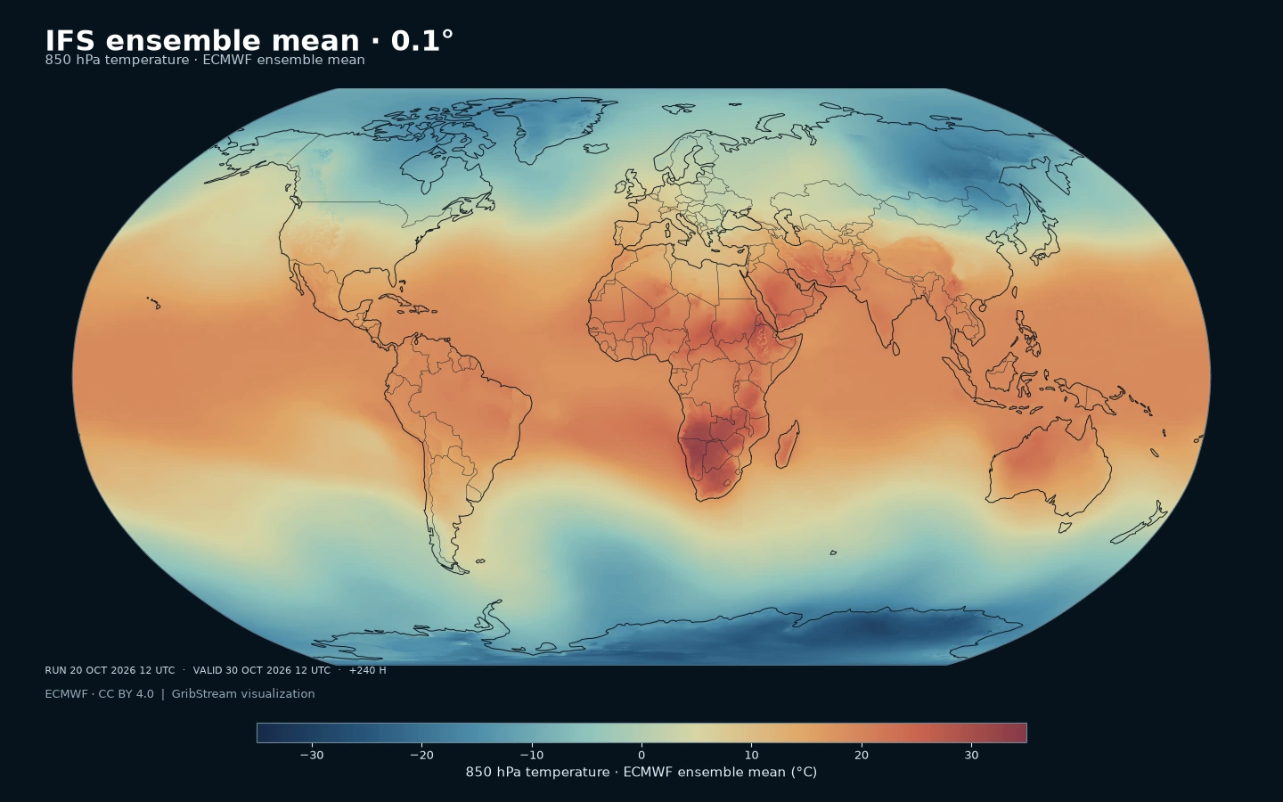
ifsenfomean0p1 · ECMWF ensemble-mean temperature at 850 hPa in °C; API temperatures remain in K. Historical example: run 20 October 2026 12 UTC; valid 30 October 2026 12 UTC (+240 h). Nearest-cell rendering of the 0.1° output grid. Source: ECMWF, CC BY 4.0; visualization: GribStream.
About this forecast
ECMWF ensemble-mean forecasts at 0.1° for temperature, wind speed, geopotential height and sea-level pressure: large-scale weather guidance to 15 days.
What is ECMWF IFS?
IFS stands for Integrated Forecasting System. Developed by the European Centre for Medium-Range Weather Forecasts (ECMWF) in cooperation with Météo-France, it combines observations through data assimilation and advances a global Earth-system model using physical equations. Its atmosphere, land, ocean and wave components exchange information. These products belong to the short- and medium-range forecast family, extending to 15 days; ECMWF also develops the separate, machine-learning-based AIFS family. ECMWF documentation.
What this product is for
The ensemble mean is ECMWF’s average across ensemble forecasts. It emphasizes the shared large-scale signal, helping reveal temperature patterns, ridges and troughs when individual members disagree on their exact location. Averaging can weaken or blur localized extremes. Read it alongside spread and individual members when storm intensity or a specific threshold matters. ECMWF documentation.
Nine selectors: temperature at 250, 500 and 850 hPa; wind speed at 250 and 850 hPa; geopotential height at 300, 500 and 1000 hPa; mean sea-level pressure.
This is an ECMWF-computed statistic with no member dimension. Wind speed is a scalar field; its ensemble mean differs from the speed calculated from averaged wind components.
The 0.1° latitude–longitude grid samples the same IFS forecast as the 0.25° products. It has 3,600 × 1,801 points, with about 11 km north–south spacing. ECMWF’s atmospheric model runs at approximately 9 km. Finer output spacing preserves more spatial detail but does not itself establish local accuracy. The 0.1° distribution follows 0.25° by about two hours. ECMWF documentation.
Resolution: 0.1° · 3600 × 1801
Temporal coverage: 00 and 12 UTC: +0–144 h every 3 h, then +150–360 h every 6 h (15 days).
Primary uses: Synoptic pattern analysis, medium-range outlooks and a central forecast signal to pair with uncertainty information.
00 and 12 UTC: +0–144 h every 3 h, then +150–360 h every 6 h (15 days).