Ultraviolet index (index).
GribStream
uvi
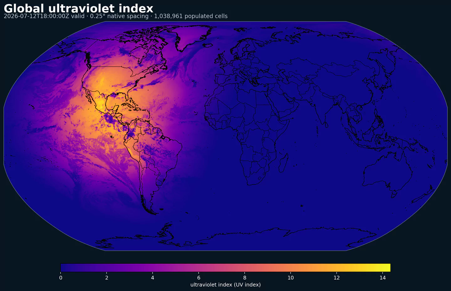
NOAA UVI is the National Weather Service ultraviolet index forecast, used to estimate the expected intensity of sunburn-producing ultraviolet radiation. The UV Index is commonly presented on a 1 to 11+ scale and is most often interpreted around solar noon, when surface UV exposure is usually strongest.
This dataset is different from most numerical weather models in GribStream. It is a public-health and environmental exposure product rather than a full atmospheric state forecast. It is useful for sun-safety tools, recreation apps, outdoor labor planning, school and sports operations, tourism, agriculture, and solar-exposure analytics.
Operational UVI depends on atmospheric inputs such as ozone, clouds, aerosols, elevation, and solar geometry. GribStream exposes the gridded forecast directly, so applications can query UVI by coordinate and lead time without using city-only bulletins or map images. Current data includes hourly forecast steps from lead time 1 hour through 120 hours.
UVIUltraviolet index (index).
| Level | Info | Horizon | Introduced | Selector |
|---|---|---|---|---|
surface |
1h-120h | 2 days ago |
{"name":"UVI","level":"surface","info":""}
|