
GribStream Blog
Five CONUS forecasts at 3 km: REFS members come to GribStream
Five individual forecast scenarios, hourly through 60 hours: complete CONUS surface and pressure-level REFS datasets, with history from September 9.
Five forecasts, a 3 km CONUS grid, and hourly steps through 60 hours. Our new REFS member datasets bring individual weather scenarios to the same GribStream API used for deterministic RRFS. You can compare the timing of rain, wind changes and cloud cover—and keep each member's forecast intact.

The two datasets cover all published fields in NOAA's CONUS member products:
Surface weather and storms
refs2dfld
- Current parameters
- 41
- Field / level / statistic combinations
- 57
Temperature, wind, clouds, precipitation, radiation and storm diagnostics.
The atmosphere above the surface
refsprslev
- Parameters
- 8
- Pressure levels
- 14
Temperature, moisture, wind, geopotential height and vorticity.
Both contain members 1–5, with new runs at 00, 06, 12 and 18 UTC. The deterministic rrfs2dfld and rrfsprslev datasets remain separate.
How RRFS generates these forecasts
NOAA’s Rapid Refresh Forecast System version 1 uses the limited-area Finite-Volume Cubed-Sphere (FV3) dynamical core within the Unified Forecast System. Its North American domain has 3 km horizontal grid spacing; these datasets expose the CONUS output on a 1,799 × 1,059 Lambert conformal grid. The system targets short-range severe convection, heavy precipitation, winter weather and other hazards for which the timing and structure of weather systems matter. RRFSv1 complements HRRR, which remains in operation. NOAA GSL: RRFSv1; NCEP: RRFS products.
The five current-cycle members vary initial conditions, lateral boundary conditions and model physics relative to the deterministic RRFS forecast. Initial conditions represent uncertainty in the starting atmosphere; boundary conditions affect weather entering the regional domain; physics choices change the treatment of processes such as clouds and turbulence. Following the same member across fields preserves its evolving weather scenario. NWS SCN 26-48.
GribStream’s REFS member datasets contain the five individual RRFS ensemble forecasts from one initialization. NOAA’s separately generated REFS statistics combine current and six-hour-old RRFS deterministic and ensemble runs, with current and older HRRR runs over CONUS and Alaska. An average or threshold count across these five members therefore has a different membership from NOAA’s published REFS mean or probability products. NWS SCN 26-48.
See how the scenarios differ
All five forecasts show a precipitation corridor through New Mexico and southern Colorado, but the placement and intensity of individual cells differ. Comparing the maps preserves those differences. This example illustrates scenario diversity; it does not establish which member was most accurate.
For a wind or solar portfolio, compare when each member forecasts a ramp or a change in cloud cover. For rainfall-sensitive operations, compare the arrival time and hourly amount of rain. For storm analysis, combine the surface fields with winds, humidity and temperature aloft.
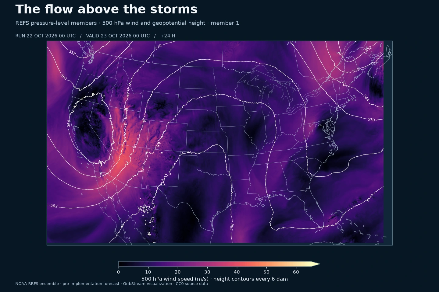
The pressure product supplies eight fields on 1000, 975, 950, 925, 900, 850, 800, 750, 700, 600, 500, 400, 300 and 250 hPa. That gives each member a consistent vertical profile alongside its surface forecast. Pressure levels below local terrain may have missing source values.
These are five forecast realizations. Their differences help describe scenario uncertainty; counting members above a threshold does not by itself produce a calibrated probability.
History starts on September 9
The new CONUS archive starts with the 9 September 2026, 12 UTC run, the earliest member run currently available in this NOAA S3 feed. It is a clean replacement for the retired refsprslev prototype, whose North America grid and old history are not carried forward.
Historical surface files include FRZR freezing-rain accumulation, so the archive contains 42 parameter names, compared with 41 in the current product. NOAA's October 15 revision removed that accumulation and changed instantaneous precipitation-type processing. The model pages retain the historical fields and describe the change so verification studies can account for it. Source gaps remain gaps; a backfill cannot recreate forecasts NOAA did not publish or no longer retains.
Pick the forecast interval you need
A preceding-hour rainfall amount and a total since initialization answer different questions. acc-1h selects the preceding hour; acc-from-init selects the total since that run began. At +1h the intervals coincide. Instantaneous values, hourly averages and hourly extrema keep their own selectors.
The model pages list every parameter, level and time statistic with its units. Use the normal /api/v2/refs2dfld/runs or /api/v2/refsprslev/runs endpoint to compare individual runs, and the corresponding /timeseries endpoint for stitched forecasts. Include the members you want in the standard members selector.
Early access ahead of NOAA's operational transition
These files come from NOAA's pre-implementation feed. The latest NWS Service Change Notice 26-48 schedules operational implementation for November 3, 2026, subject to weather-related delay. Our early access and NOAA's operational designation are separate milestones.
NOAA's ensemble means, spread and probability products will follow in a later phase. Alaska, Hawaii and Puerto Rico are also planned after the operational transition. This release focuses on the complete CONUS member products.
Explore the surface-member dataset and pressure-level members. NOAA distributes the source under CC0-1.0 through its AWS Open Data registry and requests attribution.