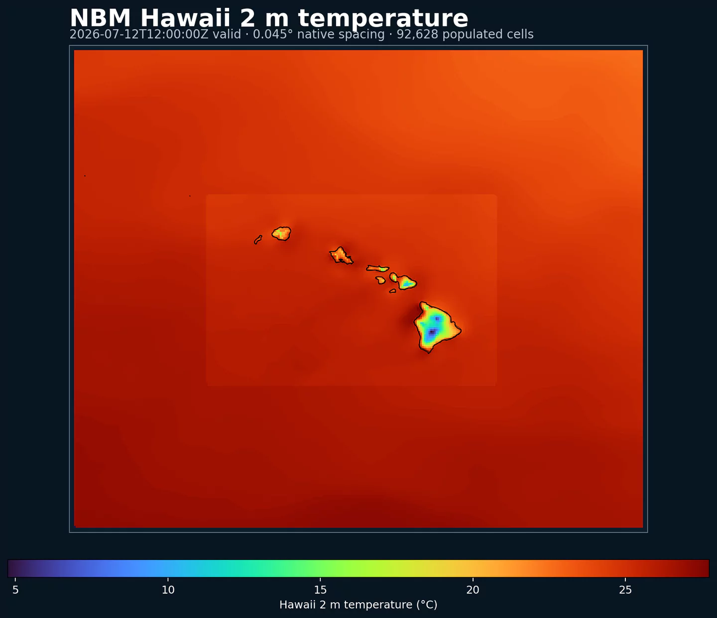
GribStream

NOAA National Blend of Models Parallel - Hawaii

Código GribStream: nbmparhi

Otras grillas NBM Parallel: nbmpar, nbmparak, nbmparpr, nbmpargu, nbmparoc

Estado: NBM v5 ya está operativo en GribStream bajo nbmhi. En nbmhi, las ejecuciones anteriores a 2026-05-05 12:00 UTC contienen la versión operativa anterior de NBM; las ejecuciones desde 2026-05-05 12:00 UTC en adelante usan NBM v5. Para integraciones de producción con NBM v5, usa nbmhi; los datasets nbmpar* quedan reservados para futuras iteraciones experimentales de NBM si NOAA vuelve a publicarlas en la línea paralela.

La fuente de origen es noaa-nbm-para-pds. GribStream mantiene la línea paralela bajo códigos dedicados para que puedas compararla con la familia operativa de NBM sin mezclarla con el dataset que usan tus integraciones actuales.

Referencias técnicas: PNS 25-45, notas de configuración v5.0 de invierno y NBM Versions.

Descripción

NBM Parallel Hawaii es la salida paralela pública del National Blend of Models para Hawái. Está pensada para comparación y validación cuando NOAA publica una línea experimental junto a la versión operativa.

Para uso de producción con NBM v5, el dataset recomendado es nbmhi. nbmparhi queda como referencia para comparar cambios o para futuras iteraciones experimentales que NOAA publique en la línea paralela.

NBM v5 no fue solo una actualización de parámetros. NOAA amplió gran parte de la guía horaria de 36 h a 48 h y revisó la mezcla con más procesamiento por mapeo de cuantiles, cambios en viento y ráfagas determinísticas, y fuentes de entrada de mayor resolución de ECMWF y Canadá.

Para Hawái, NOAA destacó la guía horaria extendida hasta 48 h, nueva guía de viento y ráfagas a 10 m con mapeo de cuantiles, y un producto reconstruido de techo de nubes y visibilidad que sigue el enfoque Meld-LAMP con pseudo-observaciones basadas en random forest (bosque aleatorio) sobre las islas.

En GribStream, nbmparhi mantiene selectores estables: los valores de name, level e info se copian exactamente desde el catálogo y no se traducen.

Detalle

Datasets relacionados

Parámetros

0 parámetros

Haz clic en un parámetro para ver sus variantes en una tabla compacta con selectores JSON listos para copiar. Los códigos, niveles y valores de selector se mantienen exactamente como los expone la API.

APCP Accumulated Precipitation (kg/m^2)
2 variants

Accumulated precipitation represents the total water-equivalent amount of rain and snow during the output period. It is a primary field for hydrologic impacts and event totals.

  • Units: kg/m^2.
  • Use with the model time interval to interpret totals and compare to gauges.
Level Info Horizon Introduced Selector
surface 1h-264h 5 days ago
{"name":"APCP","level":"surface","info":""}
surface prob >0.254 1h-264h 5 days ago
{"name":"APCP","level":"surface","info":"prob >0.254"}
APTMP Apparent Temperature (K)
1 variant

Apparent temperature combines air temperature, humidity, and wind to estimate how hot or cold it feels to humans. It is useful for heat and cold stress assessments.

  • Units: K.
Level Info Horizon Introduced Selector
2 m above ground 1h-264h 5 days ago
{"name":"APTMP","level":"2 m above ground","info":""}
CAPE Convective Available Potential Energy (J/kg)
2 variants

Convective Available Potential Energy (CAPE) quantifies buoyant energy available to rising air parcels. Larger values generally imply stronger potential updrafts and greater convective intensity.

  • Units: J/kg.
  • Often used with CIN and lifting mechanisms to assess thunderstorm potential.
Level Info Horizon Introduced Selector
surface 1h-264h 5 days ago
{"name":"CAPE","level":"surface","info":""}
surface ens std dev 1h-264h 5 days ago
{"name":"CAPE","level":"surface","info":"ens std dev"}
CEIL Ceiling Height (m)
7 variants

Ceiling height is the altitude of the lowest cloud base that covers a significant portion of the sky. It is a key aviation and surface-visibility metric.

  • Units: m.
Level Info Horizon Introduced Selector
cloud base 1h-84h 5 days ago
{"name":"CEIL","level":"cloud base","info":""}
cloud ceiling 1h-78h 5 days ago
{"name":"CEIL","level":"cloud ceiling","info":""}
cloud ceiling prob <152.4 1h-36h 5 days ago
{"name":"CEIL","level":"cloud ceiling","info":"prob <152.4"}
cloud ceiling prob <2011.68 1h-36h 5 days ago
{"name":"CEIL","level":"cloud ceiling","info":"prob <2011.68"}
cloud ceiling prob <304.8 1h-36h 5 days ago
{"name":"CEIL","level":"cloud ceiling","info":"prob <304.8"}
cloud ceiling prob <609.6 1h-36h 5 days ago
{"name":"CEIL","level":"cloud ceiling","info":"prob <609.6"}
cloud ceiling prob <914.5 1h-36h 5 days ago
{"name":"CEIL","level":"cloud ceiling","info":"prob <914.5"}
DIST Distance to Feature (km)
1 variant

Distance to feature is the horizontal distance to the named hazard or boundary in the source product. It is used to map proximity to key features like fronts or hazards.

  • Units: km.
Level Info Horizon Introduced Selector
surface - 610 m above ground 1h-36h 5 days ago
{"name":"DIST","level":"surface - 610 m above ground","info":""}
DPT Dew Point Temperature (K)
2 variants

Dew point temperature is the temperature at which the air becomes saturated. It is a direct measure of moisture content.

  • Units: K.
  • When dew point is close to air temperature, fog or low cloud potential increases.
Level Info Horizon Introduced Selector
2 m above ground 1h-264h 5 days ago
{"name":"DPT","level":"2 m above ground","info":""}
2 m above ground ens std dev 1h-264h 5 days ago
{"name":"DPT","level":"2 m above ground","info":"ens std dev"}
DSWRF Downward Short-Wave Radiation Flux (W/m^2)
1 variant

Downward radiative flux represents incoming energy at the surface. It is a key driver of surface heating and cooling.

  • Units: W/m^2.
  • Shortwave affects surface heating; longwave affects radiative cooling.
Level Info Horizon Introduced Selector
surface 1h-264h 5 days ago
{"name":"DSWRF","level":"surface","info":""}
ELLINX Ellrod Index (unitless)
1 variant

Ellrod index is a diagnostic for clear-air turbulence based on deformation and vertical wind shear. Higher values indicate greater turbulence potential for aviation.

  • Units: unitless.
Level Info Horizon Introduced Selector
400-300 mb 1h-259h 5 days ago
{"name":"ELLINX","level":"400-300 mb","info":""}
FOSINDX Fosberg Fire Weather Index (unitless)
1 variant

Fosberg fire weather index combines temperature, humidity, and wind to estimate potential fire spread. Higher values indicate more favorable wildfire conditions.

  • Units: unitless.
Level Info Horizon Introduced Selector
surface 6h-264h 5 days ago
{"name":"FOSINDX","level":"surface","info":""}
GUST Wind Speed (Gust) (m/s)
2 variants

Wind gust is the peak short-duration wind speed. It captures brief, hazardous bursts that can exceed sustained winds.

  • Units: m/s.
Level Info Horizon Introduced Selector
10 m above ground 1h-264h 5 days ago
{"name":"GUST","level":"10 m above ground","info":""}
10 m above ground ens std dev 1h-264h 5 days ago
{"name":"GUST","level":"10 m above ground","info":"ens std dev"}
MAXREF Hourly Maximum of Simulated Reflectivity at 1 km AGL (dBZ)
1 variant

Hourly maximum simulated reflectivity at 1 km AGL captures the strongest modeled reflectivity near the surface. It is used to identify peak convective intensity and heavy precipitation cores.

  • Units: dBZ.
Level Info Horizon Introduced Selector
1000 m above ground 1h-48h 5 days ago
{"name":"MAXREF","level":"1000 m above ground","info":""}
MAXRH Maximum Relative Humidity (percent)
1 variant

Maximum relative humidity is the highest RH reached during the period. It can indicate peak cloud or fog potential.

  • Units: percent.
  • Higher values indicate more atmospheric moisture and greater cloud or precip potential.
Level Info Horizon Introduced Selector
2 m above ground 13h-264h 5 days ago
{"name":"MAXRH","level":"2 m above ground","info":""}
MINRH Minimum Relative Humidity (percent)
1 variant

Minimum relative humidity is the lowest RH reached during the period. It is used in fire‑weather and drying assessments.

  • Units: percent.
  • Higher values indicate more atmospheric moisture and greater cloud or precip potential.
Level Info Horizon Introduced Selector
2 m above ground 13h-264h 5 days ago
{"name":"MINRH","level":"2 m above ground","info":""}
MIXHT Mixing Height (m)
1 variant

Mixing height is the depth of the well-mixed layer near the surface. It is widely used for dispersion, smoke, and air-quality applications.

  • Units: m.
Level Info Horizon Introduced Selector
entire atmosphere (considered as a single layer) 1h-264h 5 days ago
{"name":"MIXHT","level":"entire atmosphere (considered as a single layer)","info":""}
PCPDUR Precipitation Duration (hours)
1 variant

Precipitation duration is the total time with measurable precipitation in the output period. It helps distinguish intermittent from persistent events.

  • Units: hours.
  • Accumulations represent water-equivalent depth over the output interval; rates describe intensity.
Level Info Horizon Introduced Selector
surface 12h-36h 5 days ago
{"name":"PCPDUR","level":"surface","info":""}
PWAT Precipitable Water (kg/m^2)
9 variants

Precipitable water is the total column water vapor from the surface to the top of the atmosphere. It is a key moisture indicator.

  • Units: kg/m^2.
Level Info Horizon Introduced Selector
entire atmosphere (considered as a single layer) 1h-264h 5 days ago
{"name":"PWAT","level":"entire atmosphere (considered as a single layer)","info":""}
entire atmosphere (considered as a single layer) 10% level 1h-264h 5 days ago
{"name":"PWAT","level":"entire atmosphere (considered as a single layer)","info":"10% level"}
entire atmosphere (considered as a single layer) 50% level 1h-264h 5 days ago
{"name":"PWAT","level":"entire atmosphere (considered as a single layer)","info":"50% level"}
entire atmosphere (considered as a single layer) 90% level 1h-264h 5 days ago
{"name":"PWAT","level":"entire atmosphere (considered as a single layer)","info":"90% level"}
entire atmosphere (considered as a single layer) prob >12.7 1h-264h 5 days ago
{"name":"PWAT","level":"entire atmosphere (considered as a single layer)","info":"prob >12.7"}
entire atmosphere (considered as a single layer) prob >25.4 1h-264h 5 days ago
{"name":"PWAT","level":"entire atmosphere (considered as a single layer)","info":"prob >25.4"}
entire atmosphere (considered as a single layer) prob >38.1 1h-264h 5 days ago
{"name":"PWAT","level":"entire atmosphere (considered as a single layer)","info":"prob >38.1"}
entire atmosphere (considered as a single layer) prob >50.8 1h-264h 5 days ago
{"name":"PWAT","level":"entire atmosphere (considered as a single layer)","info":"prob >50.8"}
entire atmosphere (considered as a single layer) prob >63.5 1h-264h 5 days ago
{"name":"PWAT","level":"entire atmosphere (considered as a single layer)","info":"prob >63.5"}
RETOP Radar Echo Top Height (m)
1 variant

Echo top height is the altitude of the highest reflectivity in the column. It is a proxy for storm depth and convective vigor.

  • Units: m.
Level Info Horizon Introduced Selector
cloud top 1h-48h 5 days ago
{"name":"RETOP","level":"cloud top","info":""}
RH Relative Humidity (percent)
1 variant

Relative humidity describes how close the air is to saturation at the specified level. High values favor cloud formation.

  • Units: percent.
  • Higher values indicate more atmospheric moisture and greater cloud or precip potential.
Level Info Horizon Introduced Selector
2 m above ground 1h-264h 5 days ago
{"name":"RH","level":"2 m above ground","info":""}
SNOWLVL Snow Level (m)
16 variants

Snow level is the approximate altitude where precipitation changes from rain to snow. It is useful for terrain and road-impact forecasting.

  • Units: m.
Level Info Horizon Introduced Selector
0 m above mean sea level 1h-264h 5 days ago
{"name":"SNOWLVL","level":"0 m above mean sea level","info":""}
surface 1% level 1h-263h 5 days ago
{"name":"SNOWLVL","level":"surface","info":"1% level"}
surface 10% level 1h-263h 5 days ago
{"name":"SNOWLVL","level":"surface","info":"10% level"}
surface 20% level 1h-263h 5 days ago
{"name":"SNOWLVL","level":"surface","info":"20% level"}
surface 25% level 1h-263h 5 days ago
{"name":"SNOWLVL","level":"surface","info":"25% level"}
surface 30% level 1h-263h 5 days ago
{"name":"SNOWLVL","level":"surface","info":"30% level"}
surface 40% level 1h-263h 5 days ago
{"name":"SNOWLVL","level":"surface","info":"40% level"}
surface 5% level 1h-263h 5 days ago
{"name":"SNOWLVL","level":"surface","info":"5% level"}
surface 50% level 1h-263h 5 days ago
{"name":"SNOWLVL","level":"surface","info":"50% level"}
surface 60% level 1h-263h 5 days ago
{"name":"SNOWLVL","level":"surface","info":"60% level"}
surface 70% level 1h-263h 5 days ago
{"name":"SNOWLVL","level":"surface","info":"70% level"}
surface 75% level 1h-263h 5 days ago
{"name":"SNOWLVL","level":"surface","info":"75% level"}
surface 80% level 1h-263h 5 days ago
{"name":"SNOWLVL","level":"surface","info":"80% level"}
surface 90% level 1h-263h 5 days ago
{"name":"SNOWLVL","level":"surface","info":"90% level"}
surface 95% level 1h-263h 5 days ago
{"name":"SNOWLVL","level":"surface","info":"95% level"}
surface 99% level 1h-263h 5 days ago
{"name":"SNOWLVL","level":"surface","info":"99% level"}
TCDC Total Cloud Cover (percent)
3 variants

Total cloud cover is the fraction of the grid cell covered by clouds at any level. It influences radiation, temperature, and visibility.

  • Units: percent.
  • Cloud fraction influences surface radiation and temperature.
Level Info Horizon Introduced Selector
surface 1h-264h 5 days ago
{"name":"TCDC","level":"surface","info":""}
surface ens std dev 1h-48h 5 days ago
{"name":"TCDC","level":"surface","info":"ens std dev"}
surface unknown derived fcst 49h-264h 5 days ago
{"name":"TCDC","level":"surface","info":"unknown derived fcst"}
THUNC Thunderstorm Probability (percent)
1 variant

Thunderstorm probability gives the chance of thunderstorms during the valid period. It is used for convective hazard guidance.

  • Units: percent.
Level Info Horizon Introduced Selector
entire atmosphere 1h-36h 5 days ago
{"name":"THUNC","level":"entire atmosphere","info":""}
TMAX Maximum Temperature (K)
2 variants

Maximum temperature is the highest temperature reached during the output period. It is commonly used for heat stress and daily extremes.

  • Units: K.
Level Info Horizon Introduced Selector
2 m above ground 12h-264h 5 days ago
{"name":"TMAX","level":"2 m above ground","info":""}
2 m above ground ens std dev 12h-264h 5 days ago
{"name":"TMAX","level":"2 m above ground","info":"ens std dev"}
TMIN Minimum Temperature (K)
2 variants

Minimum temperature is the lowest temperature reached during the output period. It is commonly used for frost and cold-stress assessment.

  • Units: K.
Level Info Horizon Introduced Selector
2 m above ground 12h-264h 5 days ago
{"name":"TMIN","level":"2 m above ground","info":""}
2 m above ground ens std dev 12h-264h 5 days ago
{"name":"TMIN","level":"2 m above ground","info":"ens std dev"}
TMP Temperature (K)
2 variants

Air temperature is the thermal state of the atmosphere at the specified level. It influences density, stability, and energy exchange.

  • Units: K.
Level Info Horizon Introduced Selector
2 m above ground 1h-264h 5 days ago
{"name":"TMP","level":"2 m above ground","info":""}
2 m above ground ens std dev 1h-264h 5 days ago
{"name":"TMP","level":"2 m above ground","info":"ens std dev"}
TPWDIR Total Precipitable Water Transport Direction (degrees)
1 variant

Total precipitable water transport direction is the direction of column‑integrated moisture flux. It indicates moisture transport pathways.

  • Units: degrees.
Level Info Horizon Introduced Selector
10 m above ground 1h-167h 5 days ago
{"name":"TPWDIR","level":"10 m above ground","info":""}
TPWSPD Total Precipitable Water Transport Speed (m/s)
1 variant

Total precipitable water transport speed is the magnitude of column‑integrated moisture transport. It highlights atmospheric river strength.

  • Units: m/s.
Level Info Horizon Introduced Selector
10 m above ground 1h-167h 5 days ago
{"name":"TPWSPD","level":"10 m above ground","info":""}
TRWDIR Tropical Wind Direction (degrees)
1 variant

Tropical wind direction is the direction of the tropical wind vector used in cyclone guidance.

  • Units: degrees.
Level Info Horizon Introduced Selector
entire atmosphere (considered as a single layer) 1h-264h 5 days ago
{"name":"TRWDIR","level":"entire atmosphere (considered as a single layer)","info":""}
TRWSPD Tropical Wind Speed (m/s)
1 variant

Tropical wind speed is the magnitude of the tropical wind vector. It is often used in cyclone diagnostics.

  • Units: m/s.
Level Info Horizon Introduced Selector
entire atmosphere (considered as a single layer) 1h-264h 5 days ago
{"name":"TRWSPD","level":"entire atmosphere (considered as a single layer)","info":""}
TSTM Thunderstorm Indicator (boolean)
1 variant

Thunderstorm indicator flags the presence of thunderstorm conditions in the grid cell. It is used as a categorical hazard field.

  • Units: boolean.
Level Info Horizon Introduced Selector
surface probability forecast 1h-192h 5 days ago
{"name":"TSTM","level":"surface","info":"probability forecast"}
TURB Turbulence Index (unitless)
1 variant

Turbulence index is a diagnostic measure of aviation turbulence. Higher values indicate increased turbulence risk along flight routes.

  • Units: unitless.
Level Info Horizon Introduced Selector
surface - 1372 m above ground 1h-259h 5 days ago
{"name":"TURB","level":"surface - 1372 m above ground","info":""}
VIL Vertically-Integrated Liquid Water (kg/m^2)
1 variant

Vertically‑integrated liquid water is the total column liquid water content. It is used as a proxy for precipitation intensity and hail potential.

  • Units: kg/m^2.
Level Info Horizon Introduced Selector
entire atmosphere 1h-48h 5 days ago
{"name":"VIL","level":"entire atmosphere","info":""}
VIS Visibility (m)
5 variants

Horizontal visibility at the surface. Lower values indicate reduced visibility due to fog, precipitation, or aerosols.

  • Units: m.
Level Info Horizon Introduced Selector
surface 1h-79h 5 days ago
{"name":"VIS","level":"surface","info":""}
surface prob <1609.34 1h-36h 5 days ago
{"name":"VIS","level":"surface","info":"prob <1609.34"}
surface prob <3218.69 1h-36h 5 days ago
{"name":"VIS","level":"surface","info":"prob <3218.69"}
surface prob <4828.03 1h-36h 5 days ago
{"name":"VIS","level":"surface","info":"prob <4828.03"}
surface prob <8046.73 1h-36h 5 days ago
{"name":"VIS","level":"surface","info":"prob <8046.73"}
VRATE Ventilation Rate (m^2/s)
1 variant

Ventilation rate combines mixing depth and transport wind to estimate the atmosphere's ability to disperse smoke and pollutants.

  • Units: m^2/s.
Level Info Horizon Introduced Selector
entire atmosphere (considered as a single layer) 1h-264h 5 days ago
{"name":"VRATE","level":"entire atmosphere (considered as a single layer)","info":""}
WDIR Wind Direction (degrees)
4 variants

Wind direction indicates the direction from which the wind is blowing at the specified level.

  • Units: degrees.
Level Info Horizon Introduced Selector
10 m above ground 1h-264h 5 days ago
{"name":"WDIR","level":"10 m above ground","info":""}
30 m above ground 1h-264h 5 days ago
{"name":"WDIR","level":"30 m above ground","info":""}
80 m above ground 1h-264h 5 days ago
{"name":"WDIR","level":"80 m above ground","info":""}
surface - 610 m above ground 1h-36h 5 days ago
{"name":"WDIR","level":"surface - 610 m above ground","info":""}
WETGLBT Wet Bulb Globe Temperature (K)
1 variant

Wet bulb globe temperature combines temperature, humidity, radiation, and wind effects into a single heat-stress metric. It is commonly used for outdoor exposure and occupational heat-risk assessment.

  • Units: K.
  • Use it as a composite heat-stress indicator rather than a standard air-temperature field.
Level Info Horizon Introduced Selector
surface 1h-264h 5 days ago
{"name":"WETGLBT","level":"surface","info":""}
WIND Wind Speed (m/s)
5 variants

Wind speed is the magnitude of the horizontal wind at the specified level. It is used for transport, mixing, and hazards.

  • Units: m/s.
Level Info Horizon Introduced Selector
10 m above ground 1h-264h 5 days ago
{"name":"WIND","level":"10 m above ground","info":""}
10 m above ground ens std dev 1h-264h 5 days ago
{"name":"WIND","level":"10 m above ground","info":"ens std dev"}
30 m above ground 1h-264h 5 days ago
{"name":"WIND","level":"30 m above ground","info":""}
80 m above ground 1h-264h 5 days ago
{"name":"WIND","level":"80 m above ground","info":""}
surface - 610 m above ground 1h-36h 5 days ago
{"name":"WIND","level":"surface - 610 m above ground","info":""}

Ningún parámetro coincide con la búsqueda.