Apparent temperature combines air temperature, humidity, and wind to estimate how hot or cold it feels to humans. It is useful for heat and cold stress assessments.
- Units: K.
Código GribStream: nbmparoc
Otras grillas NBM Parallel:
nbmpar, nbmparak, nbmparhi, nbmparpr, nbmpargu
Estado: NBM v5 ya está operativo en GribStream bajo nbmoc. En nbmoc, las ejecuciones anteriores a 2026-05-05 12:00 UTC contienen la versión operativa anterior de NBM; las ejecuciones desde 2026-05-05 12:00 UTC en adelante usan NBM v5. Para integraciones de producción con NBM v5, usa nbmoc; los datasets nbmpar* quedan reservados para futuras iteraciones experimentales de NBM si NOAA vuelve a publicarlas en la línea paralela.
La fuente de origen es noaa-nbm-para-pds. GribStream mantiene la línea paralela bajo códigos dedicados para que puedas compararla con la familia operativa de NBM sin mezclarla con el dataset que usan tus integraciones actuales.
Referencias técnicas: PNS 25-45, notas de configuración v5.0 de invierno y NBM Versions.
NBM Parallel Oceanic es la salida paralela pública del National Blend of Models para la grilla oceánica. Está pensada para comparación y validación cuando NOAA publica una línea experimental junto a la versión operativa.
Para uso de producción con NBM v5, el dataset recomendado es nbmoc. nbmparoc queda como referencia para comparar cambios o para futuras iteraciones experimentales que NOAA publique en la línea paralela.
NBM v5 no fue solo una actualización de parámetros. NOAA amplió gran parte de la guía horaria de 36 h a 48 h y revisó la mezcla con más procesamiento por mapeo de cuantiles, cambios en viento y ráfagas determinísticas, y fuentes de entrada de mayor resolución de ECMWF y Canadá.
Para el dominio oceánico, las notas de NBM v5 destacan guía probabilística de viento y ráfagas corregida por mapeo de cuantiles, productos actualizados de temperatura, punto de rocío y nubosidad, y una corrección de altura significativa de ola que pasa a mapeo de cuantiles con un conjunto de fuentes de entrada mucho más amplio.
En GribStream, nbmparoc mantiene selectores estables: los valores de name, level e info se copian exactamente desde el catálogo y no se traducen.
info del catálogo de nbmparoc.Haz clic en un parámetro para ver sus variantes en una tabla compacta con selectores JSON listos para copiar. Los códigos, niveles y valores de selector se mantienen exactamente como los expone la API.
Apparent temperature combines air temperature, humidity, and wind to estimate how hot or cold it feels to humans. It is useful for heat and cold stress assessments.
| Level | Info | Horizon | Introduced | Selector |
|---|---|---|---|---|
2 m above ground |
2h-264h | 5 days ago |
{"name":"APTMP","level":"2 m above ground","info":""}
|
Dew point temperature is the temperature at which the air becomes saturated. It is a direct measure of moisture content.
| Level | Info | Horizon | Introduced | Selector |
|---|---|---|---|---|
2 m above ground |
50% level |
2h-264h | 5 days ago |
{"name":"DPT","level":"2 m above ground","info":"50% level"}
|
Freezing spray indicator flags marine conditions favorable for ice accretion on vessels. It depends on wind, air temperature, and wave conditions.
| Level | Info | Horizon | Introduced | Selector |
|---|---|---|---|---|
surface |
2h-264h | 5 days ago |
{"name":"FRZSPR","level":"surface","info":""}
|
Wind gust is the peak short-duration wind speed. It captures brief, hazardous bursts that can exceed sustained winds.
| Level | Info | Horizon | Introduced | Selector |
|---|---|---|---|---|
10 m above ground |
50% level |
2h-264h | 5 days ago |
{"name":"GUST","level":"10 m above ground","info":"50% level"}
|
Precipitable water is the total column water vapor from the surface to the top of the atmosphere. It is a key moisture indicator.
| Level | Info | Horizon | Introduced | Selector |
|---|---|---|---|---|
entire atmosphere (considered as a single layer) |
1h-264h | 5 days ago |
{"name":"PWAT","level":"entire atmosphere (considered as a single layer)","info":""}
|
|
entire atmosphere (considered as a single layer) |
10% level |
1h-264h | 5 days ago |
{"name":"PWAT","level":"entire atmosphere (considered as a single layer)","info":"10% level"}
|
entire atmosphere (considered as a single layer) |
50% level |
1h-264h | 5 days ago |
{"name":"PWAT","level":"entire atmosphere (considered as a single layer)","info":"50% level"}
|
entire atmosphere (considered as a single layer) |
90% level |
1h-264h | 5 days ago |
{"name":"PWAT","level":"entire atmosphere (considered as a single layer)","info":"90% level"}
|
entire atmosphere (considered as a single layer) |
prob >12.7 |
1h-264h | 5 days ago |
{"name":"PWAT","level":"entire atmosphere (considered as a single layer)","info":"prob >12.7"}
|
entire atmosphere (considered as a single layer) |
prob >25.4 |
1h-264h | 5 days ago |
{"name":"PWAT","level":"entire atmosphere (considered as a single layer)","info":"prob >25.4"}
|
entire atmosphere (considered as a single layer) |
prob >38.1 |
1h-264h | 5 days ago |
{"name":"PWAT","level":"entire atmosphere (considered as a single layer)","info":"prob >38.1"}
|
entire atmosphere (considered as a single layer) |
prob >50.8 |
1h-264h | 5 days ago |
{"name":"PWAT","level":"entire atmosphere (considered as a single layer)","info":"prob >50.8"}
|
entire atmosphere (considered as a single layer) |
prob >63.5 |
1h-264h | 5 days ago |
{"name":"PWAT","level":"entire atmosphere (considered as a single layer)","info":"prob >63.5"}
|
Total cloud cover is the fraction of the grid cell covered by clouds at any level. It influences radiation, temperature, and visibility.
| Level | Info | Horizon | Introduced | Selector |
|---|---|---|---|---|
surface |
2h-264h | 5 days ago |
{"name":"TCDC","level":"surface","info":""}
|
|
surface |
ens std dev |
2h-264h | 5 days ago |
{"name":"TCDC","level":"surface","info":"ens std dev"}
|
Thunderstorm probability gives the chance of thunderstorms during the valid period. It is used for convective hazard guidance.
| Level | Info | Horizon | Introduced | Selector |
|---|---|---|---|---|
entire atmosphere |
1h-36h | 5 days ago |
{"name":"THUNC","level":"entire atmosphere","info":""}
|
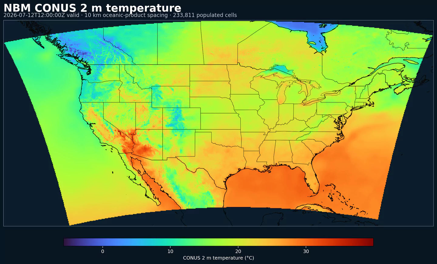
Air temperature is the thermal state of the atmosphere at the specified level. It influences density, stability, and energy exchange.
| Level | Info | Horizon | Introduced | Selector |
|---|---|---|---|---|
2 m above ground |
50% level |
2h-264h | 5 days ago |
{"name":"TMP","level":"2 m above ground","info":"50% level"}
|
surface |
2h-264h | 5 days ago |
{"name":"TMP","level":"surface","info":""}
|
Total precipitable water transport direction is the direction of column‑integrated moisture flux. It indicates moisture transport pathways.
| Level | Info | Horizon | Introduced | Selector |
|---|---|---|---|---|
10 m above ground |
2h-167h | 5 days ago |
{"name":"TPWDIR","level":"10 m above ground","info":""}
|
Total precipitable water transport speed is the magnitude of column‑integrated moisture transport. It highlights atmospheric river strength.
| Level | Info | Horizon | Introduced | Selector |
|---|---|---|---|---|
10 m above ground |
2h-167h | 5 days ago |
{"name":"TPWSPD","level":"10 m above ground","info":""}
|
Thunderstorm indicator flags the presence of thunderstorm conditions in the grid cell. It is used as a categorical hazard field.
| Level | Info | Horizon | Introduced | Selector |
|---|---|---|---|---|
surface |
probability forecast |
1h-192h | 5 days ago |
{"name":"TSTM","level":"surface","info":"probability forecast"}
|
Horizontal visibility at the surface. Lower values indicate reduced visibility due to fog, precipitation, or aerosols.
| Level | Info | Horizon | Introduced | Selector |
|---|---|---|---|---|
surface |
50% level |
2h-264h | 5 days ago |
{"name":"VIS","level":"surface","info":"50% level"}
|
Wind direction indicates the direction from which the wind is blowing at the specified level.
| Level | Info | Horizon | Introduced | Selector |
|---|---|---|---|---|
10 m above ground |
5h-264h | 5 days ago |
{"name":"WDIR","level":"10 m above ground","info":""}
|
|
10 m above ground |
50% level |
5h-264h | 5 days ago |
{"name":"WDIR","level":"10 m above ground","info":"50% level"}
|
10 m above ground |
75% level |
5h-264h | 5 days ago |
{"name":"WDIR","level":"10 m above ground","info":"75% level"}
|
10 m above ground |
90% level |
5h-264h | 5 days ago |
{"name":"WDIR","level":"10 m above ground","info":"90% level"}
|
30 m above ground |
50% level |
5h-264h | 5 days ago |
{"name":"WDIR","level":"30 m above ground","info":"50% level"}
|
80 m above ground |
50% level |
5h-264h | 5 days ago |
{"name":"WDIR","level":"80 m above ground","info":"50% level"}
|
Wind speed is the magnitude of the horizontal wind at the specified level. It is used for transport, mixing, and hazards.
| Level | Info | Horizon | Introduced | Selector |
|---|---|---|---|---|
10 m above ground |
5h-264h | 5 days ago |
{"name":"WIND","level":"10 m above ground","info":""}
|
|
10 m above ground |
10% level |
2h-264h | 5 days ago |
{"name":"WIND","level":"10 m above ground","info":"10% level"}
|
10 m above ground |
25% level |
2h-264h | 5 days ago |
{"name":"WIND","level":"10 m above ground","info":"25% level"}
|
10 m above ground |
50% level |
2h-264h | 5 days ago |
{"name":"WIND","level":"10 m above ground","info":"50% level"}
|
10 m above ground |
75% level |
2h-264h | 5 days ago |
{"name":"WIND","level":"10 m above ground","info":"75% level"}
|
10 m above ground |
90% level |
2h-264h | 5 days ago |
{"name":"WIND","level":"10 m above ground","info":"90% level"}
|
30 m above ground |
50% level |
2h-264h | 5 days ago |
{"name":"WIND","level":"30 m above ground","info":"50% level"}
|
80 m above ground |
50% level |
2h-264h | 5 days ago |
{"name":"WIND","level":"80 m above ground","info":"50% level"}
|
Ningún parámetro coincide con la búsqueda.