Apparent temperature combines air temperature, humidity, and wind to estimate how hot or cold it feels to humans. It is useful for heat and cold stress assessments.
- Units: K.
GribStream-Code: nbmparoc
Andere NBM-Parallel-Grids:
nbmpar, nbmparak, nbmparhi, nbmparpr, nbmpargu
Status: NBM v5 ist in GribStream jetzt unter nbmoc operativ. In nbmoc enthalten Läufe vor 2026-05-05 12:00 UTC die vorherige operative NBM-Version; Läufe ab 2026-05-05 12:00 UTC verwenden NBM v5. Für Produktionsintegrationen mit NBM v5 nutzen Sie nbmoc; die Datasets nbmpar* bleiben für zukünftige experimentelle NBM-Iterationen reserviert, falls NOAA sie wieder über die parallele Linie veröffentlicht.
Der Quell-Bucket ist noaa-nbm-para-pds. GribStream hält die parallele Linie unter eigenen Dataset-Codes, damit Sie sie mit der operativen NBM-Familie vergleichen können, ohne sie mit dem Archiv Ihrer laufenden Integrationen zu vermischen.
Technische Referenzen: PNS 25-45, Winter-v5.0-Konfigurationsnotizen und NBM Versions.
NBM Parallel Oceanic ist die öffentliche parallele Ausgabe des National Blend of Models für die ozeanische Domain. Sie ist für Vergleich und Validierung gedacht, wenn NOAA eine experimentelle Linie neben der operativen Version veröffentlicht.
Für Produktion mit NBM v5 ist nbmoc das empfohlene Dataset. nbmparoc bleibt als Vergleichsreferenz und als Platz für zukünftige experimentelle Iterationen erhalten, die NOAA in der parallelen Linie veröffentlichen könnte.
NBM v5 war nicht nur eine Parameteraktualisierung. NOAA erweiterte einen großen Teil der stündlichen Vorhersagebasis von 36 h auf 48 h und überarbeitete die Mischung mit mehr Quantile Mapping, Änderungen bei deterministischem Wind und Böen sowie höher aufgelösten ECMWF- und kanadischen Eingaben.
Für die ozeanische Domain nennen die NBM-v5-Notizen probabilistische Wind- und Böenvorhersagen mit Quantile Mapping, aktualisierte Produkte für Temperatur, Taupunkt und Bewölkung sowie eine Korrektur der signifikanten Wellenhöhe, die auf Quantile Mapping und eine deutlich breitere Eingabemodell-Mischung umgestellt wurde.
In GribStream behält nbmparoc stabile Selektoren: Die Werte von name, level und info werden exakt aus dem Katalog kopiert und nicht übersetzt.
info-Werte aus dem Katalog von nbmparoc.Klicken Sie auf einen Parameter, um Varianten in einer kompakten Tabelle mit kopierbaren JSON-Selektoren zu sehen. Codes, Levels und Selector-Werte bleiben exakt so, wie die API sie ausgibt.
Apparent temperature combines air temperature, humidity, and wind to estimate how hot or cold it feels to humans. It is useful for heat and cold stress assessments.
| Level | Info | Horizon | Introduced | Selector |
|---|---|---|---|---|
2 m above ground |
2h-264h | 5 days ago |
{"name":"APTMP","level":"2 m above ground","info":""}
|
Dew point temperature is the temperature at which the air becomes saturated. It is a direct measure of moisture content.
| Level | Info | Horizon | Introduced | Selector |
|---|---|---|---|---|
2 m above ground |
50% level |
2h-264h | 5 days ago |
{"name":"DPT","level":"2 m above ground","info":"50% level"}
|
Freezing spray indicator flags marine conditions favorable for ice accretion on vessels. It depends on wind, air temperature, and wave conditions.
| Level | Info | Horizon | Introduced | Selector |
|---|---|---|---|---|
surface |
2h-264h | 5 days ago |
{"name":"FRZSPR","level":"surface","info":""}
|
Wind gust is the peak short-duration wind speed. It captures brief, hazardous bursts that can exceed sustained winds.
| Level | Info | Horizon | Introduced | Selector |
|---|---|---|---|---|
10 m above ground |
50% level |
2h-264h | 5 days ago |
{"name":"GUST","level":"10 m above ground","info":"50% level"}
|
Precipitable water is the total column water vapor from the surface to the top of the atmosphere. It is a key moisture indicator.
| Level | Info | Horizon | Introduced | Selector |
|---|---|---|---|---|
entire atmosphere (considered as a single layer) |
1h-264h | 5 days ago |
{"name":"PWAT","level":"entire atmosphere (considered as a single layer)","info":""}
|
|
entire atmosphere (considered as a single layer) |
10% level |
1h-264h | 5 days ago |
{"name":"PWAT","level":"entire atmosphere (considered as a single layer)","info":"10% level"}
|
entire atmosphere (considered as a single layer) |
50% level |
1h-264h | 5 days ago |
{"name":"PWAT","level":"entire atmosphere (considered as a single layer)","info":"50% level"}
|
entire atmosphere (considered as a single layer) |
90% level |
1h-264h | 5 days ago |
{"name":"PWAT","level":"entire atmosphere (considered as a single layer)","info":"90% level"}
|
entire atmosphere (considered as a single layer) |
prob >12.7 |
1h-264h | 5 days ago |
{"name":"PWAT","level":"entire atmosphere (considered as a single layer)","info":"prob >12.7"}
|
entire atmosphere (considered as a single layer) |
prob >25.4 |
1h-264h | 5 days ago |
{"name":"PWAT","level":"entire atmosphere (considered as a single layer)","info":"prob >25.4"}
|
entire atmosphere (considered as a single layer) |
prob >38.1 |
1h-264h | 5 days ago |
{"name":"PWAT","level":"entire atmosphere (considered as a single layer)","info":"prob >38.1"}
|
entire atmosphere (considered as a single layer) |
prob >50.8 |
1h-264h | 5 days ago |
{"name":"PWAT","level":"entire atmosphere (considered as a single layer)","info":"prob >50.8"}
|
entire atmosphere (considered as a single layer) |
prob >63.5 |
1h-264h | 5 days ago |
{"name":"PWAT","level":"entire atmosphere (considered as a single layer)","info":"prob >63.5"}
|
Total cloud cover is the fraction of the grid cell covered by clouds at any level. It influences radiation, temperature, and visibility.
| Level | Info | Horizon | Introduced | Selector |
|---|---|---|---|---|
surface |
2h-264h | 5 days ago |
{"name":"TCDC","level":"surface","info":""}
|
|
surface |
ens std dev |
2h-264h | 5 days ago |
{"name":"TCDC","level":"surface","info":"ens std dev"}
|
Thunderstorm probability gives the chance of thunderstorms during the valid period. It is used for convective hazard guidance.
| Level | Info | Horizon | Introduced | Selector |
|---|---|---|---|---|
entire atmosphere |
1h-36h | 5 days ago |
{"name":"THUNC","level":"entire atmosphere","info":""}
|
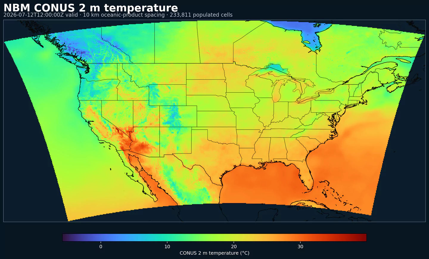
Air temperature is the thermal state of the atmosphere at the specified level. It influences density, stability, and energy exchange.
| Level | Info | Horizon | Introduced | Selector |
|---|---|---|---|---|
2 m above ground |
50% level |
2h-264h | 5 days ago |
{"name":"TMP","level":"2 m above ground","info":"50% level"}
|
surface |
2h-264h | 5 days ago |
{"name":"TMP","level":"surface","info":""}
|
Total precipitable water transport direction is the direction of column‑integrated moisture flux. It indicates moisture transport pathways.
| Level | Info | Horizon | Introduced | Selector |
|---|---|---|---|---|
10 m above ground |
2h-167h | 5 days ago |
{"name":"TPWDIR","level":"10 m above ground","info":""}
|
Total precipitable water transport speed is the magnitude of column‑integrated moisture transport. It highlights atmospheric river strength.
| Level | Info | Horizon | Introduced | Selector |
|---|---|---|---|---|
10 m above ground |
2h-167h | 5 days ago |
{"name":"TPWSPD","level":"10 m above ground","info":""}
|
Thunderstorm indicator flags the presence of thunderstorm conditions in the grid cell. It is used as a categorical hazard field.
| Level | Info | Horizon | Introduced | Selector |
|---|---|---|---|---|
surface |
probability forecast |
1h-192h | 5 days ago |
{"name":"TSTM","level":"surface","info":"probability forecast"}
|
Horizontal visibility at the surface. Lower values indicate reduced visibility due to fog, precipitation, or aerosols.
| Level | Info | Horizon | Introduced | Selector |
|---|---|---|---|---|
surface |
50% level |
2h-264h | 5 days ago |
{"name":"VIS","level":"surface","info":"50% level"}
|
Wind direction indicates the direction from which the wind is blowing at the specified level.
| Level | Info | Horizon | Introduced | Selector |
|---|---|---|---|---|
10 m above ground |
5h-264h | 5 days ago |
{"name":"WDIR","level":"10 m above ground","info":""}
|
|
10 m above ground |
50% level |
5h-264h | 5 days ago |
{"name":"WDIR","level":"10 m above ground","info":"50% level"}
|
10 m above ground |
75% level |
5h-264h | 5 days ago |
{"name":"WDIR","level":"10 m above ground","info":"75% level"}
|
10 m above ground |
90% level |
5h-264h | 5 days ago |
{"name":"WDIR","level":"10 m above ground","info":"90% level"}
|
30 m above ground |
50% level |
5h-264h | 5 days ago |
{"name":"WDIR","level":"30 m above ground","info":"50% level"}
|
80 m above ground |
50% level |
5h-264h | 5 days ago |
{"name":"WDIR","level":"80 m above ground","info":"50% level"}
|
Wind speed is the magnitude of the horizontal wind at the specified level. It is used for transport, mixing, and hazards.
| Level | Info | Horizon | Introduced | Selector |
|---|---|---|---|---|
10 m above ground |
5h-264h | 5 days ago |
{"name":"WIND","level":"10 m above ground","info":""}
|
|
10 m above ground |
10% level |
2h-264h | 5 days ago |
{"name":"WIND","level":"10 m above ground","info":"10% level"}
|
10 m above ground |
25% level |
2h-264h | 5 days ago |
{"name":"WIND","level":"10 m above ground","info":"25% level"}
|
10 m above ground |
50% level |
2h-264h | 5 days ago |
{"name":"WIND","level":"10 m above ground","info":"50% level"}
|
10 m above ground |
75% level |
2h-264h | 5 days ago |
{"name":"WIND","level":"10 m above ground","info":"75% level"}
|
10 m above ground |
90% level |
2h-264h | 5 days ago |
{"name":"WIND","level":"10 m above ground","info":"90% level"}
|
30 m above ground |
50% level |
2h-264h | 5 days ago |
{"name":"WIND","level":"30 m above ground","info":"50% level"}
|
80 m above ground |
50% level |
2h-264h | 5 days ago |
{"name":"WIND","level":"80 m above ground","info":"50% level"}
|
Keine Parameter passen zur Suche.