Apparent temperature combines air temperature, humidity, and wind to estimate how hot or cold it feels to humans. It is useful for heat and cold stress assessments.
- Units: K.
Codice GribStream: nbmparoc
Altre griglie NBM Parallel:
nbmpar, nbmparak, nbmparhi, nbmparpr, nbmpargu
Status: NBM v5 è già operativo in GribStream in nbmoc. In nbmoc, i run precedenti a 2026-05-05 12:00 UTC contengono la versione operativa precedente di NBM; i run da 2026-05-05 12:00 UTC in poi usano NBM v5. Per integrazioni di produzione con NBM v5 usa nbmoc; i dataset nbmpar* restano riservati a future iterazioni sperimentali di NBM se NOAA torna a pubblicarle nella linea parallela.
La fonte pubblica è noaa-nbm-para-pds. GribStream mantiene la linea parallela in codici dedicati, così puoi confrontarla con la famiglia NBM operativa senza mescolarla con l'archivio usato dalle integrazioni correnti.
Riferimenti tecnici: PNS 25-45, note di configurazione Winter v5.0 e NBM Versions.
NBM Parallel Oceanic è il prodotto pubblico parallelo del National Blend of Models per la griglia oceanica. Serve a confronto e validazione quando NOAA pubblica una linea sperimentale accanto alla versione operativa.
Per produzione con NBM v5, il dataset consigliato è nbmoc. nbmparoc resta come riferimento di confronto e come spazio per future iterazioni sperimentali che NOAA potrebbe pubblicare nella linea parallela.
NBM v5 non è stato solo un aggiornamento di parametri. NOAA ha esteso gran parte della previsione oraria di base da 36 h a 48 h e ha rivisto il blend con più Quantile Mapping, modifiche a vento e raffiche deterministiche, e input a risoluzione più alta da ECMWF e Canada.
Per il dominio oceanico, le note NBM v5 evidenziano vento e raffiche probabilistiche corretti con Quantile Mapping, prodotti aggiornati di temperatura, punto di rugiada e nuvolosità, e una correzione dell'altezza significativa dell'onda che usa Quantile Mapping con un insieme molto più ampio di fonti in ingresso.
In GribStream, nbmparoc mantiene selettori stabili: i valori di name, level e info vengono copiati esattamente dal catalogo e non sono tradotti.
info del catalogo di nbmparoc.Fai clic su un parametro per vedere le varianti in una tabella compatta con selettori JSON pronti da copiare. Codici, livelli e valori dei selettori restano esattamente come li espone l'API.
Apparent temperature combines air temperature, humidity, and wind to estimate how hot or cold it feels to humans. It is useful for heat and cold stress assessments.
| Level | Info | Horizon | Introduced | Selector |
|---|---|---|---|---|
2 m above ground |
2h-264h | 5 days ago |
{"name":"APTMP","level":"2 m above ground","info":""}
|
Dew point temperature is the temperature at which the air becomes saturated. It is a direct measure of moisture content.
| Level | Info | Horizon | Introduced | Selector |
|---|---|---|---|---|
2 m above ground |
50% level |
2h-264h | 5 days ago |
{"name":"DPT","level":"2 m above ground","info":"50% level"}
|
Freezing spray indicator flags marine conditions favorable for ice accretion on vessels. It depends on wind, air temperature, and wave conditions.
| Level | Info | Horizon | Introduced | Selector |
|---|---|---|---|---|
surface |
2h-264h | 5 days ago |
{"name":"FRZSPR","level":"surface","info":""}
|
Wind gust is the peak short-duration wind speed. It captures brief, hazardous bursts that can exceed sustained winds.
| Level | Info | Horizon | Introduced | Selector |
|---|---|---|---|---|
10 m above ground |
50% level |
2h-264h | 5 days ago |
{"name":"GUST","level":"10 m above ground","info":"50% level"}
|
Precipitable water is the total column water vapor from the surface to the top of the atmosphere. It is a key moisture indicator.
| Level | Info | Horizon | Introduced | Selector |
|---|---|---|---|---|
entire atmosphere (considered as a single layer) |
1h-264h | 5 days ago |
{"name":"PWAT","level":"entire atmosphere (considered as a single layer)","info":""}
|
|
entire atmosphere (considered as a single layer) |
10% level |
1h-264h | 5 days ago |
{"name":"PWAT","level":"entire atmosphere (considered as a single layer)","info":"10% level"}
|
entire atmosphere (considered as a single layer) |
50% level |
1h-264h | 5 days ago |
{"name":"PWAT","level":"entire atmosphere (considered as a single layer)","info":"50% level"}
|
entire atmosphere (considered as a single layer) |
90% level |
1h-264h | 5 days ago |
{"name":"PWAT","level":"entire atmosphere (considered as a single layer)","info":"90% level"}
|
entire atmosphere (considered as a single layer) |
prob >12.7 |
1h-264h | 5 days ago |
{"name":"PWAT","level":"entire atmosphere (considered as a single layer)","info":"prob >12.7"}
|
entire atmosphere (considered as a single layer) |
prob >25.4 |
1h-264h | 5 days ago |
{"name":"PWAT","level":"entire atmosphere (considered as a single layer)","info":"prob >25.4"}
|
entire atmosphere (considered as a single layer) |
prob >38.1 |
1h-264h | 5 days ago |
{"name":"PWAT","level":"entire atmosphere (considered as a single layer)","info":"prob >38.1"}
|
entire atmosphere (considered as a single layer) |
prob >50.8 |
1h-264h | 5 days ago |
{"name":"PWAT","level":"entire atmosphere (considered as a single layer)","info":"prob >50.8"}
|
entire atmosphere (considered as a single layer) |
prob >63.5 |
1h-264h | 5 days ago |
{"name":"PWAT","level":"entire atmosphere (considered as a single layer)","info":"prob >63.5"}
|
Total cloud cover is the fraction of the grid cell covered by clouds at any level. It influences radiation, temperature, and visibility.
| Level | Info | Horizon | Introduced | Selector |
|---|---|---|---|---|
surface |
2h-264h | 5 days ago |
{"name":"TCDC","level":"surface","info":""}
|
|
surface |
ens std dev |
2h-264h | 5 days ago |
{"name":"TCDC","level":"surface","info":"ens std dev"}
|
Thunderstorm probability gives the chance of thunderstorms during the valid period. It is used for convective hazard guidance.
| Level | Info | Horizon | Introduced | Selector |
|---|---|---|---|---|
entire atmosphere |
1h-36h | 5 days ago |
{"name":"THUNC","level":"entire atmosphere","info":""}
|
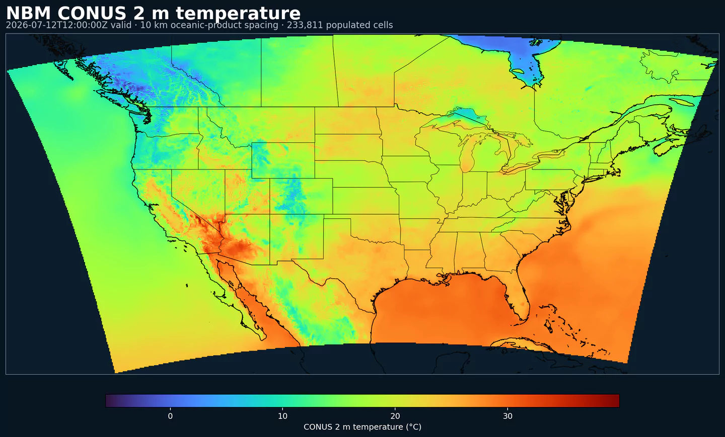
Air temperature is the thermal state of the atmosphere at the specified level. It influences density, stability, and energy exchange.
| Level | Info | Horizon | Introduced | Selector |
|---|---|---|---|---|
2 m above ground |
50% level |
2h-264h | 5 days ago |
{"name":"TMP","level":"2 m above ground","info":"50% level"}
|
surface |
2h-264h | 5 days ago |
{"name":"TMP","level":"surface","info":""}
|
Total precipitable water transport direction is the direction of column‑integrated moisture flux. It indicates moisture transport pathways.
| Level | Info | Horizon | Introduced | Selector |
|---|---|---|---|---|
10 m above ground |
2h-167h | 5 days ago |
{"name":"TPWDIR","level":"10 m above ground","info":""}
|
Total precipitable water transport speed is the magnitude of column‑integrated moisture transport. It highlights atmospheric river strength.
| Level | Info | Horizon | Introduced | Selector |
|---|---|---|---|---|
10 m above ground |
2h-167h | 5 days ago |
{"name":"TPWSPD","level":"10 m above ground","info":""}
|
Thunderstorm indicator flags the presence of thunderstorm conditions in the grid cell. It is used as a categorical hazard field.
| Level | Info | Horizon | Introduced | Selector |
|---|---|---|---|---|
surface |
probability forecast |
1h-192h | 5 days ago |
{"name":"TSTM","level":"surface","info":"probability forecast"}
|
Horizontal visibility at the surface. Lower values indicate reduced visibility due to fog, precipitation, or aerosols.
| Level | Info | Horizon | Introduced | Selector |
|---|---|---|---|---|
surface |
50% level |
2h-264h | 5 days ago |
{"name":"VIS","level":"surface","info":"50% level"}
|
Wind direction indicates the direction from which the wind is blowing at the specified level.
| Level | Info | Horizon | Introduced | Selector |
|---|---|---|---|---|
10 m above ground |
5h-264h | 5 days ago |
{"name":"WDIR","level":"10 m above ground","info":""}
|
|
10 m above ground |
50% level |
5h-264h | 5 days ago |
{"name":"WDIR","level":"10 m above ground","info":"50% level"}
|
10 m above ground |
75% level |
5h-264h | 5 days ago |
{"name":"WDIR","level":"10 m above ground","info":"75% level"}
|
10 m above ground |
90% level |
5h-264h | 5 days ago |
{"name":"WDIR","level":"10 m above ground","info":"90% level"}
|
30 m above ground |
50% level |
5h-264h | 5 days ago |
{"name":"WDIR","level":"30 m above ground","info":"50% level"}
|
80 m above ground |
50% level |
5h-264h | 5 days ago |
{"name":"WDIR","level":"80 m above ground","info":"50% level"}
|
Wind speed is the magnitude of the horizontal wind at the specified level. It is used for transport, mixing, and hazards.
| Level | Info | Horizon | Introduced | Selector |
|---|---|---|---|---|
10 m above ground |
5h-264h | 5 days ago |
{"name":"WIND","level":"10 m above ground","info":""}
|
|
10 m above ground |
10% level |
2h-264h | 5 days ago |
{"name":"WIND","level":"10 m above ground","info":"10% level"}
|
10 m above ground |
25% level |
2h-264h | 5 days ago |
{"name":"WIND","level":"10 m above ground","info":"25% level"}
|
10 m above ground |
50% level |
2h-264h | 5 days ago |
{"name":"WIND","level":"10 m above ground","info":"50% level"}
|
10 m above ground |
75% level |
2h-264h | 5 days ago |
{"name":"WIND","level":"10 m above ground","info":"75% level"}
|
10 m above ground |
90% level |
2h-264h | 5 days ago |
{"name":"WIND","level":"10 m above ground","info":"90% level"}
|
30 m above ground |
50% level |
2h-264h | 5 days ago |
{"name":"WIND","level":"30 m above ground","info":"50% level"}
|
80 m above ground |
50% level |
2h-264h | 5 days ago |
{"name":"WIND","level":"80 m above ground","info":"50% level"}
|
Nessun parametro corrisponde alla ricerca.