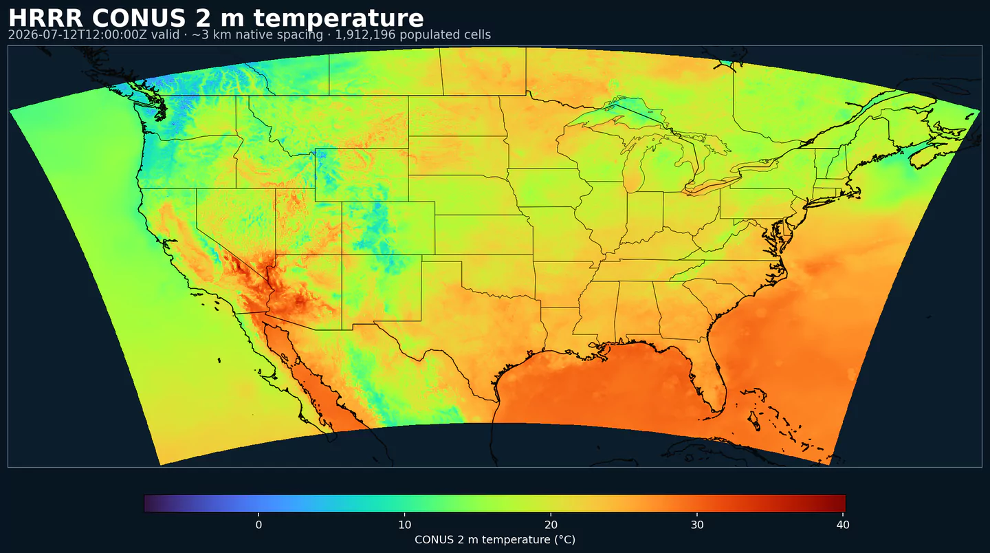
Representative HRRR coverage: 2 m temperature across the complete populated grid footprint at approximately 3 km spacing, with black state and country boundaries. This coverage reference was generated from hrrr for the hrrrsubh page; available variables may differ.
Descrizione
HRRR Sub-hourly espone campi di superficie ad alta frequenza del modello NOAA/NCEP High-Resolution Rapid Refresh. È pensato per decisioni in cui i cambiamenti dentro la stessa ora contano davvero.
Il dataset è una selezione mirata della famiglia di prodotti HRRR wrfsubhf: orari di validità ogni 15 minuti fino a 18 h. È utile quando un valore orario nasconderebbe una rampa, un fronte o un segnale superficiale di breve durata.
I casi tipici includono mercati elettrici, rampe eoliche e solari, previsione del carico, aviazione con vento, base delle nubi e visibilità, e meteo di mesoscala che cambia rapidamente vicino alla superficie.
Per l'archivio HRRR orario completo, più campi e orizzonti più lunghi, usa HRRR. Per campi di analisi vicino alla superficie invece di orari di validità della previsione, confronta con RTMA Rapid Update.
Campi superficiali ad alta frequenza dalla famiglia di prodotti HRRR wrfsubhf.
Orari di validità ogni 15 minuti fino a 18 h, con run orari.
Selezione mirata di campi superficiali; non sostituisce il prodotto HRRR completo.
Utile per rampe, fronti e segnali superficiali brevi che un valore orario può nascondere.
Risoluzione: Griglia Lambert CONUS da 3 km.
Copertura temporale: Run orari; orari di validità ogni 15 minuti fino a 18 h.
Usi principali: Mercati elettrici, rampe eoliche e solari, previsione del carico, aviazione, vento, visibilità, condizioni superficiali che cambiano rapidamente e workflow con risoluzione sub-oraria.
Fai clic su un parametro per vedere le varianti in una tabella compatta con selettori JSON pronti da copiare. Codici, livelli e valori dei selettori restano esattamente come li espone l'API.
Accumulated precipitation represents the total water-equivalent amount of rain and snow during the output period. It is a primary field for hydrologic impacts and event totals.
Units: kg/m^2.
Use with the model time interval to interpret totals and compare to gauges.
Percent frozen precipitation indicates the fraction of total precipitation that is falling in frozen form. It helps distinguish mixed-phase and winter precipitation impacts.
Units: percent.
Higher values indicate a larger frozen contribution to the total precipitation.
Geopotential height is the altitude of a pressure surface in the atmosphere. It is the primary field for identifying ridges, troughs, and large‑scale flow patterns.
Composite reflectivity is the maximum reflectivity in the column. It is a standard radar‑style field for identifying convective cores and precipitation intensity.
Simulated brightness temperature for GOES-11 channel 3 represents modeled radiance converted to an equivalent blackbody temperature. It supports satellite comparison and cloud diagnostics.
Units: K.
Level
Info
Horizon
Introduced
Selector
top of atmosphere
0m-18h
2026-02-04
{"name":"SBT113","level":"top of atmosphere","info":""}
SBT114–Simulated Brightness Temperature for GOES 11, Channel 4 (K)
Simulated brightness temperature for GOES-11 channel 4 represents modeled radiance converted to an equivalent blackbody temperature. It supports satellite comparison and cloud diagnostics.
Units: K.
Level
Info
Horizon
Introduced
Selector
top of atmosphere
0m-18h
2026-02-04
{"name":"SBT114","level":"top of atmosphere","info":""}
SBT123–Simulated Brightness Temperature for GOES 12, Channel 3 (K)
Simulated brightness temperature for GOES-12 channel 3 represents modeled radiance converted to an equivalent blackbody temperature. It supports satellite comparison and cloud diagnostics.
Units: K.
Level
Info
Horizon
Introduced
Selector
top of atmosphere
0m-18h
2026-02-04
{"name":"SBT123","level":"top of atmosphere","info":""}
SBT124–Simulated Brightness Temperature for GOES 12, Channel 4 (K)
Simulated brightness temperature for GOES-12 channel 4 represents modeled radiance converted to an equivalent blackbody temperature. It supports satellite comparison and cloud diagnostics.
Units: K.
Level
Info
Horizon
Introduced
Selector
top of atmosphere
0m-18h
2026-02-04
{"name":"SBT124","level":"top of atmosphere","info":""}