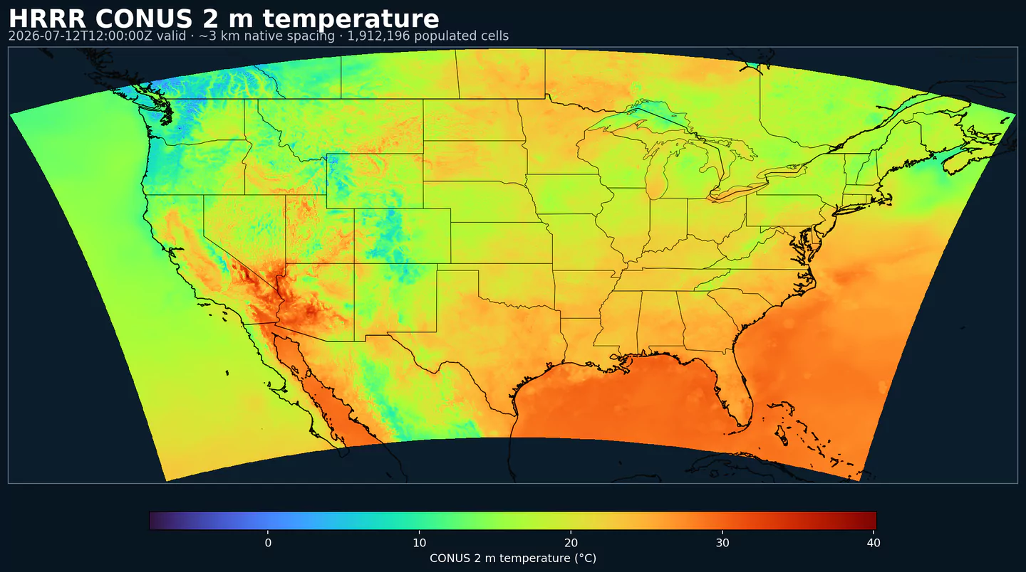
Representative HRRR coverage: 2 m temperature across the complete populated grid footprint at approximately 3 km spacing, with black state and country boundaries. This coverage reference was generated from hrrr for the hrrrsubh page; available variables may differ.
Beschreibung
HRRR Sub-hourly stellt hochfrequente Oberflächen-Ausgabe des NOAA/NCEP-Modells High-Resolution Rapid Refresh bereit. Es ist für Workflows gedacht, bei denen Änderungen innerhalb einer Stunde entscheidend sind.
Das Dataset ist eine fokussierte Auswahl aus der wrfsubhf-Produktfamilie von HRRR: gültige Zeiten alle 15 Minuten bis 18 h. Es ist nützlich, wenn ein stündlicher Wert eine Rampe, Grenze oder ein kurzlebiges Oberflächensignal verdecken würde.
Typische Anwendungen sind Strommärkte, Wind- und Solar-Rampen, Lastprognosen, Luftfahrt mit Wind, Wolkenuntergrenze und Sichtweite sowie schnell wechselndes mesoskaliges Wetter nahe der Oberfläche.
Für das vollständige stündliche HRRR-Archiv, zusätzliche Felder und längere Horizonte nutzen Sie HRRR. Für Analysefelder nahe der Oberfläche statt Vorhersagezeiten vergleichen Sie mit RTMA Rapid Update.
Klicken Sie auf einen Parameter, um Varianten in einer kompakten Tabelle mit kopierbaren JSON-Selektoren zu sehen. Codes, Levels und Selector-Werte bleiben exakt so, wie die API sie ausgibt.
Accumulated precipitation represents the total water-equivalent amount of rain and snow during the output period. It is a primary field for hydrologic impacts and event totals.
Units: kg/m^2.
Use with the model time interval to interpret totals and compare to gauges.
Percent frozen precipitation indicates the fraction of total precipitation that is falling in frozen form. It helps distinguish mixed-phase and winter precipitation impacts.
Units: percent.
Higher values indicate a larger frozen contribution to the total precipitation.
Geopotential height is the altitude of a pressure surface in the atmosphere. It is the primary field for identifying ridges, troughs, and large‑scale flow patterns.
Composite reflectivity is the maximum reflectivity in the column. It is a standard radar‑style field for identifying convective cores and precipitation intensity.
Simulated brightness temperature for GOES-11 channel 3 represents modeled radiance converted to an equivalent blackbody temperature. It supports satellite comparison and cloud diagnostics.
Units: K.
Level
Info
Horizon
Introduced
Selector
top of atmosphere
0m-18h
2026-02-04
{"name":"SBT113","level":"top of atmosphere","info":""}
SBT114–Simulated Brightness Temperature for GOES 11, Channel 4 (K)
Simulated brightness temperature for GOES-11 channel 4 represents modeled radiance converted to an equivalent blackbody temperature. It supports satellite comparison and cloud diagnostics.
Units: K.
Level
Info
Horizon
Introduced
Selector
top of atmosphere
0m-18h
2026-02-04
{"name":"SBT114","level":"top of atmosphere","info":""}
SBT123–Simulated Brightness Temperature for GOES 12, Channel 3 (K)
Simulated brightness temperature for GOES-12 channel 3 represents modeled radiance converted to an equivalent blackbody temperature. It supports satellite comparison and cloud diagnostics.
Units: K.
Level
Info
Horizon
Introduced
Selector
top of atmosphere
0m-18h
2026-02-04
{"name":"SBT123","level":"top of atmosphere","info":""}
SBT124–Simulated Brightness Temperature for GOES 12, Channel 4 (K)
Simulated brightness temperature for GOES-12 channel 4 represents modeled radiance converted to an equivalent blackbody temperature. It supports satellite comparison and cloud diagnostics.
Units: K.
Level
Info
Horizon
Introduced
Selector
top of atmosphere
0m-18h
2026-02-04
{"name":"SBT124","level":"top of atmosphere","info":""}