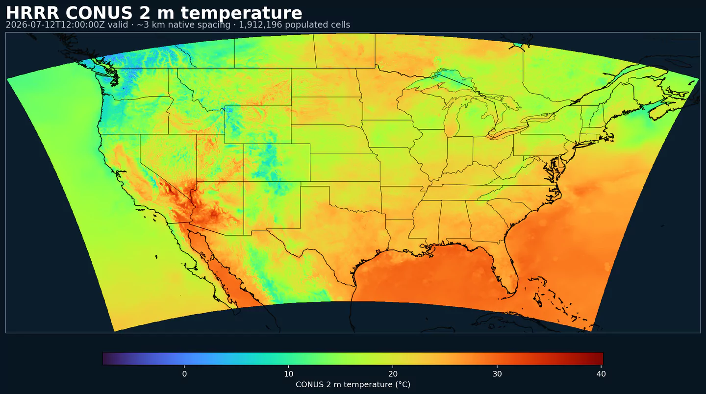
Representative HRRR coverage: 2 m temperature across the complete populated grid footprint at approximately 3 km spacing, with black state and country boundaries. This coverage reference was generated from hrrr for the hrrrsubh page; available variables may differ.
Descrição
HRRR Sub-hourly expõe a saída de superfície de alta frequência do modelo High-Resolution Rapid Refresh da NOAA/NCEP para os Estados Unidos continental.
O dataset hrrrsubh corresponde à família de produtos wrfsubhf. Ele entrega horários válidos a cada 15 minutos até 18 h, útil quando um valor horário esconderia uma rampa, um limite ou uma mudança de superfície curta.
É especialmente útil para produtos que reagem a mudanças dentro da hora: mercados de energia, previsão de geração renovável, carga, ventos de aviação, teto de nuvens, visibilidade e fenômenos de mesoescala de evolução rápida.
Para o arquivo HRRR completo, com mais campos e horizontes mais longos, use HRRR. Para campos de superfície de análise quase em tempo real, não horários válidos de previsão, compare com RTMA Rapid Update.
hrrrsubh é uma visão focada, pensada para campos de superfície de curtíssimo prazo. Ela não substitui o HRRR horário completo quando você precisa de níveis em altitude, mais variáveis ou horizontes mais longos.
Campos de superfície de alta frequência do produto wrfsubhf do HRRR.
Horários válidos a cada 15 minutos até 18 h, com ciclos horários.
Grade Lambert CONUS de 3 km, focada em mudanças rápidas perto da superfície.
Complementa o HRRR horário completo; não o substitui quando você precisa de mais variáveis ou horizontes mais longos.
Resolução: Grade Lambert CONUS de 3 km.
Cobertura temporal: Ciclos horários; horários válidos a cada 15 minutos de 0 a 18 h.
Principais usos: Rampas dentro da hora para vento, solar e carga elétrica; aviação de curto prazo; teto de nuvens, visibilidade e rajadas; acompanhamento de gradientes de mesoescala e operações que dependem de mudanças rápidas nas próximas horas.
Clique em um parâmetro para ver as variantes em uma tabela compacta, com seletores JSON prontos para copiar. Códigos, níveis e valores do seletor ficam exatamente como a API expõe.
Accumulated precipitation represents the total water-equivalent amount of rain and snow during the output period. It is a primary field for hydrologic impacts and event totals.
Units: kg/m^2.
Use with the model time interval to interpret totals and compare to gauges.
Percent frozen precipitation indicates the fraction of total precipitation that is falling in frozen form. It helps distinguish mixed-phase and winter precipitation impacts.
Units: percent.
Higher values indicate a larger frozen contribution to the total precipitation.
Geopotential height is the altitude of a pressure surface in the atmosphere. It is the primary field for identifying ridges, troughs, and large‑scale flow patterns.
Composite reflectivity is the maximum reflectivity in the column. It is a standard radar‑style field for identifying convective cores and precipitation intensity.
Simulated brightness temperature for GOES-11 channel 3 represents modeled radiance converted to an equivalent blackbody temperature. It supports satellite comparison and cloud diagnostics.
Units: K.
Level
Info
Horizon
Introduced
Selector
top of atmosphere
0m-18h
2026-02-04
{"name":"SBT113","level":"top of atmosphere","info":""}
SBT114–Simulated Brightness Temperature for GOES 11, Channel 4 (K)
Simulated brightness temperature for GOES-11 channel 4 represents modeled radiance converted to an equivalent blackbody temperature. It supports satellite comparison and cloud diagnostics.
Units: K.
Level
Info
Horizon
Introduced
Selector
top of atmosphere
0m-18h
2026-02-04
{"name":"SBT114","level":"top of atmosphere","info":""}
SBT123–Simulated Brightness Temperature for GOES 12, Channel 3 (K)
Simulated brightness temperature for GOES-12 channel 3 represents modeled radiance converted to an equivalent blackbody temperature. It supports satellite comparison and cloud diagnostics.
Units: K.
Level
Info
Horizon
Introduced
Selector
top of atmosphere
0m-18h
2026-02-04
{"name":"SBT123","level":"top of atmosphere","info":""}
SBT124–Simulated Brightness Temperature for GOES 12, Channel 4 (K)
Simulated brightness temperature for GOES-12 channel 4 represents modeled radiance converted to an equivalent blackbody temperature. It supports satellite comparison and cloud diagnostics.
Units: K.
Level
Info
Horizon
Introduced
Selector
top of atmosphere
0m-18h
2026-02-04
{"name":"SBT124","level":"top of atmosphere","info":""}