Ceiling height is the altitude of the lowest cloud base that covers a significant portion of the sky. It is a key aviation and surface-visibility metric.
- Units: m.
Código GribStream: rtmaru
RTMA Rapid Update é uma variante de baixa latência da família Real-Time Mesoscale Analysis.
Use quando a prioridade é ter um estado de superfície recente o mais rápido possível. Para uma análise finalizada e mais completa, prefira URMA.
No GribStream, rtmaru é útil em produtos que precisam atualizar painéis ou alertas quase em tempo real, mantendo o mesmo padrão de consulta da API.
Para contexto de previsão de curto prazo, combine com HRRR ou RAP.
Clique em um parâmetro para ver as variantes em uma tabela compacta, com seletores JSON prontos para copiar. Códigos, níveis e valores do seletor ficam exatamente como a API expõe.
Ceiling height is the altitude of the lowest cloud base that covers a significant portion of the sky. It is a key aviation and surface-visibility metric.
| Level | Info | Horizon | Introduced | Selector |
|---|---|---|---|---|
cloud ceiling |
-45m-0m | 2026-02-04 |
{"name":"CEIL","level":"cloud ceiling","info":""}
|
Dew point temperature is the temperature at which the air becomes saturated. It is a direct measure of moisture content.
| Level | Info | Horizon | Introduced | Selector |
|---|---|---|---|---|
2 m above ground |
-45m-0m | 2026-02-04 |
{"name":"DPT","level":"2 m above ground","info":""}
|
Wind gust is the peak short-duration wind speed. It captures brief, hazardous bursts that can exceed sustained winds.
| Level | Info | Horizon | Introduced | Selector |
|---|---|---|---|---|
10 m above ground |
-45m-0m | 2026-02-04 |
{"name":"GUST","level":"10 m above ground","info":""}
|
Geopotential height is the altitude of a pressure surface in the atmosphere. It is the primary field for identifying ridges, troughs, and large‑scale flow patterns.
| Level | Info | Horizon | Introduced | Selector |
|---|---|---|---|---|
surface |
-45m-0m | 2026-02-04 |
{"name":"HGT","level":"surface","info":""}
|
Pressure is the atmospheric pressure at the specified level. It is a fundamental mass-field variable for dynamics and thermodynamics.
| Level | Info | Horizon | Introduced | Selector |
|---|---|---|---|---|
surface |
-45m-0m | 2026-02-04 |
{"name":"PRES","level":"surface","info":""}
|
Specific humidity is the mass of water vapor per mass of air at the specified level. It is central to moisture transport.
| Level | Info | Horizon | Introduced | Selector |
|---|---|---|---|---|
2 m above ground |
-45m-0m | 2026-02-04 |
{"name":"SPFH","level":"2 m above ground","info":""}
|
Total cloud cover is the fraction of the grid cell covered by clouds at any level. It influences radiation, temperature, and visibility.
| Level | Info | Horizon | Introduced | Selector |
|---|---|---|---|---|
entire atmosphere (considered as a single layer) |
-45m-0m | 2026-02-04 |
{"name":"TCDC","level":"entire atmosphere (considered as a single layer)","info":""}
|
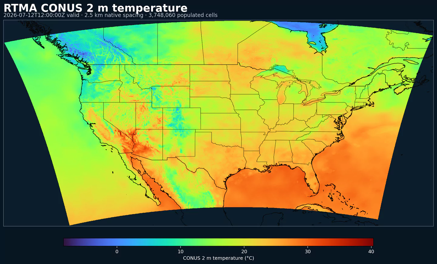
Air temperature is the thermal state of the atmosphere at the specified level. It influences density, stability, and energy exchange.
| Level | Info | Horizon | Introduced | Selector |
|---|---|---|---|---|
2 m above ground |
-45m-0m | 2026-02-04 |
{"name":"TMP","level":"2 m above ground","info":""}
|
U‑component of wind is the east‑west component of the horizontal wind. Combine with v for speed and direction.
| Level | Info | Horizon | Introduced | Selector |
|---|---|---|---|---|
10 m above ground |
-45m-0m | 2026-02-04 |
{"name":"UGRD","level":"10 m above ground","info":""}
|
V‑component of wind is the north‑south component of the horizontal wind. Combine with u for speed and direction.
| Level | Info | Horizon | Introduced | Selector |
|---|---|---|---|---|
10 m above ground |
-45m-0m | 2026-02-04 |
{"name":"VGRD","level":"10 m above ground","info":""}
|
Horizontal visibility at the surface. Lower values indicate reduced visibility due to fog, precipitation, or aerosols.
| Level | Info | Horizon | Introduced | Selector |
|---|---|---|---|---|
surface |
-45m-0m | 2026-02-04 |
{"name":"VIS","level":"surface","info":""}
|
Wind direction indicates the direction from which the wind is blowing at the specified level.
| Level | Info | Horizon | Introduced | Selector |
|---|---|---|---|---|
10 m above ground |
-45m-0m | 2026-02-04 |
{"name":"WDIR","level":"10 m above ground","info":""}
|
Wind speed is the magnitude of the horizontal wind at the specified level. It is used for transport, mixing, and hazards.
| Level | Info | Horizon | Introduced | Selector |
|---|---|---|---|---|
10 m above ground |
-45m-0m | 2026-02-04 |
{"name":"WIND","level":"10 m above ground","info":""}
|
Nenhum parâmetro corresponde à busca.