Ceiling height is the altitude of the lowest cloud base that covers a significant portion of the sky. It is a key aviation and surface-visibility metric.
- Units: m.

Codice GribStream: rtmaru
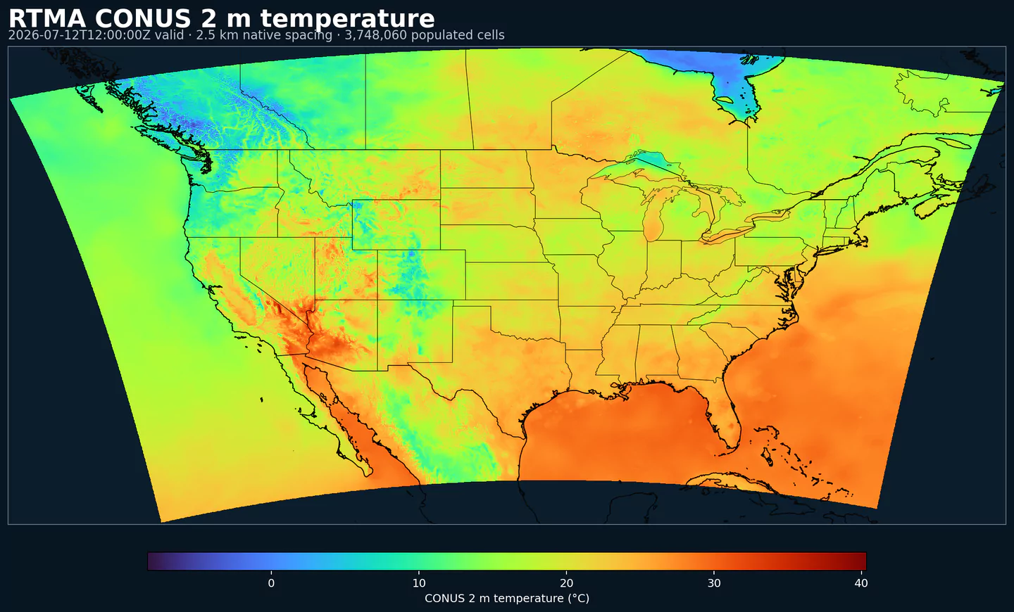
RTMA Rapid Update è la variante a cadenza più alta della famiglia RTMA per campi di superficie su CONUS. Pubblica analisi ogni 15 minuti, invece del passo orario principale.
In GribStream rtmaru è utile quando una media o istantanea oraria nasconde cambiamenti importanti: vento, temperatura, visibilità, condizioni superficiali, ramping energetico o diagnostica di breve durata.
È un prodotto di analisi, quindi l'orizzonte è 0. Non sostituisce una previsione, ma fornisce un quadro vicino al presente per dashboard, verifica e correzione bias.
Per analisi orarie a bassa latenza usa RTMA. Per analisi finalizzate più complete usa URMA.
horizon = 0, non previsione estesa.Fai clic su un parametro per vedere le varianti in una tabella compatta con selettori JSON pronti da copiare. Codici, livelli e valori dei selettori restano esattamente come li espone l'API.
Ceiling height is the altitude of the lowest cloud base that covers a significant portion of the sky. It is a key aviation and surface-visibility metric.
| Level | Info | Horizon | Introduced | Selector |
|---|---|---|---|---|
cloud ceiling |
-45m-0m | 2026-02-04 |
{"name":"CEIL","level":"cloud ceiling","info":""}
|
Dew point temperature is the temperature at which the air becomes saturated. It is a direct measure of moisture content.
| Level | Info | Horizon | Introduced | Selector |
|---|---|---|---|---|
2 m above ground |
-45m-0m | 2026-02-04 |
{"name":"DPT","level":"2 m above ground","info":""}
|
Wind gust is the peak short-duration wind speed. It captures brief, hazardous bursts that can exceed sustained winds.
| Level | Info | Horizon | Introduced | Selector |
|---|---|---|---|---|
10 m above ground |
-45m-0m | 2026-02-04 |
{"name":"GUST","level":"10 m above ground","info":""}
|
Geopotential height is the altitude of a pressure surface in the atmosphere. It is the primary field for identifying ridges, troughs, and large‑scale flow patterns.
| Level | Info | Horizon | Introduced | Selector |
|---|---|---|---|---|
surface |
-45m-0m | 2026-02-04 |
{"name":"HGT","level":"surface","info":""}
|
Pressure is the atmospheric pressure at the specified level. It is a fundamental mass-field variable for dynamics and thermodynamics.
| Level | Info | Horizon | Introduced | Selector |
|---|---|---|---|---|
surface |
-45m-0m | 2026-02-04 |
{"name":"PRES","level":"surface","info":""}
|
Specific humidity is the mass of water vapor per mass of air at the specified level. It is central to moisture transport.
| Level | Info | Horizon | Introduced | Selector |
|---|---|---|---|---|
2 m above ground |
-45m-0m | 2026-02-04 |
{"name":"SPFH","level":"2 m above ground","info":""}
|
Total cloud cover is the fraction of the grid cell covered by clouds at any level. It influences radiation, temperature, and visibility.
| Level | Info | Horizon | Introduced | Selector |
|---|---|---|---|---|
entire atmosphere (considered as a single layer) |
-45m-0m | 2026-02-04 |
{"name":"TCDC","level":"entire atmosphere (considered as a single layer)","info":""}
|
Air temperature is the thermal state of the atmosphere at the specified level. It influences density, stability, and energy exchange.
| Level | Info | Horizon | Introduced | Selector |
|---|---|---|---|---|
2 m above ground |
-45m-0m | 2026-02-04 |
{"name":"TMP","level":"2 m above ground","info":""}
|
U‑component of wind is the east‑west component of the horizontal wind. Combine with v for speed and direction.
| Level | Info | Horizon | Introduced | Selector |
|---|---|---|---|---|
10 m above ground |
-45m-0m | 2026-02-04 |
{"name":"UGRD","level":"10 m above ground","info":""}
|
V‑component of wind is the north‑south component of the horizontal wind. Combine with u for speed and direction.
| Level | Info | Horizon | Introduced | Selector |
|---|---|---|---|---|
10 m above ground |
-45m-0m | 2026-02-04 |
{"name":"VGRD","level":"10 m above ground","info":""}
|
Horizontal visibility at the surface. Lower values indicate reduced visibility due to fog, precipitation, or aerosols.
| Level | Info | Horizon | Introduced | Selector |
|---|---|---|---|---|
surface |
-45m-0m | 2026-02-04 |
{"name":"VIS","level":"surface","info":""}
|
Wind direction indicates the direction from which the wind is blowing at the specified level.
| Level | Info | Horizon | Introduced | Selector |
|---|---|---|---|---|
10 m above ground |
-45m-0m | 2026-02-04 |
{"name":"WDIR","level":"10 m above ground","info":""}
|
Wind speed is the magnitude of the horizontal wind at the specified level. It is used for transport, mixing, and hazards.
| Level | Info | Horizon | Introduced | Selector |
|---|---|---|---|---|
10 m above ground |
-45m-0m | 2026-02-04 |
{"name":"WIND","level":"10 m above ground","info":""}
|
Nessun parametro corrisponde alla ricerca.