Ceiling height is the altitude of the lowest cloud base that covers a significant portion of the sky. It is a key aviation and surface-visibility metric.
- Units: m.
Codice GribStream: rtma
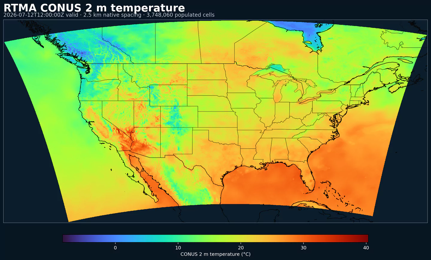
RTMA (Real-Time Mesoscale Analysis) è l'analisi oraria di superficie quasi in tempo reale di NOAA/NCEP. È progettata per fornire la migliore stima disponibile delle condizioni attuali circa 30-45 minuti dopo l'orario di validità.
Usa un sistema di assimilazione variazionale bidimensionale (2D-Var) che combina un campo di partenza del modello a breve termine con osservazioni di superficie, reti mesonet, boe, navi e dati derivati da radar.
L'analisi viene generata su griglie NDFD, inclusa la griglia Lambert CONUS da 2.5 km, più domini per Alaska, Hawaii, Puerto Rico e Guam. I campi tipici includono temperatura a 2 m, punto di rugiada, vento a 10 m, direzione e raffiche, pressione superficiale, visibilità, base delle nubi e precipitazione.
RTMA aiuta a mantenere un quadro operativo ad alta risoluzione dove le osservazioni sono sparse: acque costiere, terreno complesso o zone con cambiamenti locali rapidi.
Poiché RTMA privilegia la rapidità, non include osservazioni arrivate tardi. Per un'analisi di riferimento più completa usa URMA, che riesegue RTMA circa sei ore dopo con più dati disponibili.
Fai clic su un parametro per vedere le varianti in una tabella compatta con selettori JSON pronti da copiare. Codici, livelli e valori dei selettori restano esattamente come li espone l'API.
Ceiling height is the altitude of the lowest cloud base that covers a significant portion of the sky. It is a key aviation and surface-visibility metric.
| Level | Info | Horizon | Introduced | Selector |
|---|---|---|---|---|
cloud ceiling |
0h | 2018-01-01 |
{"name":"CEIL","level":"cloud ceiling","info":""}
|
Dew point temperature is the temperature at which the air becomes saturated. It is a direct measure of moisture content.
| Level | Info | Horizon | Introduced | Selector |
|---|---|---|---|---|
2 m above ground |
0h | 2018-01-01 |
{"name":"DPT","level":"2 m above ground","info":""}
|
Wind gust is the peak short-duration wind speed. It captures brief, hazardous bursts that can exceed sustained winds.
| Level | Info | Horizon | Introduced | Selector |
|---|---|---|---|---|
10 m above ground |
0h | 2018-01-01 |
{"name":"GUST","level":"10 m above ground","info":""}
|
Geopotential height is the altitude of a pressure surface in the atmosphere. It is the primary field for identifying ridges, troughs, and large‑scale flow patterns.
| Level | Info | Horizon | Introduced | Selector |
|---|---|---|---|---|
surface |
0h | 2018-01-01 |
{"name":"HGT","level":"surface","info":""}
|
Pressure is the atmospheric pressure at the specified level. It is a fundamental mass-field variable for dynamics and thermodynamics.
| Level | Info | Horizon | Introduced | Selector |
|---|---|---|---|---|
surface |
0h | 2018-01-01 |
{"name":"PRES","level":"surface","info":""}
|
Specific humidity is the mass of water vapor per mass of air at the specified level. It is central to moisture transport.
| Level | Info | Horizon | Introduced | Selector |
|---|---|---|---|---|
2 m above ground |
0h | 2018-01-01 |
{"name":"SPFH","level":"2 m above ground","info":""}
|
Total cloud cover is the fraction of the grid cell covered by clouds at any level. It influences radiation, temperature, and visibility.
| Level | Info | Horizon | Introduced | Selector |
|---|---|---|---|---|
entire atmosphere (considered as a single layer) |
0h | 2018-01-01 |
{"name":"TCDC","level":"entire atmosphere (considered as a single layer)","info":""}
|
Air temperature is the thermal state of the atmosphere at the specified level. It influences density, stability, and energy exchange.
| Level | Info | Horizon | Introduced | Selector |
|---|---|---|---|---|
2 m above ground |
0h | 2018-01-01 |
{"name":"TMP","level":"2 m above ground","info":""}
|
U‑component of wind is the east‑west component of the horizontal wind. Combine with v for speed and direction.
| Level | Info | Horizon | Introduced | Selector |
|---|---|---|---|---|
10 m above ground |
0h | 2018-01-01 |
{"name":"UGRD","level":"10 m above ground","info":""}
|
V‑component of wind is the north‑south component of the horizontal wind. Combine with u for speed and direction.
| Level | Info | Horizon | Introduced | Selector |
|---|---|---|---|---|
10 m above ground |
0h | 2018-01-01 |
{"name":"VGRD","level":"10 m above ground","info":""}
|
Horizontal visibility at the surface. Lower values indicate reduced visibility due to fog, precipitation, or aerosols.
| Level | Info | Horizon | Introduced | Selector |
|---|---|---|---|---|
surface |
0h | 2018-01-01 |
{"name":"VIS","level":"surface","info":""}
|
Wind direction indicates the direction from which the wind is blowing at the specified level.
| Level | Info | Horizon | Introduced | Selector |
|---|---|---|---|---|
10 m above ground |
0h | 2018-01-01 |
{"name":"WDIR","level":"10 m above ground","info":""}
|
Wind speed is the magnitude of the horizontal wind at the specified level. It is used for transport, mixing, and hazards.
| Level | Info | Horizon | Introduced | Selector |
|---|---|---|---|---|
10 m above ground |
0h | 2018-01-01 |
{"name":"WIND","level":"10 m above ground","info":""}
|
Nessun parametro corrisponde alla ricerca.