GribStreamコード: era5
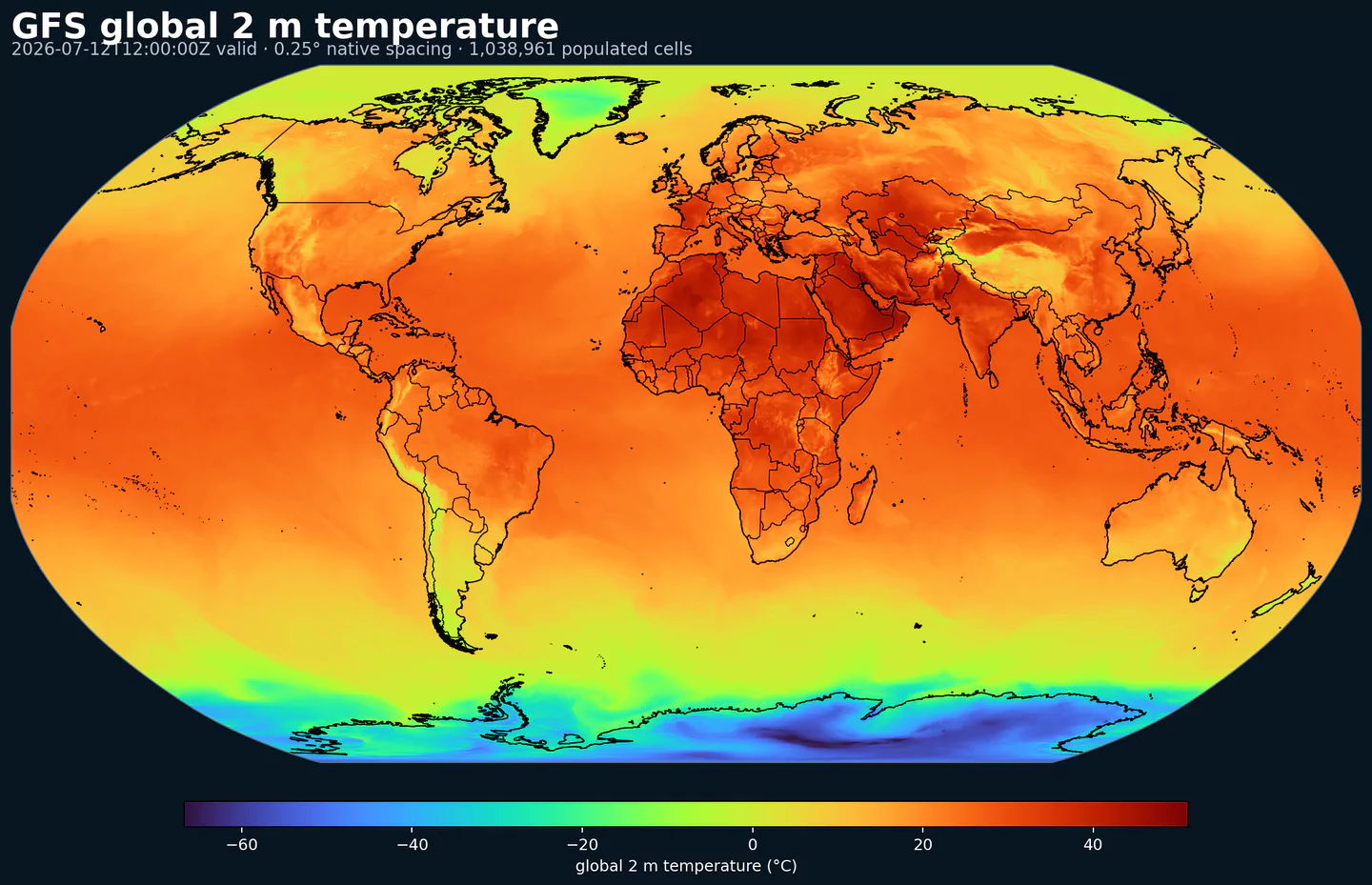
Representative global coverage: GFS 2 m temperature at its native 0.25 degree output spacing, with country boundaries overlaid. This coverage reference was generated from gfs for the era5 page; available variables may differ.
公開時点の利用可能期間: GribStreamのERA5は2020年1月1日以降 から公開します。さらに古い年は今後追加される可能性があり、履歴処理が進む間はカタログ/APIに表示される期間が現在の基準です。
ERA5Tについて: GribStreamでは現在、2026年4月1日より前 の日付をERA5の最終版として扱います。それ以降の新しい日付は、ECMWF/Copernicusが最終版に置き換えるまで、近リアルタイムの暫定版であるERA5Tの可能性があります。
概要
ERA5 は、Copernicus Climate Change Service向けにECMWFが作成している第5世代の全球再解析です。公式ソースは1940年1月から現在までを対象とし、大気、陸面、その他の気候変数を1時間ごとに推定します。
科学的な強みは、固定されたモデルとデータ同化システムで過去を再解析していることです。観測とモデル物理を組み合わせ、運用モデルの世代交代による段差が少ない、全球の格子フィールドを作ります。
ERA5は地点観測そのものではありません。空間的にそろった検証・分析用の参照データです。直近の日付では、最初にERA5Tとして提供され、後でERA5の最終版に置き換えられる点にも注意が必要です。
GribStreamではera5を有効時刻ごとの実績値として提供します。forecasted_atとforecasted_timeは同じ時刻で、horizon = 0、member = 0です。予報データセットと同じAPI構造で扱えます。
降水量や放射など、ERA5の積算量・フラックス系フィールドの一部は、ECMWFのソースアーカイブでは短い予報ステップから作られます。GribStreamではECMWFのshortNameを保ち、有効時刻のフィールドとして返すため、パラメータの意味を変えずに予報データと結合できます。
初期の取り込みでは、17個の単一レベルフィールドを変数ごとのGRIB2ファイルとして保持します。この構造により、既存のセレクタや公開済みインデックスを壊さずにERA5変数を追加できます。
ERA5はIFS Oper 、IFS ENS 、AIFS Oper と組み合わせると、予報を一貫した過去参照データと比較しやすくなります。
詳細
アーカイブ開始日: 2020-01-01プロダクトページ: https://confluence.ecmwf.int/spaces/CKB/pages/76414402/ERA5+data+documentation 主な特徴:
有効時刻ごとの実績値として扱える、ECMWF/Copernicusの時間別全球再解析です。
CDSの0.25度全球緯度経度格子にある単一レベルフィールドを対象にします。
公式ソースは1940年1月から現在まで。GribStreamは2020年以降から始め、需要に応じてさらに過去へ広げる可能性があります。
API上はforecasted_at = forecasted_time、horizon = 0、member = 0として扱います。
初期対象は、気温、風、気圧、雲、水、降水、雪、放射、地表面温度を含む17変数です。
解像度: CDS再解析サブセットの0.25度全球緯度経度格子。更新頻度と時間範囲: 有効時刻ごとの1時間値。直近のERA5Tは通常、実時間から約5日遅れで提供され、その後ERA5の最終版に置き換えられます。主な用途: 予報検証、機械学習ラベル、バックテスト、気象影響分析、バイアス補正、IFSやAIFSとの比較。
関連データセット
気象パラメータ
パラメータをクリックすると、コピーしやすいJSONセレクタ付きのコンパクトな表で候補を確認できます。コード、level、selector値はAPIが公開する値をそのまま保持します。
100u
– 100 metre U wind component (m s-1)
1 variant
Eastward component of the 100 m wind, describing near-surface flow aloft.
Comparisons to observations require care because observations represent point measurements rather than grid-box means.
Combine with the 100 m V component to derive wind speed and direction.
Level
Info
Horizon
Introduced
Selector
sfc0h
2020-01-01
{"name":"100u","level":"sfc","info":""}
Copy
100v
– 100 metre V wind component (m s-1)
1 variant
Northward component of the 100 m wind, describing near-surface flow aloft.
Comparisons to observations require care because observations represent point measurements rather than grid-box means.
Combine with the 100 m U component to derive wind speed and direction.
Level
Info
Horizon
Introduced
Selector
sfc0h
2020-01-01
{"name":"100v","level":"sfc","info":""}
Copy
10u
– 10 metre U wind component (m s-1)
1 variant
Eastward (U) component of near-surface wind.
Combine with the 10 m V component to derive wind speed and direction.
Observations can diverge due to terrain, vegetation, and local exposure.
Level
Info
Horizon
Introduced
Selector
sfc0h
2020-01-01
{"name":"10u","level":"sfc","info":""}
Copy
10v
– 10 metre V wind component (m s-1)
1 variant
Northward (V) component of near-surface wind.
Combine with the 10 m U component to derive wind speed and direction.
Observations can diverge due to terrain, vegetation, and local exposure.
Level
Info
Horizon
Introduced
Selector
sfc0h
2020-01-01
{"name":"10v","level":"sfc","info":""}
Copy
2d
– 2 metre dewpoint temperature (K)
1 variant
Dewpoint temperature describing near-surface moisture conditions. Useful for humidity diagnostics.
Often combined with temperature and pressure to estimate relative humidity.
Computed by interpolating between the lowest model level and the surface.
Level
Info
Horizon
Introduced
Selector
sfc0h
2020-01-01
{"name":"2d","level":"sfc","info":""}
Copy
2t
– 2 metre temperature (K)
1 variant
Near-surface air temperature representative of conditions over land, sea, or inland waters. Derived using surface and lowest model level information.
Units are kelvin (K); to convert to degrees Celsius (deg C), subtract 273.15.
Mean 2 metre temperature is encoded separately (parameter 228004).
Level
Info
Horizon
Introduced
Selector
sfc0h
2020-01-01
{"name":"2t","level":"sfc","info":""}
Copy
msl
– Mean sea level pressure (Pa)
1 variant
Atmospheric pressure adjusted to mean sea level, reflecting the weight of the air column.
Maps of mean sea level pressure highlight cyclones, anticyclones, and wind strength via contour spacing.
Often expressed in hPa or millibars (1 hPa = 1 mb = 100 Pa).
Level
Info
Horizon
Introduced
Selector
sfc0h
2020-01-01
{"name":"msl","level":"sfc","info":""}
Copy
sd
– Snow depth (m of water equivalent)
1 variant
Depth of snow expressed as the equivalent depth of water if the snow melted.
Represents snow over the snow-covered part of the grid box.
See parameter 228141 for the equivalent value expressed in kg m-2.
Level
Info
Horizon
Introduced
Selector
sfc0h
2020-01-01
{"name":"sd","level":"sfc","info":""}
Copy
sf
– Snowfall (m of water equivalent)
1 variant
Accumulated snowfall at the surface (large-scale + convective).
Accumulated over the extraction period; depth in metres of water equivalent.
See parameter 228144 for the equivalent value expressed in kg m-2.
Level
Info
Horizon
Introduced
Selector
sfc0h
2020-01-01
{"name":"sf","level":"sfc","info":""}
Copy
skt
– Skin temperature (K)
1 variant
Temperature of the Earth's surface required to satisfy the surface energy balance.
Represents the uppermost surface layer with no heat capacity, so it responds instantly to surface flux changes.
Computed differently over land and sea.
Units are kelvin (K); to convert to degrees Celsius (deg C), subtract 273.15.
Mean skin temperature is encoded separately (parameter 235079).
Level
Info
Horizon
Introduced
Selector
sfc0h
2020-01-01
{"name":"skt","level":"sfc","info":""}
Copy
sp
– Surface pressure (Pa)
1 variant
Atmospheric pressure at the surface of land, sea, and inland water.
Often used with temperature to estimate air density.
Mean sea level pressure is typically preferred for identifying large-scale pressure systems in mountainous regions.
Often expressed in hPa or millibars (1 hPa = 1 mb = 100 Pa).
Level
Info
Horizon
Introduced
Selector
sfc0h
2020-01-01
{"name":"sp","level":"sfc","info":""}
Copy
ssrd
– Surface short-wave (solar) radiation downwards (J m-2)
1 variant
Downward shortwave radiation at the surface (direct + diffuse).
Approximate model equivalent of pyranometer measurements.
Accumulated over the extraction period; divide by seconds to convert to W m-2.
ECMWF convention for vertical fluxes is positive downward.
Level
Info
Horizon
Introduced
Selector
sfc0h
2020-01-01
{"name":"ssrd","level":"sfc","info":""}
Copy
strd
– Surface long-wave (thermal) radiation downwards (J m-2)
1 variant
Downward longwave radiation at the surface emitted by the atmosphere and clouds.
Accumulated over the extraction period; divide by seconds to convert to W m-2.
ECMWF convention for vertical fluxes is positive downward.
Level
Info
Horizon
Introduced
Selector
sfc0h
2020-01-01
{"name":"strd","level":"sfc","info":""}
Copy
tcc
– Total cloud cover ((0 - 1))
1 variant
Fraction of a grid box covered by cloud across all model levels.
Computed from cloud across different heights with overlap assumptions.
See parameter 228164 for the equivalent value in percent.
Level
Info
Horizon
Introduced
Selector
sfc0h
2020-01-01
{"name":"tcc","level":"sfc","info":""}
Copy
tcw
– Total column water (kg m-2)
1 variant
Total column water including vapour, liquid water, cloud ice, rain, and snow.
Older IFS versions did not include rain and snow in the total.
Level
Info
Horizon
Introduced
Selector
sfc0h
2020-01-01
{"name":"tcw","level":"sfc","info":""}
Copy
tcwv
– Total column vertically-integrated water vapour (kg m-2)
1 variant
Total water vapour in a column from the surface to the top of the atmosphere.
Represents a grid-box mean value.
Level
Info
Horizon
Introduced
Selector
sfc0h
2020-01-01
{"name":"tcwv","level":"sfc","info":""}
Copy
tp
– Total precipitation (m)
1 variant
Accumulated rain + snow at the surface (large-scale + convective).
Does not include fog, dew, or precipitation that evaporates before reaching the surface.
Accumulated over the extraction period; depth in metres of water equivalent.
See parameter 228228 for the equivalent value expressed in kg m-2.
Level
Info
Horizon
Introduced
Selector
sfc0h
2020-01-01
{"name":"tp","level":"sfc","info":""}
Copy
検索に一致するパラメータはありません。