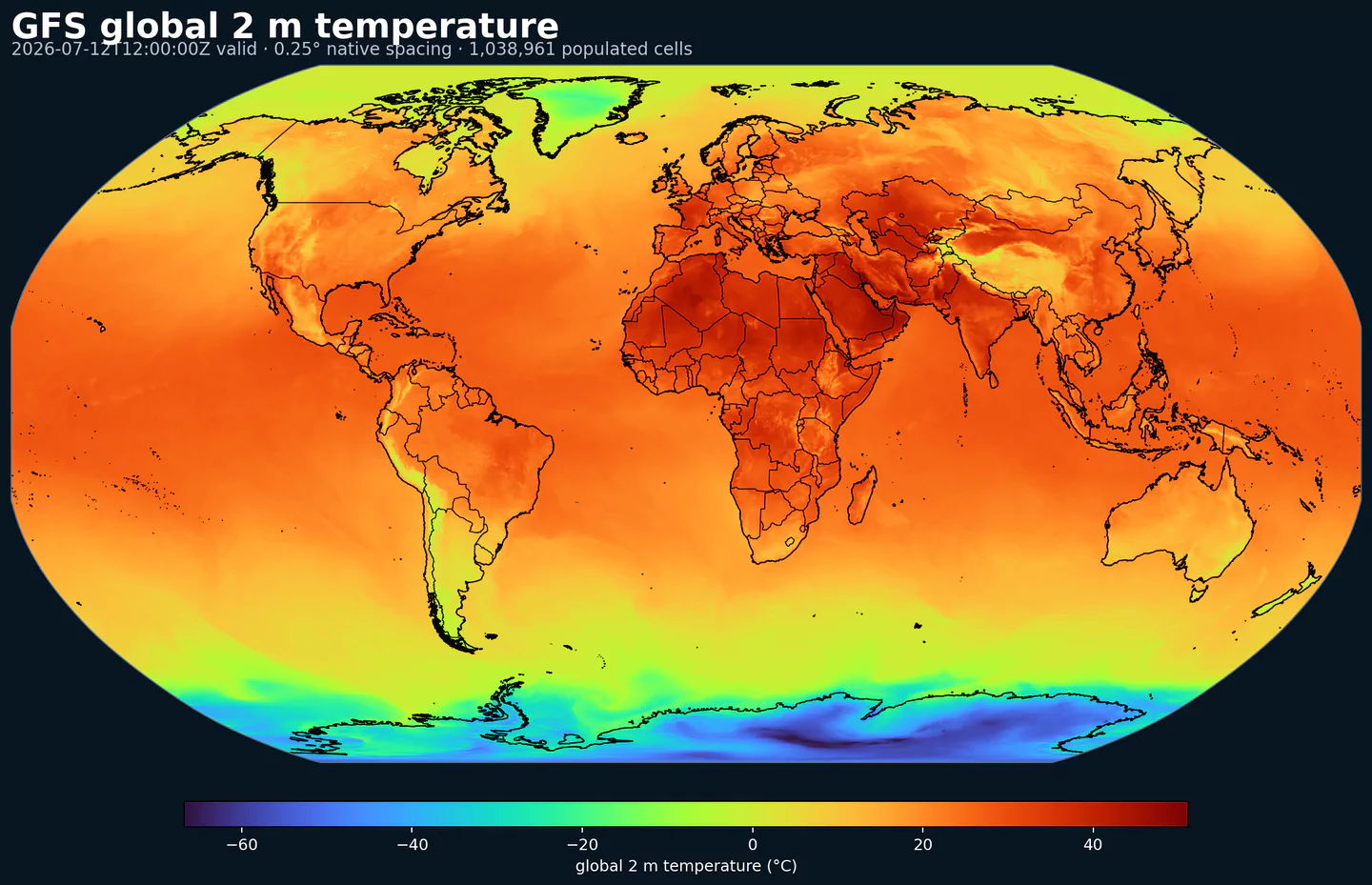
ECMWF Reanalysis v5 (ERA5)

GribStream Code: era5

Launch availability: ERA5 is launching on GribStream with coverage from January 1, 2020 onward. Older years may be added later, and the catalog/API archive window is the current source of truth while the historical load advances.

ERA5T note: GribStream currently treats dates before April 1, 2026 as final ERA5. Newer dates may still be ERA5T, the near-real-time preliminary release, until ECMWF/Copernicus finalizes and replaces them.

Description

ERA5 is ECMWF's fifth-generation global reanalysis, produced for the Copernicus Climate Change Service. The source archive extends from January 1940 to the present, with hourly estimates of atmospheric, land, and ocean conditions built from ECMWF's Integrated Forecasting System and a large observing record.

ERA5 is valuable because it applies one stable modern assimilation system across decades. Observations are blended with model physics to produce complete gridded analyses, avoiding the artificial jumps that can appear when long histories are assembled from many generations of operational forecast systems. It is still a reanalysis, not a station observation network: changes in the observing system and the provisional ERA5T stream can matter for the newest dates.

On GribStream, era5 is served as valid-time actuals: forecasted_at and forecasted_time are the same valid time, with horizon = 0 and member = 0. That keeps the API shape aligned with forecast datasets while making ERA5 practical for forecast verification, training labels, bias correction, weather-impact studies, and backtesting.

Some ERA5 accumulated and flux-style fields, including precipitation and radiation products, originate from short forecast steps in ECMWF's source archive rather than from instantaneous analyses. GribStream keeps ECMWF short names and exposes the mirrored field at the valid time so users can join it cleanly with forecasts while still reading the parameter definition as ERA5 defines it.

GribStream starts with a core single-level subset on the CDS 0.25 degree global latitude/longitude grid. The public ERA5 source is much broader than GribStream's first archive window; the initial GribStream release covers 2020 onward, and availability may expand backward as older years are validated and backfilled. Files are stored variable by variable so additional ERA5 parameters can be added later without rewriting existing data or index objects.

Detail

Related datasets

Parameters

0 parameters

Click a parameter to reveal variants in a compact table with ready-to-copy JSON selectors.

100u –100 metre U wind component (m s-1)
1 variant

Parameter ID 228246

ECMWF param DB

Eastward component of the 100 m wind, describing near-surface flow aloft.

  • Comparisons to observations require care because observations represent point measurements rather than grid-box means.
  • Combine with the 100 m V component to derive wind speed and direction.
Level Info Horizon Introduced Selector
sfc 0h 2020-01-01
{"name":"100u","level":"sfc","info":""}
100v –100 metre V wind component (m s-1)
1 variant

Parameter ID 228247

ECMWF param DB

Northward component of the 100 m wind, describing near-surface flow aloft.

  • Comparisons to observations require care because observations represent point measurements rather than grid-box means.
  • Combine with the 100 m U component to derive wind speed and direction.
Level Info Horizon Introduced Selector
sfc 0h 2020-01-01
{"name":"100v","level":"sfc","info":""}
10u –10 metre U wind component (m s-1)
1 variant

Parameter ID 165

ECMWF param DB

Eastward (U) component of near-surface wind.

  • Combine with the 10 m V component to derive wind speed and direction.
  • Observations can diverge due to terrain, vegetation, and local exposure.
Level Info Horizon Introduced Selector
sfc 0h 2020-01-01
{"name":"10u","level":"sfc","info":""}
10v –10 metre V wind component (m s-1)
1 variant

Parameter ID 166

ECMWF param DB

Northward (V) component of near-surface wind.

  • Combine with the 10 m U component to derive wind speed and direction.
  • Observations can diverge due to terrain, vegetation, and local exposure.
Level Info Horizon Introduced Selector
sfc 0h 2020-01-01
{"name":"10v","level":"sfc","info":""}
2d –2 metre dewpoint temperature (K)
1 variant

Parameter ID 168

ECMWF param DB

Dewpoint temperature describing near-surface moisture conditions. Useful for humidity diagnostics.

  • Often combined with temperature and pressure to estimate relative humidity.
  • Computed by interpolating between the lowest model level and the surface.
Level Info Horizon Introduced Selector
sfc 0h 2020-01-01
{"name":"2d","level":"sfc","info":""}
2t –2 metre temperature (K)
1 variant

Parameter ID 167

ECMWF param DB

Near-surface air temperature representative of conditions over land, sea, or inland waters. Derived using surface and lowest model level information.

  • Units are kelvin (K); to convert to degrees Celsius (deg C), subtract 273.15.
  • Mean 2 metre temperature is encoded separately (parameter 228004).
Level Info Horizon Introduced Selector
sfc 0h 2020-01-01
{"name":"2t","level":"sfc","info":""}
msl –Mean sea level pressure (Pa)
1 variant

Parameter ID 151

ECMWF param DB

Atmospheric pressure adjusted to mean sea level, reflecting the weight of the air column.

  • Maps of mean sea level pressure highlight cyclones, anticyclones, and wind strength via contour spacing.
  • Often expressed in hPa or millibars (1 hPa = 1 mb = 100 Pa).
Level Info Horizon Introduced Selector
sfc 0h 2020-01-01
{"name":"msl","level":"sfc","info":""}
sd –Snow depth (m of water equivalent)
1 variant

Parameter ID 141

ECMWF param DB

Depth of snow expressed as the equivalent depth of water if the snow melted.

  • Represents snow over the snow-covered part of the grid box.
  • See parameter 228141 for the equivalent value expressed in kg m-2.
Level Info Horizon Introduced Selector
sfc 0h 2020-01-01
{"name":"sd","level":"sfc","info":""}
sf –Snowfall (m of water equivalent)
1 variant

Parameter ID 144

ECMWF param DB

Accumulated snowfall at the surface (large-scale + convective).

  • Accumulated over the extraction period; depth in metres of water equivalent.
  • See parameter 228144 for the equivalent value expressed in kg m-2.
Level Info Horizon Introduced Selector
sfc 0h 2020-01-01
{"name":"sf","level":"sfc","info":""}
skt –Skin temperature (K)
1 variant

Parameter ID 235

ECMWF param DB

Temperature of the Earth's surface required to satisfy the surface energy balance.

  • Represents the uppermost surface layer with no heat capacity, so it responds instantly to surface flux changes.
  • Computed differently over land and sea.
  • Units are kelvin (K); to convert to degrees Celsius (deg C), subtract 273.15.
  • Mean skin temperature is encoded separately (parameter 235079).
Level Info Horizon Introduced Selector
sfc 0h 2020-01-01
{"name":"skt","level":"sfc","info":""}
sp –Surface pressure (Pa)
1 variant

Parameter ID 134

ECMWF param DB

Atmospheric pressure at the surface of land, sea, and inland water.

  • Often used with temperature to estimate air density.
  • Mean sea level pressure is typically preferred for identifying large-scale pressure systems in mountainous regions.
  • Often expressed in hPa or millibars (1 hPa = 1 mb = 100 Pa).
Level Info Horizon Introduced Selector
sfc 0h 2020-01-01
{"name":"sp","level":"sfc","info":""}
ssrd –Surface short-wave (solar) radiation downwards (J m-2)
1 variant

Parameter ID 169

ECMWF param DB

Downward shortwave radiation at the surface (direct + diffuse).

  • Approximate model equivalent of pyranometer measurements.
  • Accumulated over the extraction period; divide by seconds to convert to W m-2.
  • ECMWF convention for vertical fluxes is positive downward.
Level Info Horizon Introduced Selector
sfc 0h 2020-01-01
{"name":"ssrd","level":"sfc","info":""}
strd –Surface long-wave (thermal) radiation downwards (J m-2)
1 variant

Parameter ID 175

ECMWF param DB

Downward longwave radiation at the surface emitted by the atmosphere and clouds.

  • Accumulated over the extraction period; divide by seconds to convert to W m-2.
  • ECMWF convention for vertical fluxes is positive downward.
Level Info Horizon Introduced Selector
sfc 0h 2020-01-01
{"name":"strd","level":"sfc","info":""}
tcc –Total cloud cover ((0 - 1))
1 variant

Parameter ID 164

ECMWF param DB

Fraction of a grid box covered by cloud across all model levels.

  • Computed from cloud across different heights with overlap assumptions.
  • See parameter 228164 for the equivalent value in percent.
Level Info Horizon Introduced Selector
sfc 0h 2020-01-01
{"name":"tcc","level":"sfc","info":""}
tcw –Total column water (kg m-2)
1 variant

Parameter ID 136

ECMWF param DB

Total column water including vapour, liquid water, cloud ice, rain, and snow.

  • Older IFS versions did not include rain and snow in the total.
Level Info Horizon Introduced Selector
sfc 0h 2020-01-01
{"name":"tcw","level":"sfc","info":""}
tcwv –Total column vertically-integrated water vapour (kg m-2)
1 variant

Parameter ID 137

ECMWF param DB

Total water vapour in a column from the surface to the top of the atmosphere.

  • Represents a grid-box mean value.
Level Info Horizon Introduced Selector
sfc 0h 2020-01-01
{"name":"tcwv","level":"sfc","info":""}
tp –Total precipitation (m)
1 variant

Parameter ID 228

ECMWF param DB

Accumulated rain + snow at the surface (large-scale + convective).

  • Does not include fog, dew, or precipitation that evaporates before reaching the surface.
  • Accumulated over the extraction period; depth in metres of water equivalent.
  • See parameter 228228 for the equivalent value expressed in kg m-2.
Level Info Horizon Introduced Selector
sfc 0h 2020-01-01
{"name":"tp","level":"sfc","info":""}

No parameters match your search.