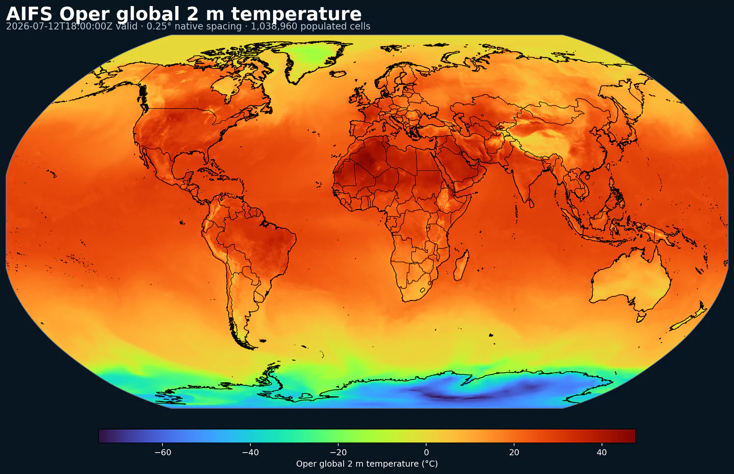
GribStream

ECMWF Artificial Intelligence/Integrated Forecasting System (AIFS)

GribStream Code: aifsoper

Description

AIFS Oper is ECMWF’s AI-based global forecasting system run alongside the physics-based IFS. It replaces numerical solvers with a learned model trained on ERA5 and fine-tuned on operational IFS analyses. The network uses a graph-based encoder/decoder with a transformer processor to predict atmospheric evolution from an analysed initial state. Inputs span pressure-level and surface fields plus simple forcings (for example time of year and insolation). Closely related suites are the physics counterpart IFS Oper and the ensemble variant AIFS Ensemble.

Detail

Parameters

0 parameters

Click a parameter to reveal variants in a compact table with ready-to-copy JSON selectors.

100u –100 metre U wind component (m s-1)
1 variant

Parameter ID 228246

ECMWF param DB

Eastward component of the 100 m wind, describing near-surface flow aloft.

  • Comparisons to observations require care because observations represent point measurements rather than grid-box means.
  • Combine with the 100 m V component to derive wind speed and direction.
Level Info Horizon Introduced Selector
sfc 0h-360h 2025-02-25
{"name":"100u","level":"sfc","info":""}
100v –100 metre V wind component (m s-1)
1 variant

Parameter ID 228247

ECMWF param DB

Northward component of the 100 m wind, describing near-surface flow aloft.

  • Comparisons to observations require care because observations represent point measurements rather than grid-box means.
  • Combine with the 100 m U component to derive wind speed and direction.
Level Info Horizon Introduced Selector
sfc 0h-360h 2025-02-25
{"name":"100v","level":"sfc","info":""}
10u –10 metre U wind component (m s-1)
1 variant

Parameter ID 165

ECMWF param DB

Eastward (U) component of near-surface wind.

  • Combine with the 10 m V component to derive wind speed and direction.
  • Observations can diverge due to terrain, vegetation, and local exposure.
Level Info Horizon Introduced Selector
sfc 0h-360h 2025-02-25
{"name":"10u","level":"sfc","info":""}
10v –10 metre V wind component (m s-1)
1 variant

Parameter ID 166

ECMWF param DB

Northward (V) component of near-surface wind.

  • Combine with the 10 m U component to derive wind speed and direction.
  • Observations can diverge due to terrain, vegetation, and local exposure.
Level Info Horizon Introduced Selector
sfc 0h-360h 2025-02-25
{"name":"10v","level":"sfc","info":""}
2d –2 metre dewpoint temperature (K)
1 variant

Parameter ID 168

ECMWF param DB

Dewpoint temperature describing near-surface moisture conditions. Useful for humidity diagnostics.

  • Often combined with temperature and pressure to estimate relative humidity.
  • Computed by interpolating between the lowest model level and the surface.
Level Info Horizon Introduced Selector
sfc 0h-360h 2025-02-25
{"name":"2d","level":"sfc","info":""}
2t –2 metre temperature (K)
1 variant

Parameter ID 167

ECMWF param DB

Near-surface air temperature representative of conditions over land, sea, or inland waters. Derived using surface and lowest model level information.

  • Units are kelvin (K); to convert to degrees Celsius (deg C), subtract 273.15.
  • Mean 2 metre temperature is encoded separately (parameter 228004).
Level Info Horizon Introduced Selector
sfc 0h-360h 2025-02-25
{"name":"2t","level":"sfc","info":""}
cp –Convective precipitation (m)
1 variant

Parameter ID 143

ECMWF param DB

Accumulated precipitation from the convection scheme (rain + snow).

  • Does not include fog, dew, or precipitation that evaporates before reaching the surface.
  • Accumulated over the extraction period; depth in metres of water equivalent.
  • See parameter 228143 for the equivalent value expressed in kg m-2.
Level Info Horizon Introduced Selector
sfc 0h-360h 2025-02-25
{"name":"cp","level":"sfc","info":""}
hcc –High cloud cover ((0 - 1))
1 variant

Parameter ID 188

ECMWF param DB

Fraction of a grid box covered by high-level cloud.

  • Computed from model levels with pressure < 0.45 of surface pressure (~6 km and above).
  • Cloud fractions range from 0 to 1; overlap assumptions are applied across levels.
  • See parameter 3075 for the equivalent value in percent.
Level Info Horizon Introduced Selector
sfc 0h-360h 2025-02-25
{"name":"hcc","level":"sfc","info":""}
lcc –Low cloud cover ((0 - 1))
1 variant

Parameter ID 186

ECMWF param DB

Fraction of a grid box covered by low-level cloud.

  • Computed from model levels with pressure > 0.8 of surface pressure (~2 km and below).
  • Cloud fractions range from 0 to 1; overlap assumptions are applied across levels.
  • See parameter 3073 for the equivalent value in percent.
Level Info Horizon Introduced Selector
sfc 0h-360h 2025-02-25
{"name":"lcc","level":"sfc","info":""}
lsm –Land-sea mask ((0 - 1))
1 variant

Parameter ID 172

ECMWF param DB

Fraction of land within a grid box relative to ocean and inland waters.

  • Values range from 0 to 1 and are dimensionless.
  • From IFS CY41R1 (May 2015), grid boxes >0.5 may mix land and inland water; <=0.5 are water only.
  • Before CY41R1, >0.5 implied land only; <=0.5 implied ocean only (no inland water differentiation).
Level Info Horizon Introduced Selector
sfc 0h 2025-02-25
{"name":"lsm","level":"sfc","info":""}
msl –Mean sea level pressure (Pa)
1 variant

Parameter ID 151

ECMWF param DB

Atmospheric pressure adjusted to mean sea level, reflecting the weight of the air column.

  • Maps of mean sea level pressure highlight cyclones, anticyclones, and wind strength via contour spacing.
  • Often expressed in hPa or millibars (1 hPa = 1 mb = 100 Pa).
Level Info Horizon Introduced Selector
sfc 0h-360h 2025-02-25
{"name":"msl","level":"sfc","info":""}
q –Specific humidity (kg kg-1)
13 variants

Parameter ID 133

ECMWF param DB

Mass of water vapour per kilogram of moist air.

  • Moist air includes dry air, water vapour, cloud liquid, cloud ice, rain, and falling snow.
Level Info Horizon Introduced Selector
pl 100 0h-360h 2025-02-25
{"name":"q","level":"pl 100","info":""}
pl 1000 0h-360h 2025-02-25
{"name":"q","level":"pl 1000","info":""}
pl 150 0h-360h 2025-02-25
{"name":"q","level":"pl 150","info":""}
pl 200 0h-360h 2025-02-25
{"name":"q","level":"pl 200","info":""}
pl 250 0h-360h 2025-02-25
{"name":"q","level":"pl 250","info":""}
pl 300 0h-360h 2025-02-25
{"name":"q","level":"pl 300","info":""}
pl 400 0h-360h 2025-02-25
{"name":"q","level":"pl 400","info":""}
pl 50 0h-360h 2025-02-25
{"name":"q","level":"pl 50","info":""}
pl 500 0h-360h 2025-02-25
{"name":"q","level":"pl 500","info":""}
pl 600 0h-360h 2025-02-25
{"name":"q","level":"pl 600","info":""}
pl 700 0h-360h 2025-02-25
{"name":"q","level":"pl 700","info":""}
pl 850 0h-360h 2025-02-25
{"name":"q","level":"pl 850","info":""}
pl 925 0h-360h 2025-02-25
{"name":"q","level":"pl 925","info":""}
rowe –Runoff water equivalent (surface plus subsurface) (kg m-2)
1 variant

Parameter ID 231002

ECMWF param DB

Total surface + subsurface runoff accumulated over the output period, expressed as water equivalent mass.

  • Useful for drought/flood assessment; comparisons to observations require care due to scale differences.
  • See parameter 205 for the equivalent value expressed in metres.
Level Info Horizon Introduced Selector
sfc 0h-360h 2025-02-25
{"name":"rowe","level":"sfc","info":""}
sdor –Standard deviation of sub-gridscale orography (m)
1 variant

Parameter ID 160

ECMWF param DB

Standard deviation of sub-grid orography within a grid box (valleys, hills, and mountains below model resolution).

  • Derived from ~1 km land-surface data for features between 5 km and the model grid resolution.
  • Used by the sub-grid orography scheme for low-level blocking and gravity-wave drag.
Level Info Horizon Introduced Selector
sfc 0h 2025-02-25
{"name":"sdor","level":"sfc","info":""}
sot –Soil temperature (K)
2 variants
Level Info Horizon Introduced Selector
sol 1 0h-360h 2025-02-25
{"name":"sot","level":"sol 1","info":""}
sol 2 0h-360h 2025-02-25
{"name":"sot","level":"sol 2","info":""}
sp –Surface pressure (Pa)
1 variant

Parameter ID 134

ECMWF param DB

Atmospheric pressure at the surface of land, sea, and inland water.

  • Often used with temperature to estimate air density.
  • Mean sea level pressure is typically preferred for identifying large-scale pressure systems in mountainous regions.
  • Often expressed in hPa or millibars (1 hPa = 1 mb = 100 Pa).
Level Info Horizon Introduced Selector
sfc 0h-360h 2025-02-25
{"name":"sp","level":"sfc","info":""}
ssrd –Surface short-wave (solar) radiation downwards (J m-2)
1 variant

Parameter ID 169

ECMWF param DB

Downward shortwave radiation at the surface (direct + diffuse).

  • Approximate model equivalent of pyranometer measurements.
  • Accumulated over the extraction period; divide by seconds to convert to W m-2.
  • ECMWF convention for vertical fluxes is positive downward.
Level Info Horizon Introduced Selector
sfc 0h-360h 2025-02-25
{"name":"ssrd","level":"sfc","info":""}
strd –Surface long-wave (thermal) radiation downwards (J m-2)
1 variant

Parameter ID 175

ECMWF param DB

Downward longwave radiation at the surface emitted by the atmosphere and clouds.

  • Accumulated over the extraction period; divide by seconds to convert to W m-2.
  • ECMWF convention for vertical fluxes is positive downward.
Level Info Horizon Introduced Selector
sfc 0h-360h 2025-02-25
{"name":"strd","level":"sfc","info":""}
t –Temperature (K)
13 variants

Parameter ID 130

ECMWF param DB

Air temperature throughout the atmosphere.

  • Units are kelvin (K); to convert to degrees Celsius (deg C), subtract 273.15.
  • Available on multiple vertical levels.
Level Info Horizon Introduced Selector
pl 100 0h-360h 2025-02-25
{"name":"t","level":"pl 100","info":""}
pl 1000 0h-360h 2025-02-25
{"name":"t","level":"pl 1000","info":""}
pl 150 0h-360h 2025-02-25
{"name":"t","level":"pl 150","info":""}
pl 200 0h-360h 2025-02-25
{"name":"t","level":"pl 200","info":""}
pl 250 0h-360h 2025-02-25
{"name":"t","level":"pl 250","info":""}
pl 300 0h-360h 2025-02-25
{"name":"t","level":"pl 300","info":""}
pl 400 0h-360h 2025-02-25
{"name":"t","level":"pl 400","info":""}
pl 50 0h-360h 2025-02-25
{"name":"t","level":"pl 50","info":""}
pl 500 0h-360h 2025-02-25
{"name":"t","level":"pl 500","info":""}
pl 600 0h-360h 2025-02-25
{"name":"t","level":"pl 600","info":""}
pl 700 0h-360h 2025-02-25
{"name":"t","level":"pl 700","info":""}
pl 850 0h-360h 2025-02-25
{"name":"t","level":"pl 850","info":""}
pl 925 0h-360h 2025-02-25
{"name":"t","level":"pl 925","info":""}
tcc –Total cloud cover ((0 - 1))
1 variant

Parameter ID 164

ECMWF param DB

Fraction of a grid box covered by cloud across all model levels.

  • Computed from cloud across different heights with overlap assumptions.
  • See parameter 228164 for the equivalent value in percent.
Level Info Horizon Introduced Selector
sfc 0h-360h 2025-02-25
{"name":"tcc","level":"sfc","info":""}
tcw –Total column water (kg m-2)
1 variant

Parameter ID 136

ECMWF param DB

Total column water including vapour, liquid water, cloud ice, rain, and snow.

  • Older IFS versions did not include rain and snow in the total.
Level Info Horizon Introduced Selector
sfc 0h-360h 2025-02-25
{"name":"tcw","level":"sfc","info":""}
tp –Total precipitation (m)
1 variant

Parameter ID 228

ECMWF param DB

Accumulated rain + snow at the surface (large-scale + convective).

  • Does not include fog, dew, or precipitation that evaporates before reaching the surface.
  • Accumulated over the extraction period; depth in metres of water equivalent.
  • See parameter 228228 for the equivalent value expressed in kg m-2.
Level Info Horizon Introduced Selector
sfc 0h-360h 2025-02-25
{"name":"tp","level":"sfc","info":""}
u –U component of wind (m s-1)
13 variants

Parameter ID 131

ECMWF param DB

Eastward wind component; negative values indicate westward flow.

  • Combine with the V component to derive wind speed and direction.
Level Info Horizon Introduced Selector
pl 100 0h-360h 2025-02-25
{"name":"u","level":"pl 100","info":""}
pl 1000 0h-360h 2025-02-25
{"name":"u","level":"pl 1000","info":""}
pl 150 0h-360h 2025-02-25
{"name":"u","level":"pl 150","info":""}
pl 200 0h-360h 2025-02-25
{"name":"u","level":"pl 200","info":""}
pl 250 0h-360h 2025-02-25
{"name":"u","level":"pl 250","info":""}
pl 300 0h-360h 2025-02-25
{"name":"u","level":"pl 300","info":""}
pl 400 0h-360h 2025-02-25
{"name":"u","level":"pl 400","info":""}
pl 50 0h-360h 2025-02-25
{"name":"u","level":"pl 50","info":""}
pl 500 0h-360h 2025-02-25
{"name":"u","level":"pl 500","info":""}
pl 600 0h-360h 2025-02-25
{"name":"u","level":"pl 600","info":""}
pl 700 0h-360h 2025-02-25
{"name":"u","level":"pl 700","info":""}
pl 850 0h-360h 2025-02-25
{"name":"u","level":"pl 850","info":""}
pl 925 0h-360h 2025-02-25
{"name":"u","level":"pl 925","info":""}
v –V component of wind (m s-1)
13 variants

Parameter ID 132

ECMWF param DB

Northward wind component; negative values indicate southward flow.

  • Combine with the U component to derive wind speed and direction.
Level Info Horizon Introduced Selector
pl 100 0h-360h 2025-02-25
{"name":"v","level":"pl 100","info":""}
pl 1000 0h-360h 2025-02-25
{"name":"v","level":"pl 1000","info":""}
pl 150 0h-360h 2025-02-25
{"name":"v","level":"pl 150","info":""}
pl 200 0h-360h 2025-02-25
{"name":"v","level":"pl 200","info":""}
pl 250 0h-360h 2025-02-25
{"name":"v","level":"pl 250","info":""}
pl 300 0h-360h 2025-02-25
{"name":"v","level":"pl 300","info":""}
pl 400 0h-360h 2025-02-25
{"name":"v","level":"pl 400","info":""}
pl 50 0h-360h 2025-02-25
{"name":"v","level":"pl 50","info":""}
pl 500 0h-360h 2025-02-25
{"name":"v","level":"pl 500","info":""}
pl 600 0h-360h 2025-02-25
{"name":"v","level":"pl 600","info":""}
pl 700 0h-360h 2025-02-25
{"name":"v","level":"pl 700","info":""}
pl 850 0h-360h 2025-02-25
{"name":"v","level":"pl 850","info":""}
pl 925 0h-360h 2025-02-25
{"name":"v","level":"pl 925","info":""}
vsw –Volumetric soil moisture (m3 m-3)
2 variants

Parameter ID 260199

ECMWF param DB

Volumetric soil moisture content.

  • Time-mean volumetric soil moisture is encoded separately (parameter 235077).
Level Info Horizon Introduced Selector
sol 1 0h-360h 2025-02-25
{"name":"vsw","level":"sol 1","info":""}
sol 2 0h-360h 2025-02-25
{"name":"vsw","level":"sol 2","info":""}
w –Vertical velocity (Pa s-1)
13 variants

Parameter ID 135

ECMWF param DB

Vertical motion in pressure coordinates; negative values indicate upward motion.

  • Useful for diagnosing large-scale ascent (negative) and subsidence (positive).
Level Info Horizon Introduced Selector
pl 100 0h-360h 2025-02-25
{"name":"w","level":"pl 100","info":""}
pl 1000 0h-360h 2025-02-25
{"name":"w","level":"pl 1000","info":""}
pl 150 0h-360h 2025-02-25
{"name":"w","level":"pl 150","info":""}
pl 200 0h-360h 2025-02-25
{"name":"w","level":"pl 200","info":""}
pl 250 0h-360h 2025-02-25
{"name":"w","level":"pl 250","info":""}
pl 300 0h-360h 2025-02-25
{"name":"w","level":"pl 300","info":""}
pl 400 0h-360h 2025-02-25
{"name":"w","level":"pl 400","info":""}
pl 50 0h-360h 2025-02-25
{"name":"w","level":"pl 50","info":""}
pl 500 0h-360h 2025-02-25
{"name":"w","level":"pl 500","info":""}
pl 600 0h-360h 2025-02-25
{"name":"w","level":"pl 600","info":""}
pl 700 0h-360h 2025-02-25
{"name":"w","level":"pl 700","info":""}
pl 850 0h-360h 2025-02-25
{"name":"w","level":"pl 850","info":""}
pl 925 0h-360h 2025-02-25
{"name":"w","level":"pl 925","info":""}
z –Geopotential (m2 s-2)
14 variants

Parameter ID 129

ECMWF param DB

Gravitational potential energy per unit mass relative to mean sea level.

  • Geopotential height = geopotential / g (9.80665 m s-2).
  • At the surface, reflects orography (geopotential height of the surface).
  • Constant-pressure charts of geopotential height are key for synoptic analysis.
Level Info Horizon Introduced Selector
pl 100 0h-360h 2025-02-25
{"name":"z","level":"pl 100","info":""}
pl 1000 0h-360h 2025-02-25
{"name":"z","level":"pl 1000","info":""}
pl 150 0h-360h 2025-02-25
{"name":"z","level":"pl 150","info":""}
pl 200 0h-360h 2025-02-25
{"name":"z","level":"pl 200","info":""}
pl 250 0h-360h 2025-02-25
{"name":"z","level":"pl 250","info":""}
pl 300 0h-360h 2025-02-25
{"name":"z","level":"pl 300","info":""}
pl 400 0h-360h 2025-02-25
{"name":"z","level":"pl 400","info":""}
pl 50 0h-360h 2025-02-25
{"name":"z","level":"pl 50","info":""}
pl 500 0h-360h 2025-02-25
{"name":"z","level":"pl 500","info":""}
pl 600 0h-360h 2025-02-25
{"name":"z","level":"pl 600","info":""}
pl 700 0h-360h 2025-02-25
{"name":"z","level":"pl 700","info":""}
pl 850 0h-360h 2025-02-25
{"name":"z","level":"pl 850","info":""}
pl 925 0h-360h 2025-02-25
{"name":"z","level":"pl 925","info":""}
sfc 0h 2025-02-25
{"name":"z","level":"sfc","info":""}

No parameters match your search.