ABI quantitative precipitation estimate rainfall rate (mm h-1).

GribStream
GribStream Code: goes19rrqpef
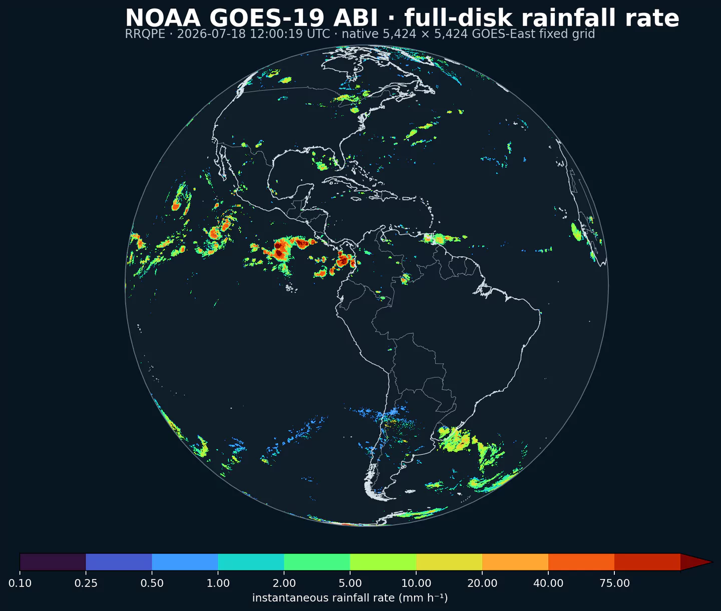
Legacy dataset code: goes19rrqpef remains readable so existing integrations and links continue to work. New integrations should use goes19abi with the identical RRQPE selector. Both dataset codes read the same 2 km source record.
Current coverage: goes19rrqpef provides the NOAA Level 2 full-disk RRQPE instantaneous rainfall-rate estimate from April 8, 2025 onward. It is an observation-derived analysis, not a forecast; forecasted_at and forecasted_time identify the same scan and horizon is 0.
Stable operational grid: NOAA moved GOES-19 from checkout near 89.5W to the GOES-East slot before declaring it operational on April 7, 2025. GribStream starts on the next UTC day and excludes earlier checkout and drift data. The operational ABI product is published on the nominal fixed grid centered at 75W.
Availability: new scans depend on NOAA's satellite feed. Maneuvers, calibration, outages, and product transitions can create gaps or temporarily pause updates. A future change of satellite or grid may therefore mark a new coverage period rather than extend this record seamlessly.
Open data: NOAA data distributed through the NOAA Open Data Dissemination program are open for public use. NOAA requests attribution for unaltered data and prohibits implying NOAA endorsement or affiliation.
ABI is the Advanced Baseline Imager aboard NOAA's GOES-R-series geostationary satellites. It observes the same broad Earth disk continuously in 16 spectral bands. RRQPE turns cloud-top infrared observations, calibrated with microwave rainfall information, into a full-disk estimate of instantaneous rainfall rate.
The product is especially valuable beyond dense radar networks: over oceans, islands, mountains, and radar-sparse regions, the satellite provides one consistent view across most of the Americas and surrounding waters. It also gives applications a common observation layer for storms that cross national radar boundaries.
RRQPE is a satellite-derived estimate, not a direct rain-gauge or weather-radar measurement. Cloud properties, viewing angle, algorithm assumptions, and the availability of microwave calibration can affect accuracy. Ground footprint and retrieval confidence generally degrade toward the satellite limb. For important decisions, compare it with local observations and available quality information.
Use /api/v2/goes19rrqpef/timeseries for point histories and /api/v2/goes19rrqpef/runs for exact scan times or gridded extraction. The inventory below publishes the exact selector {"name":"RRQPE","level":"surface","info":""}.
RRQPE at surface, an instantaneous rainfall rate in mm h-1.Click a parameter to reveal variants in a compact table with ready-to-copy JSON selectors.
ABI quantitative precipitation estimate rainfall rate (mm h-1).
| Level | Info | Horizon | Introduced | Selector |
|---|---|---|---|---|
surface |
0h | 2025-04-08 |
{"name":"RRQPE","level":"surface","info":""}
|
No parameters match your search.