
GribStream Blog
45 new weather datasets and live MCP access on GribStream
GribStream added 45 datasets since March 26, including ERA5, MRMS, GOES, NWM land forecasts, high-resolution European models, AI weather models, and live MCP queries.
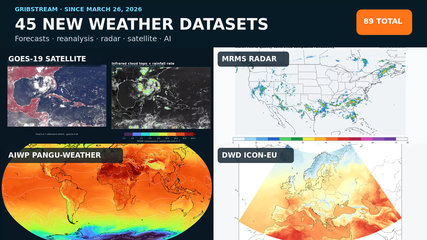
The GribStream public catalog has grown from 44 to 89 datasets since March 26, 2026. The 45 additions extend the API beyond conventional numerical forecasts into reanalysis actuals, rapid radar and satellite observations, land-surface hydrology, atmospheric composition, specialized aviation and severe-weather guidance, and a much broader set of regional and AI forecast systems.
These are dataset codes rather than 45 unrelated model families. Some systems are split by grid, domain, initialization source, member structure, or product type so that each dataset has an exact catalog, coverage period, and set of selectors. They all use the same GribStream /timeseries and /runs request structure.
Actuals, radar, and satellite observations
ERA5 adds hourly global reanalysis actuals from 2020 onward for forecast verification, machine-learning labels, bias correction, and weather-impact backtesting. CCPA adds calibrated hourly precipitation analysis over CONUS.
For faster-changing conditions, MRMS provides rapid radar and multi-sensor analyses for composite reflectivity, hail size, precipitation rate, quantitative precipitation estimates, and radar quality. MRMS azimuthal shear adds a roughly 500 m radar-derived view of low-level storm rotation.
The two GOES-19 ABI collections now expose 61 satellite-observation fields across native 2 km and 10 km fixed grids. They cover 16-band imagery, cloud properties, smoke and dust flags, fire characterization, radiation, rainfall, snow, land and sea-surface temperature, atmospheric moisture, stability, and cloud layers.
GOES-18 ABI adds the same two-grid, 61-field view from operational GOES-West, complementing GOES-19's GOES-East perspective. GMGSI adds an hourly near-global mosaic that combines operational geostationary satellites into visible, shortwave-infrared, water-vapor, and longwave-infrared imagery.
These datasets serve different kinds of “what happened?” questions. ERA5 provides a consistent reanalysis record, CCPA focuses on hourly precipitation, MRMS follows radar-scale hazards, the GOES collections preserve source-native full-disk views, and GMGSI provides one cross-satellite global mosaic. They complement rather than replace one another.
New regional coverage in Europe and the western Pacific
GribStream now includes five new European model families. DWD ICON-EU provides regional guidance across Europe. ItaliaMeteo ICON-2I and its rapid-update cycle focus on Italy and nearby areas at 2.2 km. DMI HARMONIE DINI adds a surface-focused subset for solar, wind, and near-surface weather workflows over Northwestern Europe.
Météo-France AROME adds convection-permitting surface guidance for France and nearby countries at 0.01° output spacing, while DWD ICON-D2 supplies approximately 2.2 km very-short-range guidance for Germany and neighboring countries. CWA WRF 15 km, produced by Taiwan's Central Weather Administration, adds regional coverage for East Asia and the western Pacific.
Together these datasets create new options for renewable-energy forecasting, transport, agriculture, hydrology, and regional weather products outside GribStream's earlier NOAA-heavy catalog.
Land-surface hydrology from the National Water Model
Two NOAA National Water Model datasets add 1 km land forecasts across CONUS and adjacent contributing areas. nwmshortland refreshes hourly with deterministic soil saturation, snowpack, and evapotranspiration guidance through hour 18. nwmmediumlandens extends those questions into the medium range with six time-lagged, GFS-forced members and lead times of up to ten days for member 1.
These are land-state forecasts rather than streamflow collections. They are useful for comparing snow water storage, near-surface soil wetness, and evapotranspiration scenarios, while channel routing and reservoir outputs remain outside these two datasets.
Operational and experimental AI forecasts
NOAA's operational AI guidance is available through four AIGFS and AIGEFS datasets: deterministic surface and pressure-level forecasts, plus ensemble surface and pressure-level forecasts.
Six experimental AIWP datasets provide Pangu-Weather, GraphCast, and FourCastNet forecasts initialized from either GFS or IFS analyses. The paired initialization sources make them useful for model comparison and research into how starting analyses affect AI forecast output. AIWP remains experimental evaluation guidance; operational workflows should treat its availability and behavior accordingly.
Air quality, aviation, and severe-weather guidance
Three NOAA AQM domains add ozone and PM2.5 guidance for CONUS, Alaska, and Hawaii. CAMS Global broadens that environmental view with global atmospheric-composition forecasts, including particulate matter, aerosol optical depth, and column chemical species.
Specialized NOAA additions cover aviation icing and turbulence through DAFS and GTGN, ultraviolet exposure through UVI, and calibrated thunderstorm, lightning, hail, tornado, and severe-wind probabilities through six SPC HREF products. The new RRFS 2D fields dataset also expands RRFS into surface, cloud, radiation, land, fire-weather, and storm diagnostics, while NBM QMD exposes operational NBM v5 quantile and probabilistic CONUS guidance.
All 45 additions
- Actuals, radar, and satellite (9):
era5,ccpa1hndgd25,mrms,mrmsazshear,goes18abi,goes18abi10km,goes19abi,goes19abi10km, andgmgsi. - Regional Europe and Asia-Pacific forecasts (7):
dmidini,icon2i,icon2iruc,iconeu,aromefrance,icond2, andcwawrf15. - Operational NOAA AI forecasts (4):
aigfssfc,aigfspres,aigefssfc, andaigefspres. - Experimental AIWP forecasts (6):
aiwppangu,aiwppanguifs,aiwpfourcastnet,aiwpfourcastnetifs,aiwpgraphcast, andaiwpgraphcastifs. - Air quality and atmospheric composition (4):
aqm,aqmak,aqmhi, andcamsglobal. - Aviation, severe weather, and UV (11):
dafsgtg,dafsificonus,dafsifiak,gtgn,spctstm1hr,spctstm4hr,spcltg4hr,spchail4hr,spctor4hr,spcwind4hr, anduvi. - Land-surface hydrology (2):
nwmshortlandandnwmmediumlandens. - Core forecast extensions (2):
rrfs2dfldandnbmqmd.
Coverage is not identical across this list. ERA5 currently begins in 2020 on GribStream, the GOES-19 record begins April 8, 2025, and several specialized or high-resolution operational products retain shorter rolling windows. NOAA describes the source NWM archive as rolling, so older retained objects should be treated as opportunistic rather than guaranteed permanent history. Use the model catalog and each generated field inventory for the current archive window, cadence, horizon, members, and exact selectors.
Query new datasets with the same API
The integration shape does not change when the scientific source changes. For example, this request returns ERA5 2 metre temperature as CSV for one coordinate:
curl -sS 'https://gribstream.com/api/v2/era5/timeseries' \
  -H 'Authorization: Bearer YOUR_API_TOKEN' \
  -H 'Content-Type: application/json' \
  -H 'Accept: text/csv' \
  --data '{
    "fromTime": "2026-06-01T00:00:00Z",
    "untilTime": "2026-06-02T00:00:00Z",
    "coordinates": [{"lat": 40.7128, "lon": -74.0060}],
    "variables": [{"name": "2t", "level": "sfc", "info": ""}]
  }'
The public catalog endpoints can list datasets, parameters, selector variations, archive coverage, and shared cross-dataset mappings before a data query is built.
Live weather queries through MCP
The hosted GribStream MCP connector gives MCP-capable AI tools a catalog-aware path into the same data. Public tools can discover datasets, resolve exact selectors, build requests, and validate expressions. After GribStream OAuth, bounded live-query tools can return CSV, JSON, or NDJSON data through an API token selected during authorization.
That makes the MCP useful for interactive exploration and first-pass analysis: finding an appropriate model, checking whether a field exists, pulling a bounded sample, or building a chart from real values. The regular API remains the better interface for large exports, scheduled jobs, and production services. See the live MCP weather-analysis example and AI setup guide for the complete workflow.
Explore the expanded catalog
Browse all 89 datasets in the model catalog, inspect exact selectors on any model page, or create a free API token and try a small request. If a missing dataset would unlock a product or research workflow, contact us; customer demand remains one of the strongest inputs into what GribStream supports next.